Lower Pahranagat Lake Nw Topo Map Nevada
To zoom in, hover over the map of Lower Pahranagat Lake Nw
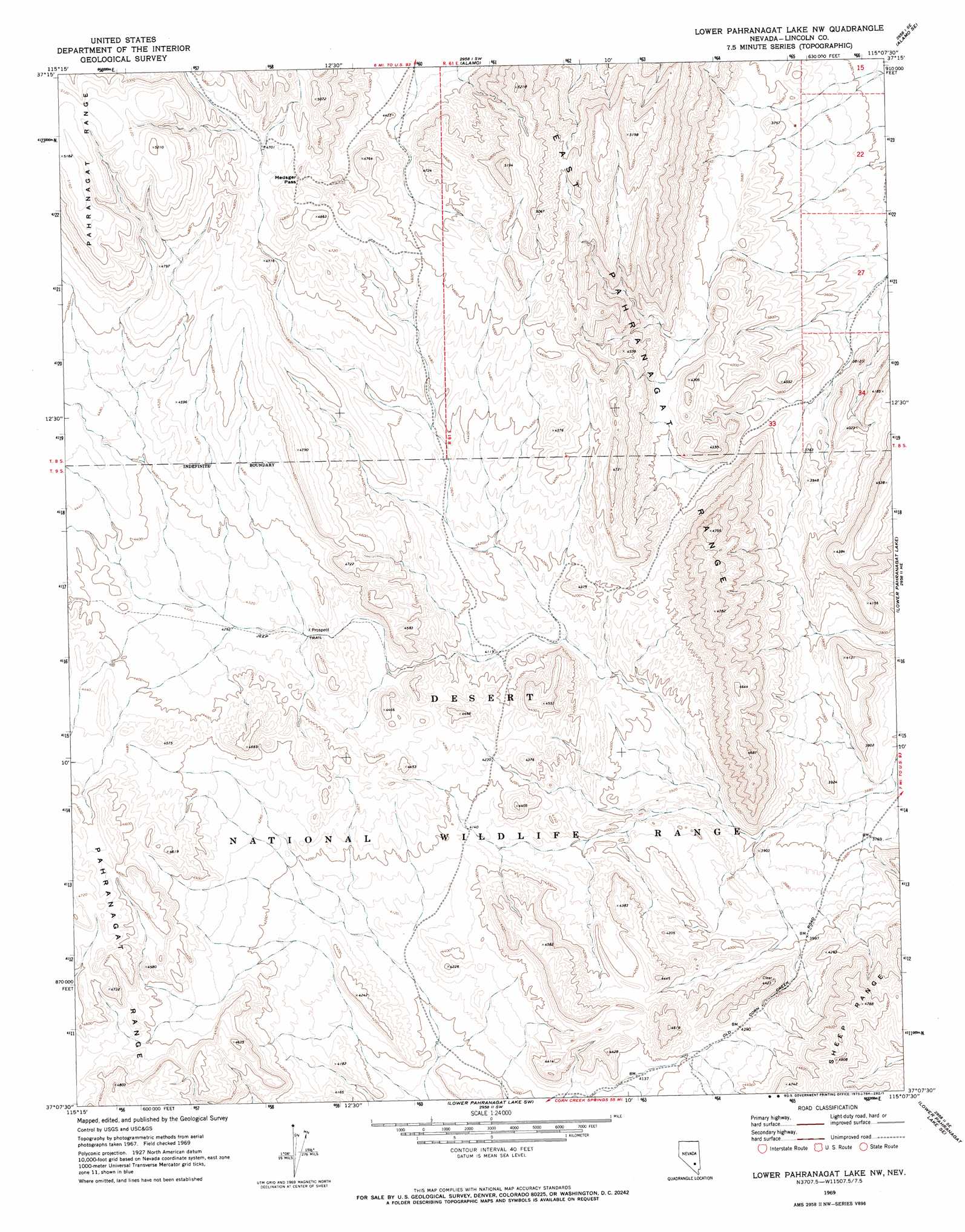
USGS Topo Quad 37115b2 - 1:24,000 scale
| Topo Map Name: | Lower Pahranagat Lake Nw |
| USGS Topo Quad ID: | 37115b2 |
| Print Size: | ca. 21 1/4" wide x 27" high |
| Southeast Coordinates: | 37.125° N latitude / 115.125° W longitude |
| Map Center Coordinates: | 37.1875° N latitude / 115.1875° W longitude |
| U.S. State: | NV |
| Filename: | o37115b2.jpg |
| Download Map JPG Image: | Lower Pahranagat Lake Nw topo map 1:24,000 scale |
| Map Type: | Topographic |
| Topo Series: | 7.5´ |
| Map Scale: | 1:24,000 |
| Source of Map Images: | United States Geological Survey (USGS) |
| Alternate Map Versions: |
Lower Pahranagat Lake NW NV 1969, updated 1973 Download PDF Buy paper map Lower Pahranagat Lake NW NV 2012 Download PDF Buy paper map Lower Pahranagat Lake NW NV 2015 Download PDF Buy paper map |
1:24,000 Topo Quads surrounding Lower Pahranagat Lake Nw
Crescent Reservoir |
Hancock Summit |
Ash Springs |
Alamo Ne |
Delamar Nw |
Cutler Reservoir |
Badger Spring |
Alamo |
Alamo Se |
Delamar Lake |
Desert Hills Nw |
Desert Hills Ne |
Lower Pahranagat Lake Nw |
Lower Pahranagat Lake |
Delamar 3 Nw |
Desert Hills Sw |
Desert Hills Se |
Lower Pahranagat Lake Sw |
Lower Pahranagat Lake Se |
Delamar 3 Sw |
Dog Bone Lake North |
Burro Basin |
Mule Deer Ridge Nw |
Mule Deer Ridge Ne |
Wildcat Wash Nw |
> Back to 37115a1 at 1:100,000 scale
> Back to 37114a1 at 1:250,000 scale
> Back to U.S. Topo Maps home
Lower Pahranagat Lake Nw topo map: Gazetteer
Lower Pahranagat Lake Nw: Gaps
Medsger Pass elevation 1437m 4714′Lower Pahranagat Lake Nw: Springs
Lower Lake Spring elevation 1197m 3927′Lower Pahranagat Lake Nw digital topo map on disk
Buy this Lower Pahranagat Lake Nw topo map showing relief, roads, GPS coordinates and other geographical features, as a high-resolution digital map file on DVD: