Groom Mine Sw Topo Map Nevada
To zoom in, hover over the map of Groom Mine Sw
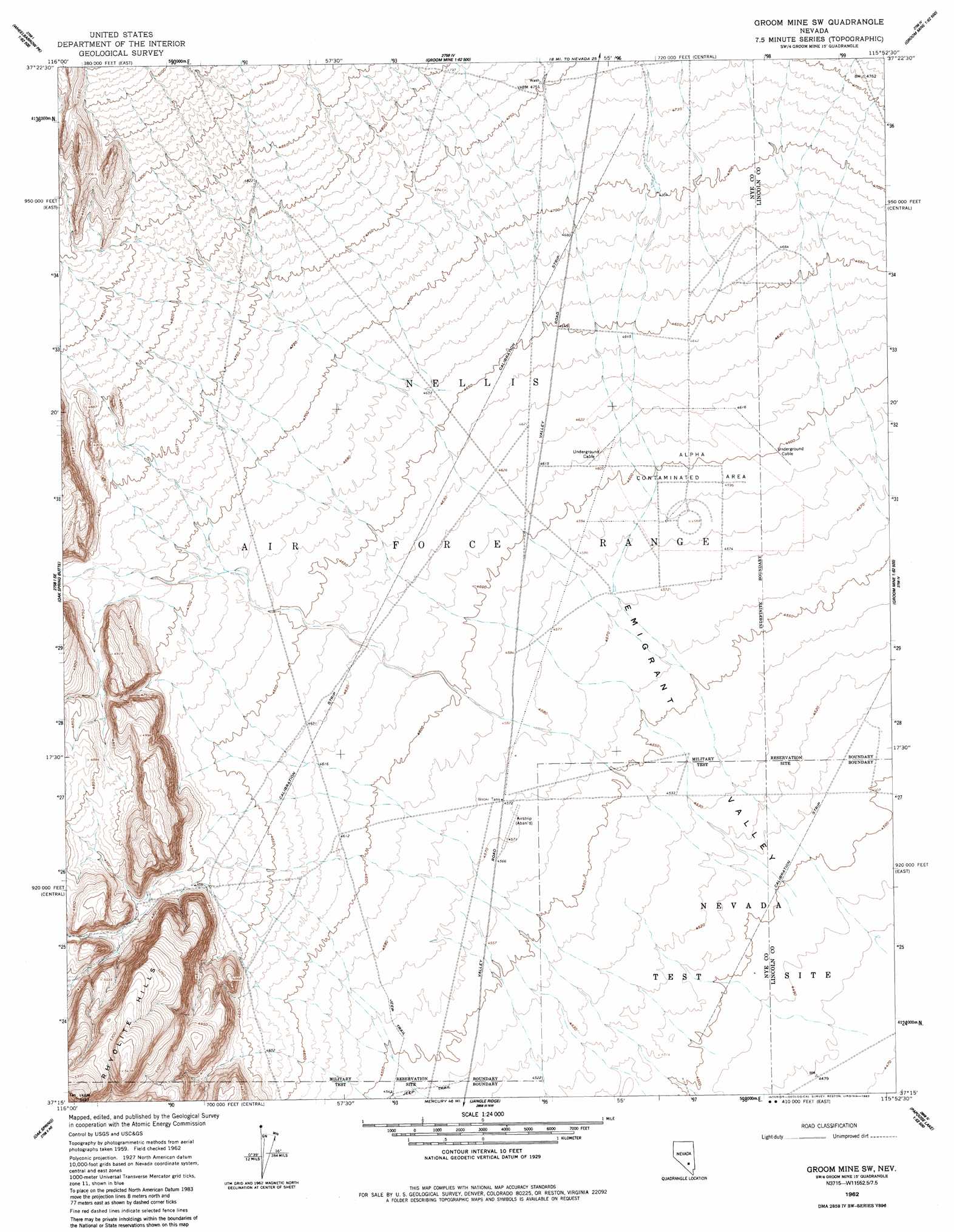
USGS Topo Quad 37115c8 - 1:24,000 scale
| Topo Map Name: | Groom Mine Sw |
| USGS Topo Quad ID: | 37115c8 |
| Print Size: | ca. 21 1/4" wide x 27" high |
| Southeast Coordinates: | 37.25° N latitude / 115.875° W longitude |
| Map Center Coordinates: | 37.3125° N latitude / 115.9375° W longitude |
| U.S. State: | NV |
| Filename: | o37115c8.jpg |
| Download Map JPG Image: | Groom Mine Sw topo map 1:24,000 scale |
| Map Type: | Topographic |
| Topo Series: | 7.5´ |
| Map Scale: | 1:24,000 |
| Source of Map Images: | United States Geological Survey (USGS) |
| Alternate Map Versions: |
Groom Mine SW NV 1962, updated 1963 Download PDF Buy paper map Groom Mine SW NV 1962, updated 1983 Download PDF Buy paper map |
1:24,000 Topo Quads surrounding Groom Mine Sw
Lambs Pond |
Belted Peak |
White Blotch Springs |
White Blotch Springs Se |
Tempiute Mountain South |
Sundown Reservoir |
Wheelbarrow Peak |
Groom Mine Nw |
Cattle Spring |
Groom Range |
Quartet Dome |
Oak Spring Butte |
Groom Mine Sw |
Groom Mine |
Groom Range Sw |
Rainier Mesa |
Oak Spring |
Jangle Ridge |
Papoose Range |
Fallout Hills Nw |
Tippipah Spring |
Yucca Flat |
Paiute Ridge |
Papoose Lake |
Fallout Hills |
> Back to 37115a1 at 1:100,000 scale
> Back to 37114a1 at 1:250,000 scale
> Back to U.S. Topo Maps home
No gazetteer data is available for the Groom Mine Sw topo map sheet.
Groom Mine Sw digital topo map on disk
Buy this Groom Mine Sw topo map showing relief, roads, GPS coordinates and other geographical features, as a high-resolution digital map file on DVD: