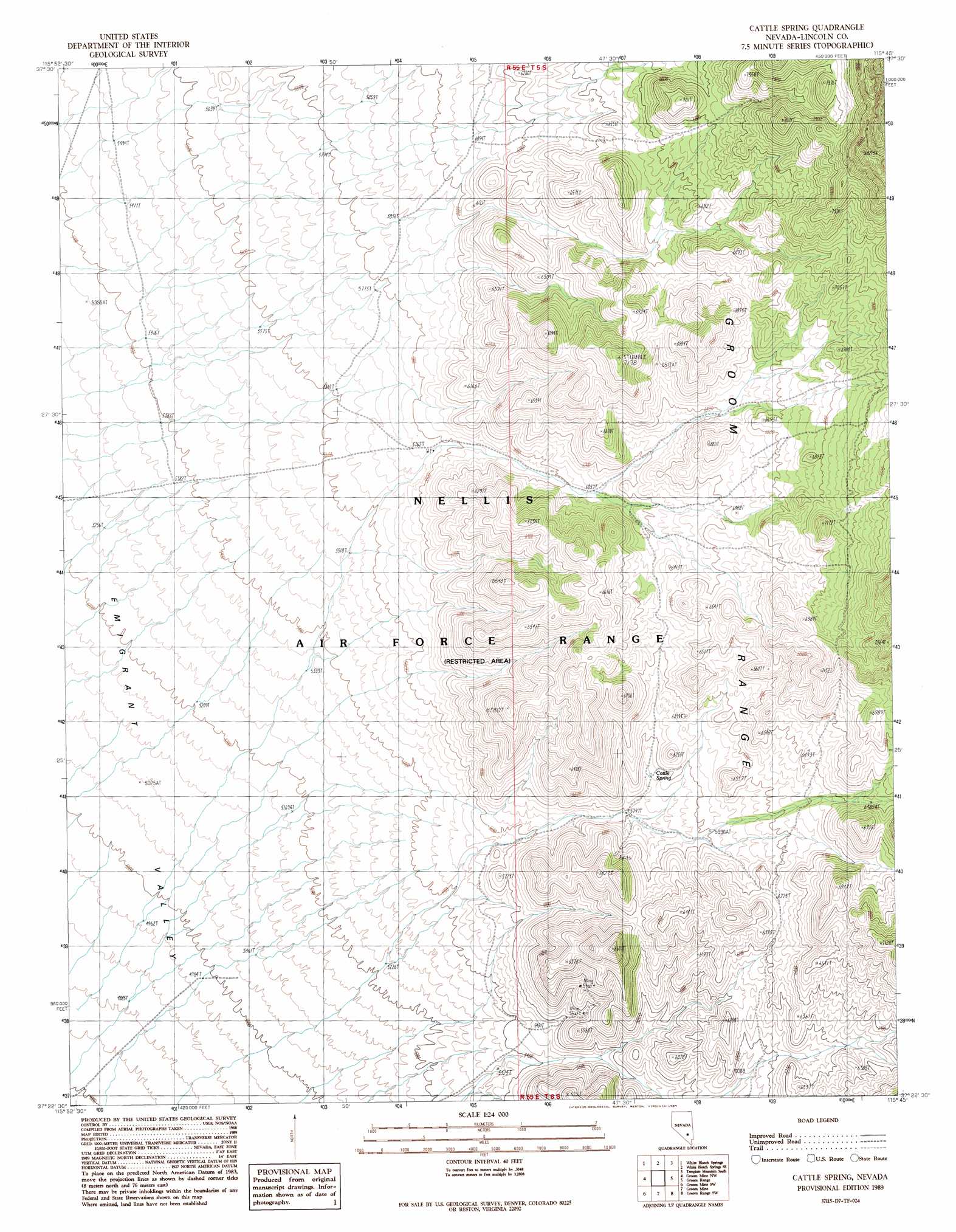
Cattle Spring Topo Map Nevada
To zoom in, hover over the map of Cattle Spring
USGS Topo Quad 37115d7 - 1:24,000 scale
| Topo Map Name: | Cattle Spring |
| USGS Topo Quad ID: | 37115d7 |
| Print Size: | ca. 21 1/4" wide x 27" high |
| Southeast Coordinates: | 37.375° N latitude / 115.75° W longitude |
| Map Center Coordinates: | 37.4375° N latitude / 115.8125° W longitude |
| U.S. State: | NV |
| Filename: | o37115d7.jpg |
| Download Map JPG Image: | Cattle Spring topo map 1:24,000 scale |
| Map Type: | Topographic |
| Topo Series: | 7.5´ |
| Map Scale: | 1:24,000 |
| Source of Map Images: | United States Geological Survey (USGS) |
| Alternate Map Versions: |
Cattle Spring NV 1989, updated 1989 Download PDF Buy paper map |
1:24,000 Topo Quads surrounding Cattle Spring
Monotony Valley |
White Blotch Springs Nw |
White Blotch Springs Ne |
Timpiute Mountain North |
Monte Mountain |
Belted Peak |
White Blotch Springs |
White Blotch Springs Se |
Tempiute Mountain South |
Tempiute Mountain Se |
Wheelbarrow Peak |
Groom Mine Nw |
Cattle Spring |
Groom Range |
Groom Range Ne |
Oak Spring Butte |
Groom Mine Sw |
Groom Mine |
Groom Range Sw |
Groom Range Se |
Oak Spring |
Jangle Ridge |
Papoose Range |
Fallout Hills Nw |
Fallout Hills Ne |
> Back to 37115a1 at 1:100,000 scale
> Back to 37114a1 at 1:250,000 scale
> Back to U.S. Topo Maps home
Cattle Spring topo map: Gazetteer
Cattle Spring: Mines
Hanus Mine elevation 1747m 5731′Cattle Spring: Springs
Bullwack Spring elevation 2181m 7155′Cattle Spring elevation 1808m 5931′
Cliff Spring elevation 2209m 7247′
Indian Spring elevation 2107m 6912′
Pine Spring elevation 2110m 6922′
Rose Bud Spring elevation 2049m 6722′
Cattle Spring digital topo map on disk
Buy this Cattle Spring topo map showing relief, roads, GPS coordinates and other geographical features, as a high-resolution digital map file on DVD: