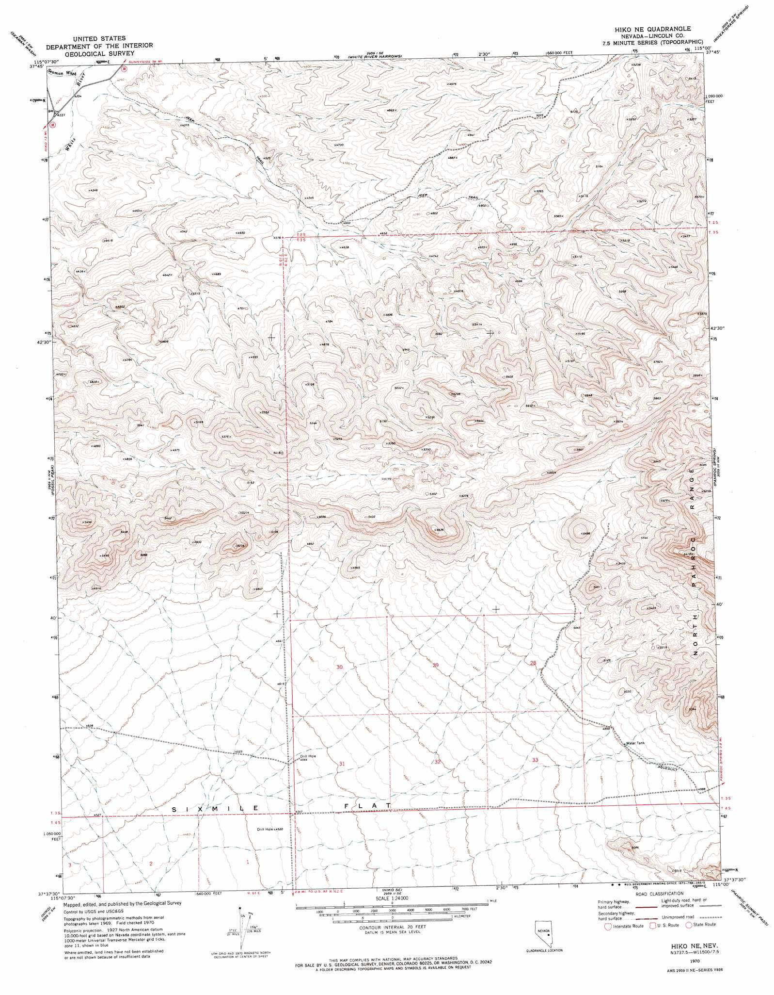
Hiko Ne Topo Map Nevada
To zoom in, hover over the map of Hiko Ne
USGS Topo Quad 37115f1 - 1:24,000 scale
| Topo Map Name: | Hiko Ne |
| USGS Topo Quad ID: | 37115f1 |
| Print Size: | ca. 21 1/4" wide x 27" high |
| Southeast Coordinates: | 37.625° N latitude / 115° W longitude |
| Map Center Coordinates: | 37.6875° N latitude / 115.0625° W longitude |
| U.S. State: | NV |
| Filename: | o37115f1.jpg |
| Download Map JPG Image: | Hiko Ne topo map 1:24,000 scale |
| Map Type: | Topographic |
| Topo Series: | 7.5´ |
| Map Scale: | 1:24,000 |
| Source of Map Images: | United States Geological Survey (USGS) |
| Alternate Map Versions: |
Hiko NE NV 1970, updated 1973 Download PDF Buy paper map Hiko NE NV 2012 Download PDF Buy paper map Hiko NE NV 2014 Download PDF Buy paper map |
1:24,000 Topo Quads surrounding Hiko Ne
Coal Valley Reservoir |
Oreana Spring |
Weepah Spring |
Deadman Spring |
Deadman Spring Ne |
Murphy Gap Se |
Seaman Wash |
White River Narrows |
Wheatgrass Spring |
Deadman Spring Se |
Mail Summit |
Fossil Peak |
Hiko Ne |
Pahroc Spring |
Pahroc Spring Ne |
Mount Irish Se |
Hiko |
Hiko Se |
Pahroc Summit Pass |
Pahroc Spring Se |
Hancock Summit |
Ash Springs |
Alamo Ne |
Delamar Nw |
Delamar |
> Back to 37115e1 at 1:100,000 scale
> Back to 37114a1 at 1:250,000 scale
> Back to U.S. Topo Maps home
Hiko Ne topo map: Gazetteer
Hiko Ne: Ranges
Spur of Pahrock Mountains elevation 1521m 4990′Hiko Ne: Streams
Seaman Wash elevation 1293m 4242′Hiko Ne digital topo map on disk
Buy this Hiko Ne topo map showing relief, roads, GPS coordinates and other geographical features, as a high-resolution digital map file on DVD: