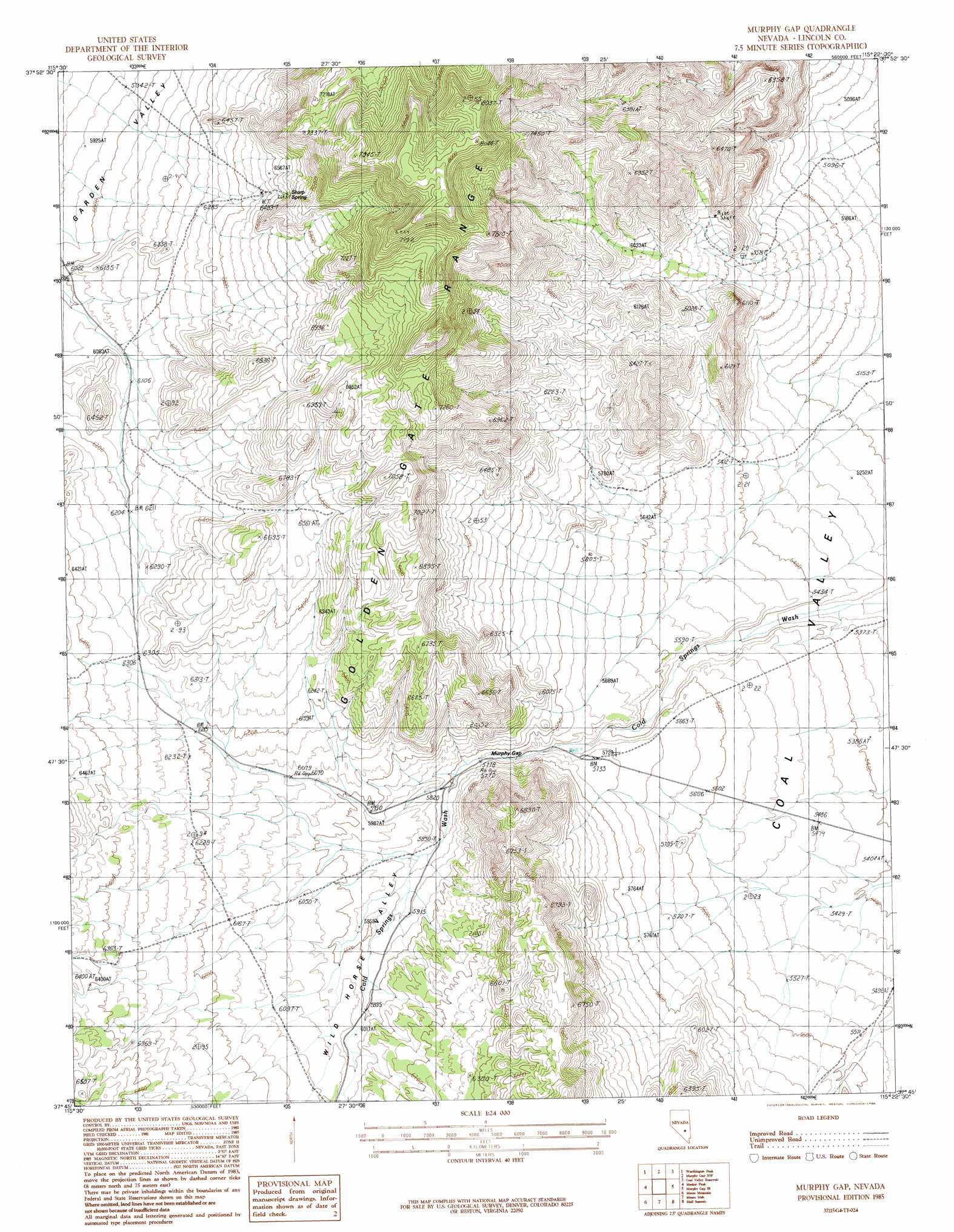
Murphy Gap Topo Map Nevada
To zoom in, hover over the map of Murphy Gap
USGS Topo Quad 37115g4 - 1:24,000 scale
| Topo Map Name: | Murphy Gap |
| USGS Topo Quad ID: | 37115g4 |
| Print Size: | ca. 21 1/4" wide x 27" high |
| Southeast Coordinates: | 37.75° N latitude / 115.375° W longitude |
| Map Center Coordinates: | 37.8125° N latitude / 115.4375° W longitude |
| U.S. State: | NV |
| Filename: | o37115g4.jpg |
| Download Map JPG Image: | Murphy Gap topo map 1:24,000 scale |
| Map Type: | Topographic |
| Topo Series: | 7.5´ |
| Map Scale: | 1:24,000 |
| Source of Map Images: | United States Geological Survey (USGS) |
| Alternate Map Versions: |
Murphy Gap NV 1985, updated 1986 Download PDF Buy paper map Murphy Gap NV 2012 Download PDF Buy paper map Murphy Gap NV 2015 Download PDF Buy paper map |
1:24,000 Topo Quads surrounding Murphy Gap
Badger Gulch |
Wadsworth Ranch |
Water Gap West |
Water Gap East |
Timber Mountain Pass West |
Mccutchen Spring |
Worthington Peak |
Murphy Gap Nw |
Coal Valley Reservoir |
Oreana Spring |
Worthington Peak Sw |
Meeker Peak |
Murphy Gap |
Murphy Gap Se |
Seaman Wash |
Timpiute Mountain North |
Monte Mountain |
Mount Irish |
Mail Summit |
Fossil Peak |
Tempiute Mountain South |
Tempiute Mountain Se |
Crescent Spring |
Mount Irish Se |
Hiko |
> Back to 37115e1 at 1:100,000 scale
> Back to 37114a1 at 1:250,000 scale
> Back to U.S. Topo Maps home
Murphy Gap topo map: Gazetteer
Murphy Gap: Gaps
Murphy Gap elevation 1750m 5741′Murphy Gap: Springs
Sharp Spring elevation 2031m 6663′Tule Spring elevation 1525m 5003′
Murphy Gap: Valleys
Wild Horse Valley elevation 1765m 5790′Murphy Gap digital topo map on disk
Buy this Murphy Gap topo map showing relief, roads, GPS coordinates and other geographical features, as a high-resolution digital map file on DVD: