Trail Ridge Topo Map Nevada
To zoom in, hover over the map of Trail Ridge
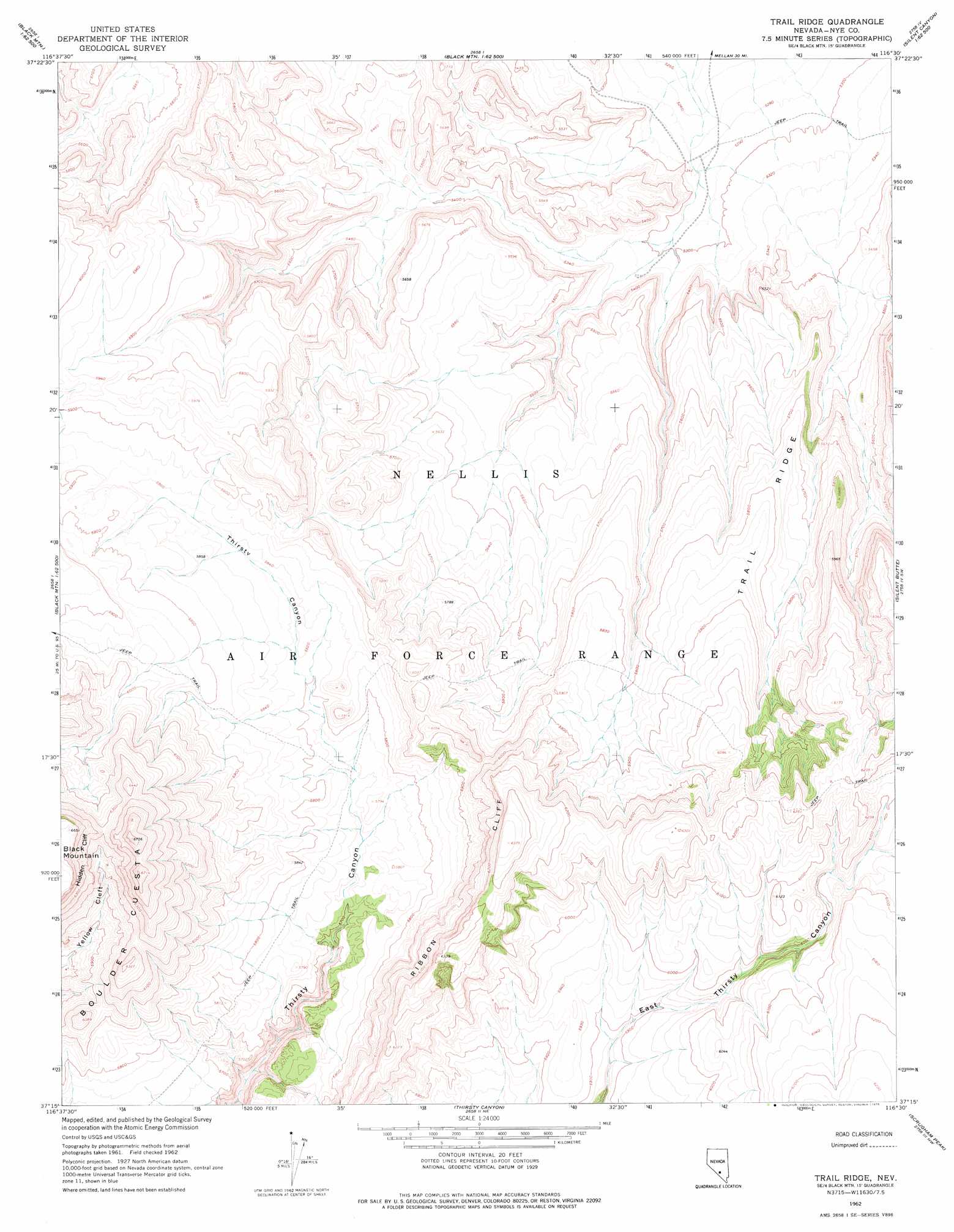
USGS Topo Quad 37116c5 - 1:24,000 scale
| Topo Map Name: | Trail Ridge |
| USGS Topo Quad ID: | 37116c5 |
| Print Size: | ca. 21 1/4" wide x 27" high |
| Southeast Coordinates: | 37.25° N latitude / 116.5° W longitude |
| Map Center Coordinates: | 37.3125° N latitude / 116.5625° W longitude |
| U.S. State: | NV |
| Filename: | o37116c5.jpg |
| Download Map JPG Image: | Trail Ridge topo map 1:24,000 scale |
| Map Type: | Topographic |
| Topo Series: | 7.5´ |
| Map Scale: | 1:24,000 |
| Source of Map Images: | United States Geological Survey (USGS) |
| Alternate Map Versions: |
Trail Ridge NV 1962, updated 1964 Download PDF Buy paper map Trail Ridge NV 1962, updated 1975 Download PDF Buy paper map |
1:24,000 Topo Quads surrounding Trail Ridge
Civet Cat Cave |
Trappman Hills |
Triangle Mountain |
West Of Quartzite Mountain |
Quartzite Mountain |
Tolicha Peak Ne |
Mount Helen |
Gold Flat West |
Gold Flat East |
Apache Tear Canyon |
Tolicha Peak |
Black Mountain |
Trail Ridge |
Silent Butte |
Dead Horse Flat |
Springdale Ne |
Thirsty Canyon Nw |
Thirsty Canyon |
Scrugham Peak |
Ammonia Tanks |
Springdale |
Thirsty Canyon Sw |
Thirsty Canyon Se |
Timber Mountain |
Buckboard Mesa |
> Back to 37116a1 at 1:100,000 scale
> Back to 37116a1 at 1:250,000 scale
> Back to U.S. Topo Maps home
Trail Ridge topo map: Gazetteer
Trail Ridge: Cliffs
Hidden Cliff elevation 1986m 6515′Ribbon Cliff elevation 1890m 6200′
Trail Ridge: Ridges
Boulder Cuesta elevation 1888m 6194′Trail Ridge elevation 1778m 5833′
Trail Ridge digital topo map on disk
Buy this Trail Ridge topo map showing relief, roads, GPS coordinates and other geographical features, as a high-resolution digital map file on DVD: