Tolicha Peak Sw Topo Map Nevada
To zoom in, hover over the map of Tolicha Peak Sw
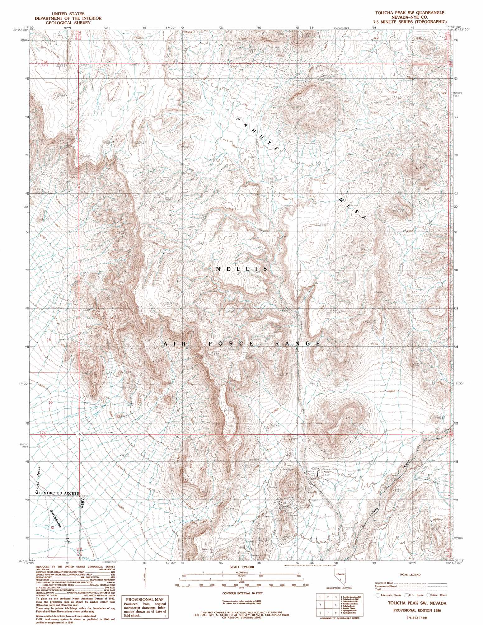
USGS Topo Quad 37116c8 - 1:24,000 scale
| Topo Map Name: | Tolicha Peak Sw |
| USGS Topo Quad ID: | 37116c8 |
| Print Size: | ca. 21 1/4" wide x 27" high |
| Southeast Coordinates: | 37.25° N latitude / 116.875° W longitude |
| Map Center Coordinates: | 37.3125° N latitude / 116.9375° W longitude |
| U.S. State: | NV |
| Filename: | o37116c8.jpg |
| Download Map JPG Image: | Tolicha Peak Sw topo map 1:24,000 scale |
| Map Type: | Topographic |
| Topo Series: | 7.5´ |
| Map Scale: | 1:24,000 |
| Source of Map Images: | United States Geological Survey (USGS) |
| Alternate Map Versions: |
Tolicha Peak SW NV 1986, updated 1986 Download PDF Buy paper map |
1:24,000 Topo Quads surrounding Tolicha Peak Sw
Ralston |
Stonewall Spring |
Pack Rat Canyon |
Civet Cat Cave |
Trappman Hills |
Stonewall Pass |
Scottys Junction Ne |
Tolicha Peak Nw |
Tolicha Peak Ne |
Mount Helen |
Scottys Junction Sw |
Scottys Junction |
Tolicha Peak Sw |
Tolicha Peak |
Black Mountain |
Bonnie Claire Lake |
Bonnie Claire |
Springdale Nw |
Springdale Ne |
Thirsty Canyon Nw |
Bonnie Claire Sw |
Bonnie Claire Se |
Springdale Sw |
Springdale |
Thirsty Canyon Sw |
> Back to 37116a1 at 1:100,000 scale
> Back to 37116a1 at 1:250,000 scale
> Back to U.S. Topo Maps home
Tolicha Peak Sw topo map: Gazetteer
Tolicha Peak Sw: Mines
Clarkdale Mine elevation 1408m 4619′Wyoming Scorpion Mine elevation 1449m 4753′
Yellow Gold Mine elevation 1443m 4734′
Tolicha Peak Sw: Populated Places
Carrs Camp (historical) elevation 1414m 4639′Clarkdale (historical) elevation 1404m 4606′
Tolicha Peak Sw digital topo map on disk
Buy this Tolicha Peak Sw topo map showing relief, roads, GPS coordinates and other geographical features, as a high-resolution digital map file on DVD: