Mount Helen Topo Map Nevada
To zoom in, hover over the map of Mount Helen
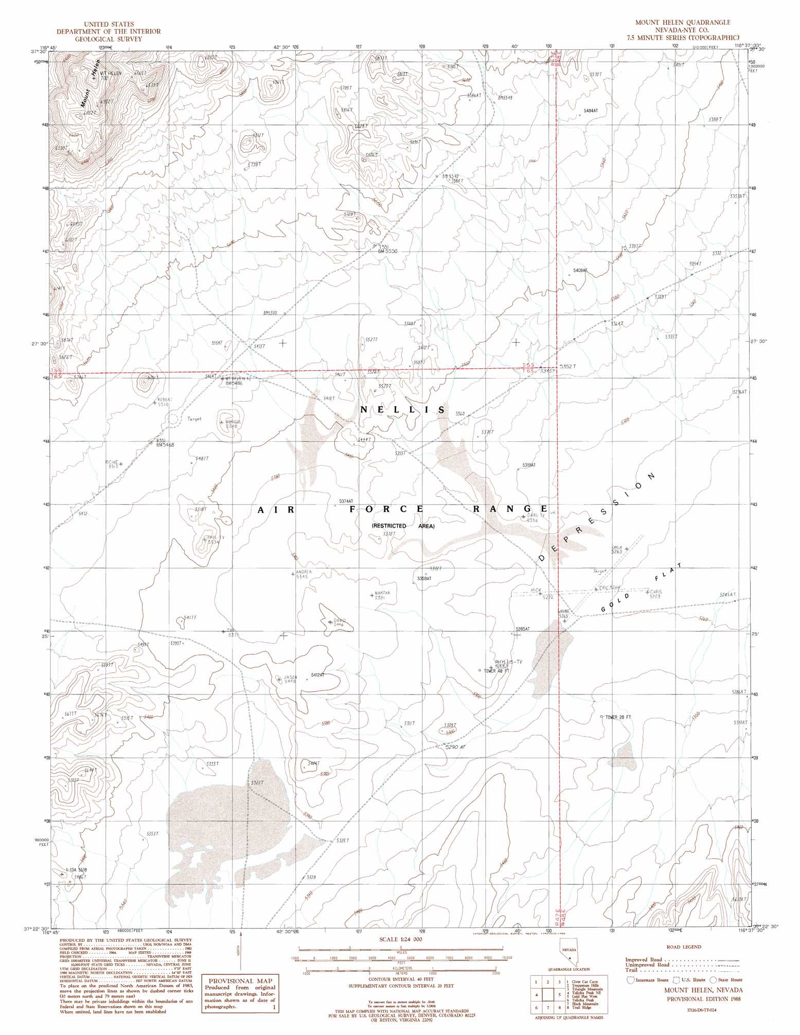
USGS Topo Quad 37116d6 - 1:24,000 scale
| Topo Map Name: | Mount Helen |
| USGS Topo Quad ID: | 37116d6 |
| Print Size: | ca. 21 1/4" wide x 27" high |
| Southeast Coordinates: | 37.375° N latitude / 116.625° W longitude |
| Map Center Coordinates: | 37.4375° N latitude / 116.6875° W longitude |
| U.S. State: | NV |
| Filename: | o37116d6.jpg |
| Download Map JPG Image: | Mount Helen topo map 1:24,000 scale |
| Map Type: | Topographic |
| Topo Series: | 7.5´ |
| Map Scale: | 1:24,000 |
| Source of Map Images: | United States Geological Survey (USGS) |
| Alternate Map Versions: |
Mount Helen NV 1988, updated 1988 Download PDF Buy paper map |
1:24,000 Topo Quads surrounding Mount Helen
White Patch Draw |
Cactus Spring |
Roller Coaster Knob |
Mellan |
Wild Horse Ranch |
Pack Rat Canyon |
Civet Cat Cave |
Trappman Hills |
Triangle Mountain |
West Of Quartzite Mountain |
Tolicha Peak Nw |
Tolicha Peak Ne |
Mount Helen |
Gold Flat West |
Gold Flat East |
Tolicha Peak Sw |
Tolicha Peak |
Black Mountain |
Trail Ridge |
Silent Butte |
Springdale Nw |
Springdale Ne |
Thirsty Canyon Nw |
Thirsty Canyon |
Scrugham Peak |
> Back to 37116a1 at 1:100,000 scale
> Back to 37116a1 at 1:250,000 scale
> Back to U.S. Topo Maps home
Mount Helen topo map: Gazetteer
Mount Helen: Lakes
Dry Lake elevation 1625m 5331′Mount Helen: Wells
Salisbury Well (historical) elevation 1606m 5269′Mount Helen digital topo map on disk
Buy this Mount Helen topo map showing relief, roads, GPS coordinates and other geographical features, as a high-resolution digital map file on DVD: