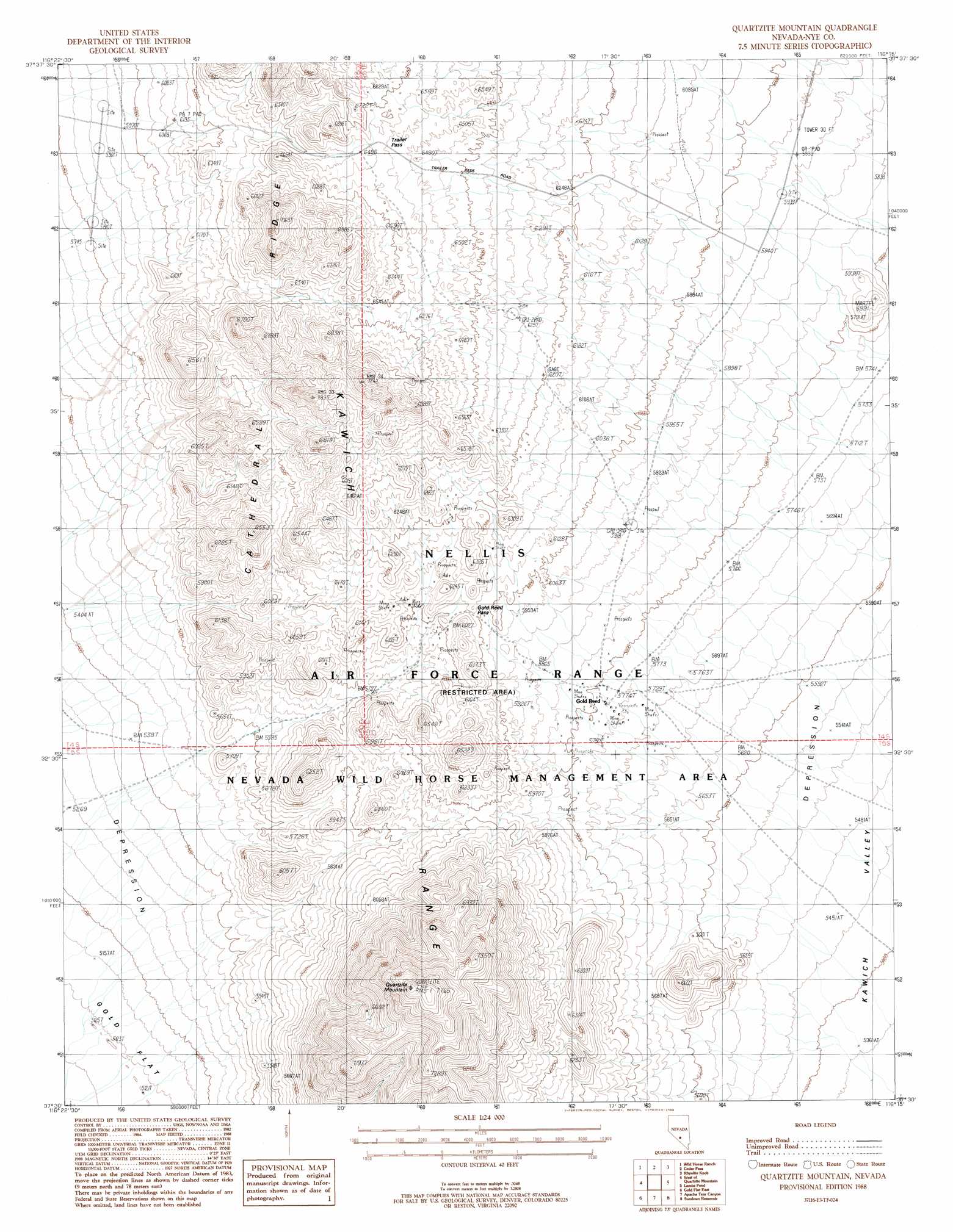
Quartzite Mountain Topo Map Nevada
To zoom in, hover over the map of Quartzite Mountain
USGS Topo Quad 37116e3 - 1:24,000 scale
| Topo Map Name: | Quartzite Mountain |
| USGS Topo Quad ID: | 37116e3 |
| Print Size: | ca. 21 1/4" wide x 27" high |
| Southeast Coordinates: | 37.5° N latitude / 116.25° W longitude |
| Map Center Coordinates: | 37.5625° N latitude / 116.3125° W longitude |
| U.S. State: | NV |
| Filename: | o37116e3.jpg |
| Download Map JPG Image: | Quartzite Mountain topo map 1:24,000 scale |
| Map Type: | Topographic |
| Topo Series: | 7.5´ |
| Map Scale: | 1:24,000 |
| Source of Map Images: | United States Geological Survey (USGS) |
| Alternate Map Versions: |
1:24,000 Topo Quads surrounding Quartzite Mountain
Breen Creek |
Kawich Peak Sw |
Georges Well |
Reveille Peak |
Reveille Peak Se |
Mellan |
Wild Horse Ranch |
Cedar Pass |
Rhyolite Knob |
Monotony Valley |
Triangle Mountain |
West Of Quartzite Mountain |
Quartzite Mountain |
Lambs Pond |
Belted Peak |
Gold Flat West |
Gold Flat East |
Apache Tear Canyon |
Sundown Reservoir |
Wheelbarrow Peak |
Trail Ridge |
Silent Butte |
Dead Horse Flat |
Quartet Dome |
Oak Spring Butte |
> Back to 37116e1 at 1:100,000 scale
> Back to 37116a1 at 1:250,000 scale
> Back to U.S. Topo Maps home
Quartzite Mountain topo map: Gazetteer
Quartzite Mountain: Gaps
Gold Reed Pass elevation 1859m 6099′Trailer Pass elevation 1913m 6276′
Quartzite Mountain: Mines
Gold Reed Mine elevation 1765m 5790′Quartzite Mountain: Post Offices
Kawich Post Office (historical) elevation 1765m 5790′Quartzite Mountain: Ridges
Cathedral Ridge elevation 2012m 6601′Quartzite Mountain: Summits
Quartzite Mountain elevation 2366m 7762′Quartzite Mountain digital topo map on disk
Buy this Quartzite Mountain topo map showing relief, roads, GPS coordinates and other geographical features, as a high-resolution digital map file on DVD: