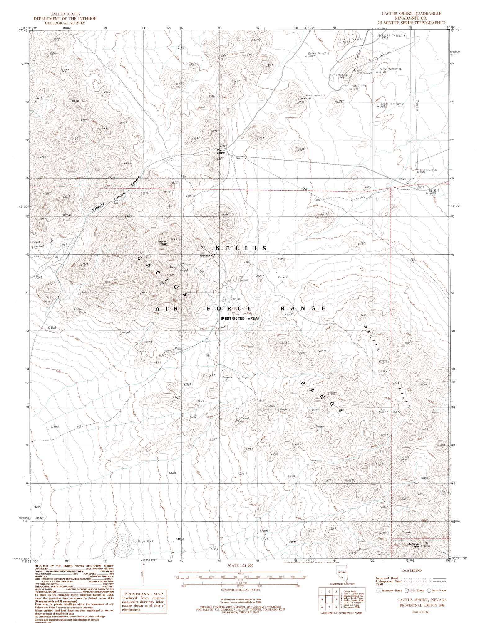
Cactus Spring Topo Map Nevada
To zoom in, hover over the map of Cactus Spring
USGS Topo Quad 37116f7 - 1:24,000 scale
| Topo Map Name: | Cactus Spring |
| USGS Topo Quad ID: | 37116f7 |
| Print Size: | ca. 21 1/4" wide x 27" high |
| Southeast Coordinates: | 37.625° N latitude / 116.75° W longitude |
| Map Center Coordinates: | 37.6875° N latitude / 116.8125° W longitude |
| U.S. State: | NV |
| Filename: | o37116f7.jpg |
| Download Map JPG Image: | Cactus Spring topo map 1:24,000 scale |
| Map Type: | Topographic |
| Topo Series: | 7.5´ |
| Map Scale: | 1:24,000 |
| Source of Map Images: | United States Geological Survey (USGS) |
| Alternate Map Versions: |
Cactus Spring NV 1988, updated 1988 Download PDF Buy paper map |
1:24,000 Topo Quads surrounding Cactus Spring
Mud Lake North |
Monitor Peak |
Reeds Ranch |
Stinking Spring Nw |
Stinking Spring |
Mud Lake South |
Cactus Peak |
East Of Cactus Peak |
Stinking Spring Sw |
Breen Creek |
East Of Goldfield |
White Patch Draw |
Cactus Spring |
Roller Coaster Knob |
Mellan |
Stonewall Spring |
Pack Rat Canyon |
Civet Cat Cave |
Trappman Hills |
Triangle Mountain |
Scottys Junction Ne |
Tolicha Peak Nw |
Tolicha Peak Ne |
Mount Helen |
Gold Flat West |
> Back to 37116e1 at 1:100,000 scale
> Back to 37116a1 at 1:250,000 scale
> Back to U.S. Topo Maps home
Cactus Spring topo map: Gazetteer
Cactus Spring: Mines
Adolph Neher Adit elevation 1874m 6148′Cactus Silver Mine elevation 1967m 6453′
Urania Mine elevation 1904m 6246′
Cactus Spring: Ranges
Cactus Range elevation 1796m 5892′Cactus Spring: Springs
Cactus Spring elevation 1943m 6374′Cactus Spring: Summits
Antelope Peak elevation 2295m 7529′Dacite Hills elevation 1992m 6535′
Urania Peak elevation 2179m 7148′
Cactus Spring digital topo map on disk
Buy this Cactus Spring topo map showing relief, roads, GPS coordinates and other geographical features, as a high-resolution digital map file on DVD: