Stinking Spring Sw Topo Map Nevada
To zoom in, hover over the map of Stinking Spring Sw
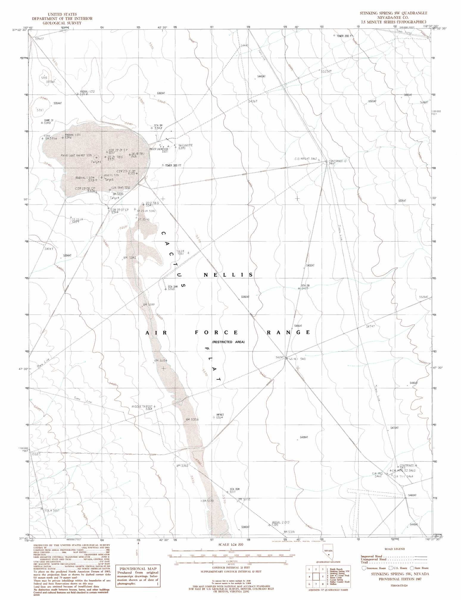
USGS Topo Quad 37116g6 - 1:24,000 scale
| Topo Map Name: | Stinking Spring Sw |
| USGS Topo Quad ID: | 37116g6 |
| Print Size: | ca. 21 1/4" wide x 27" high |
| Southeast Coordinates: | 37.75° N latitude / 116.625° W longitude |
| Map Center Coordinates: | 37.8125° N latitude / 116.6875° W longitude |
| U.S. State: | NV |
| Filename: | o37116g6.jpg |
| Download Map JPG Image: | Stinking Spring Sw topo map 1:24,000 scale |
| Map Type: | Topographic |
| Topo Series: | 7.5´ |
| Map Scale: | 1:24,000 |
| Source of Map Images: | United States Geological Survey (USGS) |
| Alternate Map Versions: |
Stinking Spring SW NV 1987, updated 1988 Download PDF Buy paper map |
1:24,000 Topo Quads surrounding Stinking Spring Sw
Mckinney Tanks |
Yellow Cone |
Stone Cabin Ranch Sw |
Stone Cabin Ranch Se |
Bellehelen |
Monitor Peak |
Reeds Ranch |
Stinking Spring Nw |
Stinking Spring |
Kawich Peak |
Cactus Peak |
East Of Cactus Peak |
Stinking Spring Sw |
Breen Creek |
Kawich Peak Sw |
White Patch Draw |
Cactus Spring |
Roller Coaster Knob |
Mellan |
Wild Horse Ranch |
Pack Rat Canyon |
Civet Cat Cave |
Trappman Hills |
Triangle Mountain |
West Of Quartzite Mountain |
> Back to 37116e1 at 1:100,000 scale
> Back to 37116a1 at 1:250,000 scale
> Back to U.S. Topo Maps home
Stinking Spring Sw digital topo map on disk
Buy this Stinking Spring Sw topo map showing relief, roads, GPS coordinates and other geographical features, as a high-resolution digital map file on DVD: