Piper Peak Topo Map Nevada
To zoom in, hover over the map of Piper Peak
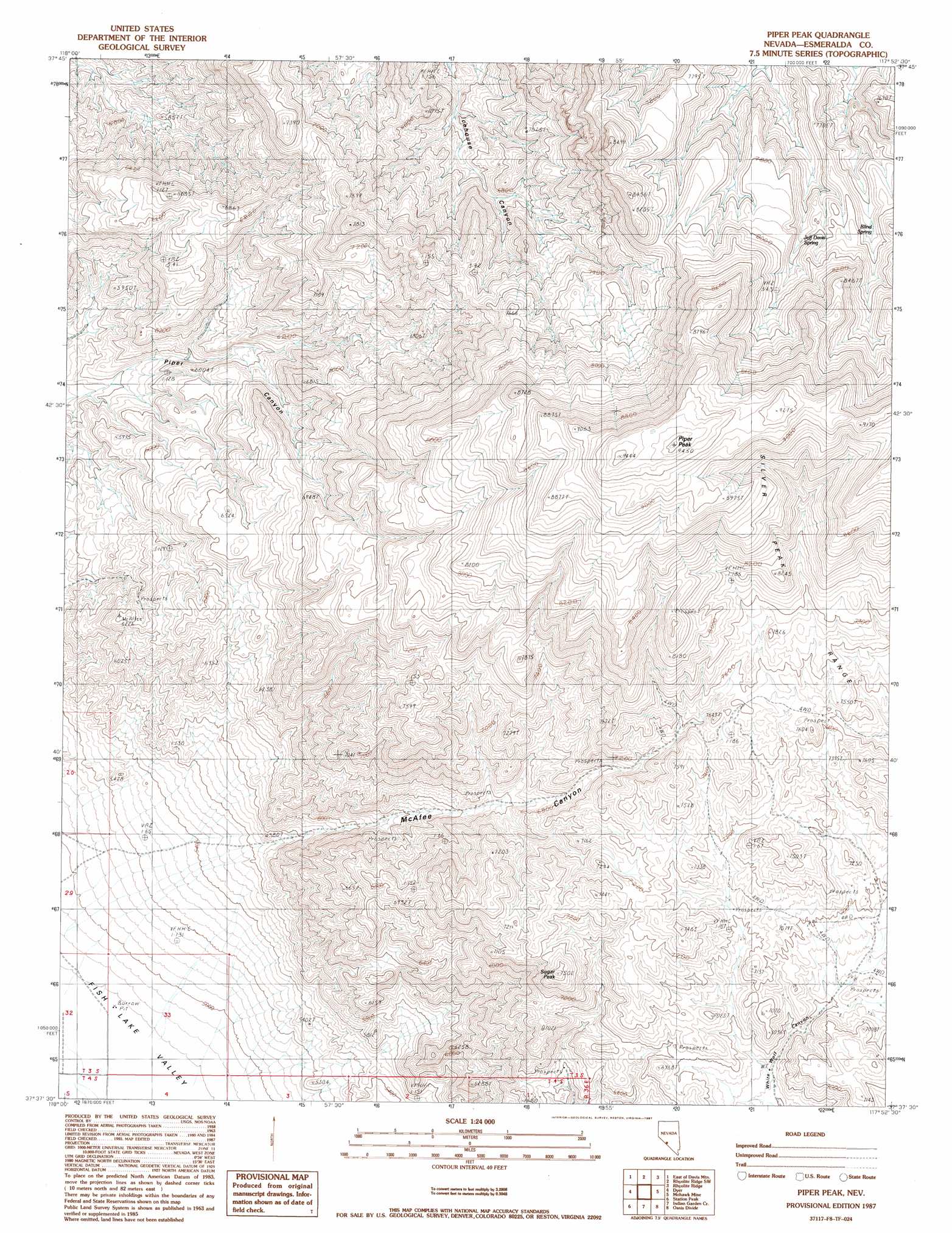
USGS Topo Quad 37117f8 - 1:24,000 scale
| Topo Map Name: | Piper Peak |
| USGS Topo Quad ID: | 37117f8 |
| Print Size: | ca. 21 1/4" wide x 27" high |
| Southeast Coordinates: | 37.625° N latitude / 117.875° W longitude |
| Map Center Coordinates: | 37.6875° N latitude / 117.9375° W longitude |
| U.S. State: | NV |
| Filename: | o37117f8.jpg |
| Download Map JPG Image: | Piper Peak topo map 1:24,000 scale |
| Map Type: | Topographic |
| Topo Series: | 7.5´ |
| Map Scale: | 1:24,000 |
| Source of Map Images: | United States Geological Survey (USGS) |
| Alternate Map Versions: |
Piper Peak NV 1987, updated 1987 Download PDF Buy paper map Piper Peak NV 2011 Download PDF Buy paper map Piper Peak NV 2014 Download PDF Buy paper map |
1:24,000 Topo Quads surrounding Piper Peak
Volcanic Hills West |
Volcanic Hills East |
Rhyolite Ridge Nw |
Rhyolite Ridge Ne |
North Of Silver Peak |
Davis Mountain |
East Of Davis Mountain |
Rhyolite Ridge Sw |
Rhyolite Ridge |
Silver Peak |
Juniper Mountain |
Dyer |
Piper Peak |
Mohawk Mine |
Lida Wash Nw |
Mount Barcroft |
Station Peak |
Indian Garden Creek |
Oasis Divide |
Lida Wash Sw |
Blanco Mountain |
Crooked Creek |
Chocolate Mountain |
Sylvania Canyon |
Sylvania Mountains |
> Back to 37117e1 at 1:100,000 scale
> Back to 37116a1 at 1:250,000 scale
> Back to U.S. Topo Maps home
Piper Peak topo map: Gazetteer
Piper Peak: Springs
Blind Spring elevation 2354m 7723′Jeff Davis Spring elevation 2401m 7877′
Piper Peak: Summits
Piper Peak elevation 2856m 9370′Sugar Peak elevation 2265m 7431′
Piper Peak: Valleys
McAfee Canyon elevation 1710m 5610′Piper Peak digital topo map on disk
Buy this Piper Peak topo map showing relief, roads, GPS coordinates and other geographical features, as a high-resolution digital map file on DVD: