Rhyolite Ridge Nw Topo Map Nevada
To zoom in, hover over the map of Rhyolite Ridge Nw
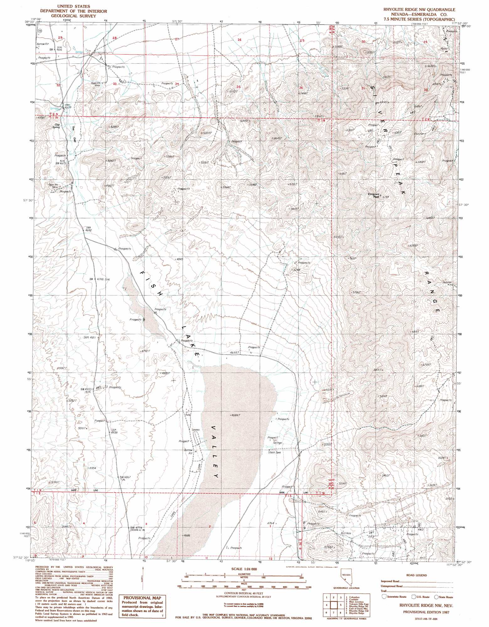
USGS Topo Quad 37117h8 - 1:24,000 scale
| Topo Map Name: | Rhyolite Ridge Nw |
| USGS Topo Quad ID: | 37117h8 |
| Print Size: | ca. 21 1/4" wide x 27" high |
| Southeast Coordinates: | 37.875° N latitude / 117.875° W longitude |
| Map Center Coordinates: | 37.9375° N latitude / 117.9375° W longitude |
| U.S. State: | NV |
| Filename: | o37117h8.jpg |
| Download Map JPG Image: | Rhyolite Ridge Nw topo map 1:24,000 scale |
| Map Type: | Topographic |
| Topo Series: | 7.5´ |
| Map Scale: | 1:24,000 |
| Source of Map Images: | United States Geological Survey (USGS) |
| Alternate Map Versions: |
Rhyolite Ridge NW NV 1987, updated 1987 Download PDF Buy paper map Rhyolite Ridge NW NV 2011 Download PDF Buy paper map Rhyolite Ridge NW NV 2014 Download PDF Buy paper map |
1:24,000 Topo Quads surrounding Rhyolite Ridge Nw
Belleville |
Candelaria |
Rock Hill |
Coaldale Ne |
Gilbert |
Miller Mountain |
Columbus |
Coaldale |
Blair Junction |
Devils Gate |
Volcanic Hills West |
Volcanic Hills East |
Rhyolite Ridge Nw |
Rhyolite Ridge Ne |
North Of Silver Peak |
Davis Mountain |
East Of Davis Mountain |
Rhyolite Ridge Sw |
Rhyolite Ridge |
Silver Peak |
Juniper Mountain |
Dyer |
Piper Peak |
Mohawk Mine |
Lida Wash Nw |
> Back to 37117e1 at 1:100,000 scale
> Back to 37116a1 at 1:250,000 scale
> Back to U.S. Topo Maps home
Rhyolite Ridge Nw topo map: Gazetteer
Rhyolite Ridge Nw: Flats
Fish Lake Valley Marsh elevation 1430m 4691′Rhyolite Ridge Nw: Gaps
Emigrant Pass elevation 1848m 6062′Rhyolite Ridge Nw: Mines
Gap Strike Mine elevation 1489m 4885′Rhyolite Ridge Nw: Springs
Gap Spring elevation 1412m 4632′Rhyolite Ridge Nw: Summits
Emigrant Peak elevation 1980m 6496′Rhyolite Ridge Nw digital topo map on disk
Buy this Rhyolite Ridge Nw topo map showing relief, roads, GPS coordinates and other geographical features, as a high-resolution digital map file on DVD: