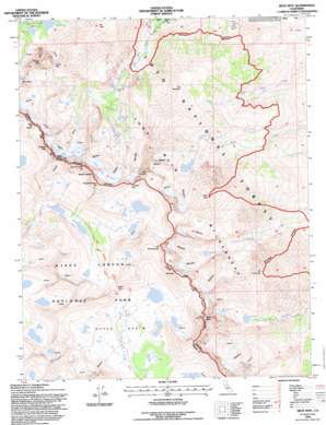
Split Mountain Topo Map California
To zoom in, hover over the map of Split Mountain
USGS Topo Quad 37118a4 - 1:24,000 scale
| Topo Map Name: | Split Mountain |
| USGS Topo Quad ID: | 37118a4 |
| Print Size: | ca. 21 1/4" wide x 27" high |
| Southeast Coordinates: | 37° N latitude / 118.375° W longitude |
| Map Center Coordinates: | 37.0625° N latitude / 118.4375° W longitude |
| U.S. State: | CA |
| Filename: | o37118a4.jpg |
| Download Map JPG Image: | Split Mountain topo map 1:24,000 scale |
| Map Type: | Topographic |
| Topo Series: | 7.5´ |
| Map Scale: | 1:24,000 |
| Source of Map Images: | United States Geological Survey (USGS) |
| Alternate Map Versions: |
Split Mtn. CA 1984, updated 1984 Download PDF Buy paper map Split Mtn CA 1990, updated 1995 Download PDF Buy paper map Split Mtn CA 1994, updated 1997 Download PDF Buy paper map Split Mountain CA 2012 Download PDF Buy paper map Split Mountain CA 2015 Download PDF Buy paper map |
| FStopo: | US Forest Service topo Split Mountain is available: Download FStopo PDF Download FStopo TIF |
1:24,000 Topo Quads surrounding Split Mountain
> Back to 37118a1 at 1:100,000 scale
> Back to 37118a1 at 1:250,000 scale
> Back to U.S. Topo Maps home
Split Mountain topo map: Gazetteer
Split Mountain: Basins
Upper Basin elevation 3395m 11138′Split Mountain: Dams
Big Pine Creek Number 2 6-011 Dam elevation 3075m 10088′Split Mountain: Gaps
Contact Pass elevation 3620m 11876′Mather Pass elevation 3678m 12066′
Southfork Pass elevation 3760m 12335′
Split Mountain: Glaciers
Middle Palisade Glacier elevation 3890m 12762′Norman Clyde Glacier elevation 3682m 12080′
Split Mountain: Lakes
Birch Lake elevation 3296m 10813′Brainerd Lake elevation 3131m 10272′
Elinor Lake elevation 3360m 11023′
Finger Lake elevation 3321m 10895′
Palisade Lakes elevation 3268m 10721′
Red Lake elevation 3198m 10492′
Second Lake elevation 3075m 10088′
Third Lake elevation 3143m 10311′
Tinemaha Lake elevation 3476m 11404′
Willow Lake elevation 2917m 9570′
Split Mountain: Mines
Blue Star Mines elevation 2468m 8097′Split Mountain: Streams
North Fork Big Pine Creek elevation 2372m 7782′South Fork Big Pine Creek elevation 2372m 7782′
Split Mountain: Summits
Birch Mountain elevation 4134m 13562′Disappointment Peak elevation 4208m 13805′
Kid Mountain elevation 3563m 11689′
Middle Palisade elevation 4124m 13530′
Mount Alice elevation 3451m 11322′
Mount Bolton Brown elevation 4092m 13425′
Mount Jepson elevation 3994m 13103′
Mount Prater elevation 4097m 13441′
Mount Tinemaha elevation 3770m 12368′
Norman Clyde Peak elevation 4047m 13277′
Palisade Crest elevation 4061m 13323′
Split Mountain elevation 4269m 14005′
Temple Crag elevation 3907m 12818′
The Thumb elevation 4058m 13313′
Split Mountain digital topo map on disk
Buy this Split Mountain topo map showing relief, roads, GPS coordinates and other geographical features, as a high-resolution digital map file on DVD:


