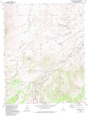
Tungsten Hills Topo Map California
To zoom in, hover over the map of Tungsten Hills
USGS Topo Quad 37118c5 - 1:24,000 scale
| Topo Map Name: | Tungsten Hills |
| USGS Topo Quad ID: | 37118c5 |
| Print Size: | ca. 21 1/4" wide x 27" high |
| Southeast Coordinates: | 37.25° N latitude / 118.5° W longitude |
| Map Center Coordinates: | 37.3125° N latitude / 118.5625° W longitude |
| U.S. State: | CA |
| Filename: | o37118c5.jpg |
| Download Map JPG Image: | Tungsten Hills topo map 1:24,000 scale |
| Map Type: | Topographic |
| Topo Series: | 7.5´ |
| Map Scale: | 1:24,000 |
| Source of Map Images: | United States Geological Survey (USGS) |
| Alternate Map Versions: |
Tungsten Hills CA 1982, updated 1983 Download PDF Buy paper map Tungsten Hills CA 1982, updated 1987 Download PDF Buy paper map Tungsten Hills CA 1990, updated 1995 Download PDF Buy paper map Tungsten Hills CA 1994, updated 1997 Download PDF Buy paper map Tungsten Hills CA 2012 Download PDF Buy paper map Tungsten Hills CA 2015 Download PDF Buy paper map |
| FStopo: | US Forest Service topo Tungsten Hills is available: Download FStopo PDF Download FStopo TIF |
1:24,000 Topo Quads surrounding Tungsten Hills
> Back to 37118a1 at 1:100,000 scale
> Back to 37118a1 at 1:250,000 scale
> Back to U.S. Topo Maps home
Tungsten Hills topo map: Gazetteer
Tungsten Hills: Areas
Buttermilk Country elevation 2411m 7910′Tungsten Hills: Flats
Dutch Johns Meadow elevation 2104m 6902′Longley Meadow elevation 1793m 5882′
McGee Meadow elevation 1805m 5921′
Sharps Meadow elevation 1888m 6194′
Tungsten Hills elevation 1741m 5711′
Upper Meadow elevation 2160m 7086′
Tungsten Hills: Mines
Aeroplane Mine elevation 1787m 5862′Hilltop Prospect elevation 3118m 10229′
Jackrabbit Mine elevation 1595m 5232′
Little Egypt Prospect elevation 2979m 9773′
Little Sister Mine elevation 1662m 5452′
Lucky Strike Mine elevation 1719m 5639′
Raindrop Prospect elevation 1875m 6151′
Tungsten Blue Mine elevation 1635m 5364′
Tungsten Peak Prospect elevation 1735m 5692′
Van Loon Prospect elevation 1831m 6007′
White Caps Mine elevation 1638m 5374′
Tungsten Hills: Streams
Coyote Creek elevation 1675m 5495′Egypt Creek elevation 1960m 6430′
Middle Fork Bishop Creek elevation 2265m 7431′
South Fork Bishop Creek elevation 2256m 7401′
Tungsten Hills: Summits
Grouse Mountain elevation 2437m 7995′Tungsten Hills: Valleys
Deep Canyon elevation 1416m 4645′Sand Canyon elevation 1585m 5200′
Tungsten Hills digital topo map on disk
Buy this Tungsten Hills topo map showing relief, roads, GPS coordinates and other geographical features, as a high-resolution digital map file on DVD:


