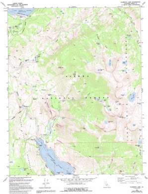
Florence Lake Topo Map California
To zoom in, hover over the map of Florence Lake
USGS Topo Quad 37118c8 - 1:24,000 scale
| Topo Map Name: | Florence Lake |
| USGS Topo Quad ID: | 37118c8 |
| Print Size: | ca. 21 1/4" wide x 27" high |
| Southeast Coordinates: | 37.25° N latitude / 118.875° W longitude |
| Map Center Coordinates: | 37.3125° N latitude / 118.9375° W longitude |
| U.S. State: | CA |
| Filename: | o37118c8.jpg |
| Download Map JPG Image: | Florence Lake topo map 1:24,000 scale |
| Map Type: | Topographic |
| Topo Series: | 7.5´ |
| Map Scale: | 1:24,000 |
| Source of Map Images: | United States Geological Survey (USGS) |
| Alternate Map Versions: |
Florence Lake CA 1983, updated 1983 Download PDF Buy paper map Florence Lake CA 1983, updated 1994 Download PDF Buy paper map Florence Lake CA 2004, updated 2007 Download PDF Buy paper map Florence Lake CA 2012 Download PDF Buy paper map Florence Lake CA 2015 Download PDF Buy paper map |
| FStopo: | US Forest Service topo Florence Lake is available: Download FStopo PDF Download FStopo TIF |
1:24,000 Topo Quads surrounding Florence Lake
> Back to 37118a1 at 1:100,000 scale
> Back to 37118a1 at 1:250,000 scale
> Back to U.S. Topo Maps home
Florence Lake topo map: Gazetteer
Florence Lake: Dams
Bear Creek Diversion 104-000 Dam elevation 2265m 7431′Bear Diversion Dam elevation 2243m 7358′
Florence Lake 104-009 Dam elevation 2234m 7329′
Hooper Diversion Dam elevation 2319m 7608′
Mono Creek Diversion 104-012 Dam elevation 2238m 7342′
Vermilion Valley 104-023 Dam elevation 2331m 7647′
Vermilion Valley Dam elevation 2331m 7647′
Florence Lake: Flats
Hell Hole Meadow elevation 2074m 6804′Jackass Meadow elevation 2195m 7201′
Manse Meadow elevation 2778m 9114′
Poison Meadow elevation 2071m 6794′
Florence Lake: Islands
MacKenzie Island elevation 2235m 7332′Florence Lake: Lakes
Apollo Lake elevation 3214m 10544′Bear Twin Lakes elevation 2928m 9606′
Chamberlain Lake elevation 3186m 10452′
Cirque Lake elevation 3181m 10436′
Crazy Lake elevation 3377m 11079′
Depressed Lake elevation 3315m 10875′
Dutch Lake elevation 2777m 9110′
Foolish Lake elevation 3329m 10921′
Gordon Lake elevation 3027m 9931′
Harvey Lake elevation 3094m 10150′
Hooper Lake elevation 3226m 10583′
Marcella Lake elevation 2982m 9783′
Marshall Lake elevation 3164m 10380′
Neil Lake elevation 3242m 10636′
Orchid Lake elevation 3239m 10626′
Rose Lake elevation 3201m 10501′
Rosebud Lake elevation 3306m 10846′
Ward Lake elevation 2226m 7303′
Florence Lake: Pillars
The Tombstone elevation 3207m 10521′Florence Lake: Reservoirs
Florence Lake elevation 2234m 7329′Lake Thomas A Edison elevation 2331m 7647′
Florence Lake: Ridges
Bear Ridge elevation 2636m 8648′Florence Lake: Streams
Bear Creek elevation 2065m 6774′Cirque Creek elevation 2492m 8175′
Crater Creek elevation 2235m 7332′
Hilgard Branch elevation 2846m 9337′
Hooper Creek elevation 2306m 7565′
Tombstone Creek elevation 2196m 7204′
Florence Lake: Summits
Bear Dome elevation 3001m 9845′Florence Rock elevation 2346m 7696′
Infant Buttes elevation 3032m 9947′
Jackass Dike elevation 2336m 7664′
Mount Hooper elevation 3710m 12171′
North Rock elevation 2699m 8854′
Florence Lake digital topo map on disk
Buy this Florence Lake topo map showing relief, roads, GPS coordinates and other geographical features, as a high-resolution digital map file on DVD:


