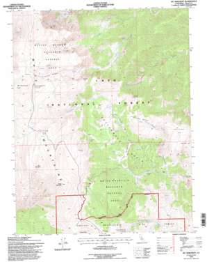
Mount Barcroft Topo Map California
To zoom in, hover over the map of Mount Barcroft
USGS Topo Quad 37118e2 - 1:24,000 scale
| Topo Map Name: | Mount Barcroft |
| USGS Topo Quad ID: | 37118e2 |
| Print Size: | ca. 21 1/4" wide x 27" high |
| Southeast Coordinates: | 37.5° N latitude / 118.125° W longitude |
| Map Center Coordinates: | 37.5625° N latitude / 118.1875° W longitude |
| U.S. State: | CA |
| Filename: | o37118e2.jpg |
| Download Map JPG Image: | Mount Barcroft topo map 1:24,000 scale |
| Map Type: | Topographic |
| Topo Series: | 7.5´ |
| Map Scale: | 1:24,000 |
| Source of Map Images: | United States Geological Survey (USGS) |
| Alternate Map Versions: |
Mt. Barcroft CA 1987, updated 1987 Download PDF Buy paper map Mt. Barcroft CA 1994, updated 1997 Download PDF Buy paper map Mount Barcroft CA 2012 Download PDF Buy paper map Mount Barcroft CA 2015 Download PDF Buy paper map |
| FStopo: | US Forest Service topo Mount Barcroft is available: Download FStopo PDF Download FStopo TIF |
1:24,000 Topo Quads surrounding Mount Barcroft
> Back to 37118e1 at 1:100,000 scale
> Back to 37118a1 at 1:250,000 scale
> Back to U.S. Topo Maps home
Mount Barcroft topo map: Gazetteer
Mount Barcroft: Areas
Ancient Bristlecone Pine Area elevation 3211m 10534′McAfee Meadow Research Natural Area elevation 3600m 11811′
White Mountain Research Natural Area elevation 3314m 10872′
Mount Barcroft: Basins
Cottonwood Basin elevation 2902m 9520′Mount Barcroft: Flats
Campito Meadow elevation 3302m 10833′Granite Meadow elevation 2999m 9839′
McAfee Meadow elevation 3579m 11742′
Tres Plumas Flat elevation 3114m 10216′
Tres Plumas Meadow elevation 3135m 10285′
Mount Barcroft: Mines
Eva Belle Mine elevation 3278m 10754′Golden Siren Mine elevation 3193m 10475′
Mount Barcroft: Streams
North Fork McAfee Creek elevation 2250m 7381′Poison Creek elevation 2869m 9412′
South Fork Cottonwood Creek elevation 2767m 9078′
South Fork McAfee Creek elevation 2242m 7355′
Tres Plumas Creek elevation 2845m 9333′
Mount Barcroft: Summits
Mount Barcroft elevation 3979m 13054′Piute Mountain elevation 3827m 12555′
Sheep Mountain elevation 3801m 12470′
Mount Barcroft digital topo map on disk
Buy this Mount Barcroft topo map showing relief, roads, GPS coordinates and other geographical features, as a high-resolution digital map file on DVD:


