Juniper Mountain Topo Map California
To zoom in, hover over the map of Juniper Mountain
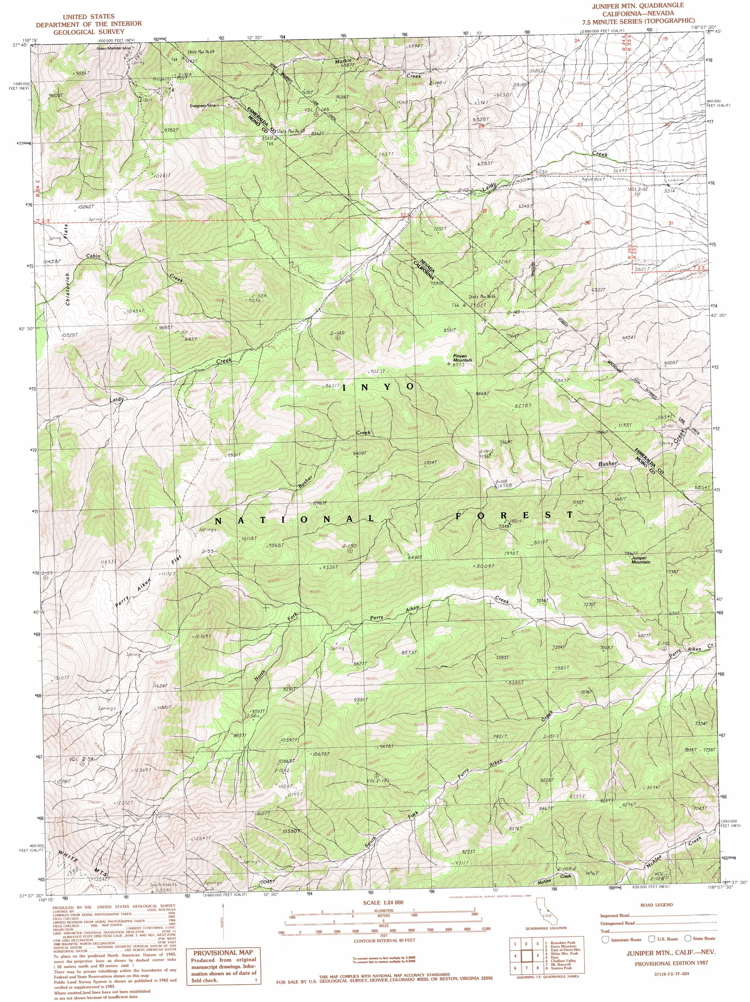
USGS Topo Quad 37118f2 - 1:24,000 scale
| Topo Map Name: | Juniper Mountain |
| USGS Topo Quad ID: | 37118f2 |
| Print Size: | ca. 21 1/4" wide x 27" high |
| Southeast Coordinates: | 37.625° N latitude / 118.125° W longitude |
| Map Center Coordinates: | 37.6875° N latitude / 118.1875° W longitude |
| U.S. States: | CA, NV |
| Filename: | o37118f2.jpg |
| Download Map JPG Image: | Juniper Mountain topo map 1:24,000 scale |
| Map Type: | Topographic |
| Topo Series: | 7.5´ |
| Map Scale: | 1:24,000 |
| Source of Map Images: | United States Geological Survey (USGS) |
| Alternate Map Versions: |
Juniper Mtn CA 1987, updated 1987 Download PDF Buy paper map Juniper Mountain CA 1994, updated 1998 Download PDF Buy paper map Juniper Mountain CA 2012 Download PDF Buy paper map Juniper Mountain CA 2015 Download PDF Buy paper map |
| FStopo: | US Forest Service topo Juniper Mountain is available: Download FStopo PDF Download FStopo TIF |
1:24,000 Topo Quads surrounding Juniper Mountain
Truman Meadows |
Mount Montgomery |
Volcanic Hills West |
Volcanic Hills East |
Rhyolite Ridge Nw |
Benton |
Boundary Peak |
Davis Mountain |
East Of Davis Mountain |
Rhyolite Ridge Sw |
Hammil Valley |
White Mountain Peak |
Juniper Mountain |
Dyer |
Piper Peak |
Chidago Canyon |
Chalfant Valley |
Mount Barcroft |
Station Peak |
Indian Garden Creek |
Fish Slough |
Laws |
Blanco Mountain |
Crooked Creek |
Chocolate Mountain |
> Back to 37118e1 at 1:100,000 scale
> Back to 37118a1 at 1:250,000 scale
> Back to U.S. Topo Maps home
Juniper Mountain topo map: Gazetteer
Juniper Mountain: Flats
Perry Aiken Flat elevation 3407m 11177′Juniper Mountain: Mines
Evergreen Mine elevation 2187m 7175′Evergreen Mine elevation 2344m 7690′
Green Monster Mine elevation 2537m 8323′
Juniper Mountain: Streams
Cabin Creek elevation 2350m 7709′North Fork Perry Aiken Creek elevation 1898m 6227′
South Fork Perry Aiken Creek elevation 1898m 6227′
Juniper Mountain: Summits
Juniper Mountain elevation 2394m 7854′Pinyon Mountain elevation 2669m 8756′
Juniper Mountain digital topo map on disk
Buy this Juniper Mountain topo map showing relief, roads, GPS coordinates and other geographical features, as a high-resolution digital map file on DVD: