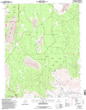
Crestview Topo Map California
To zoom in, hover over the map of Crestview
USGS Topo Quad 37118g8 - 1:24,000 scale
| Topo Map Name: | Crestview |
| USGS Topo Quad ID: | 37118g8 |
| Print Size: | ca. 21 1/4" wide x 27" high |
| Southeast Coordinates: | 37.75° N latitude / 118.875° W longitude |
| Map Center Coordinates: | 37.8125° N latitude / 118.9375° W longitude |
| U.S. State: | CA |
| Filename: | o37118g8.jpg |
| Download Map JPG Image: | Crestview topo map 1:24,000 scale |
| Map Type: | Topographic |
| Topo Series: | 7.5´ |
| Map Scale: | 1:24,000 |
| Source of Map Images: | United States Geological Survey (USGS) |
| Alternate Map Versions: |
Crestview CA 1986, updated 1986 Download PDF Buy paper map Crestview CA 1994, updated 1997 Download PDF Buy paper map Crestview CA 2012 Download PDF Buy paper map Crestview CA 2015 Download PDF Buy paper map |
| FStopo: | US Forest Service topo Crestview is available: Download FStopo PDF Download FStopo TIF |
1:24,000 Topo Quads surrounding Crestview
> Back to 37118e1 at 1:100,000 scale
> Back to 37118a1 at 1:250,000 scale
> Back to U.S. Topo Maps home
Crestview topo map: Gazetteer
Crestview: Flats
East Craters Sand Flat elevation 2421m 7942′Little Sand Flat elevation 2440m 8005′
Crestview: Parks
Indiana Summit Research Natural Area elevation 2476m 8123′Crestview: Populated Places
Crestview elevation 2292m 7519′Crestview: Springs
Bald Mountain Spring elevation 2508m 8228′Big Springs elevation 2224m 7296′
Crestview: Streams
Deadman Creek elevation 2210m 7250′Crestview: Summits
Bald Mountain elevation 2769m 9084′Indiana Summit elevation 2496m 8188′
Crestview: Valleys
Alpers Canyon elevation 2169m 7116′Clark Canyon elevation 2153m 7063′
Crestview digital topo map on disk
Buy this Crestview topo map showing relief, roads, GPS coordinates and other geographical features, as a high-resolution digital map file on DVD:


