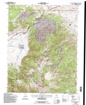
Mount Montgomery Topo Map Nevada
To zoom in, hover over the map of Mount Montgomery
USGS Topo Quad 37118h3 - 1:24,000 scale
| Topo Map Name: | Mount Montgomery |
| USGS Topo Quad ID: | 37118h3 |
| Print Size: | ca. 21 1/4" wide x 27" high |
| Southeast Coordinates: | 37.875° N latitude / 118.25° W longitude |
| Map Center Coordinates: | 37.9375° N latitude / 118.3125° W longitude |
| U.S. State: | NV |
| Filename: | o37118h3.jpg |
| Download Map JPG Image: | Mount Montgomery topo map 1:24,000 scale |
| Map Type: | Topographic |
| Topo Series: | 7.5´ |
| Map Scale: | 1:24,000 |
| Source of Map Images: | United States Geological Survey (USGS) |
| Alternate Map Versions: |
Mt. Montgomery NV 1987, updated 1987 Download PDF Buy paper map Mt. Montgomery NV 1994, updated 1997 Download PDF Buy paper map Mount Montgomery NV 2012 Download PDF Buy paper map Mount Montgomery NV 2014 Download PDF Buy paper map |
| FStopo: | US Forest Service topo Mount Montgomery is available: Download FStopo PDF Download FStopo TIF |
1:24,000 Topo Quads surrounding Mount Montgomery
> Back to 37118e1 at 1:100,000 scale
> Back to 37118a1 at 1:250,000 scale
> Back to U.S. Topo Maps home
Mount Montgomery topo map: Gazetteer
Mount Montgomery: Flats
Kennedy Flats elevation 2986m 9796′Sagehen Flat elevation 2769m 9084′
Mount Montgomery: Gaps
Montgomery Pass elevation 2179m 7148′Mount Montgomery: Mines
Albert Mine elevation 2511m 8238′B and B Mine elevation 2346m 7696′
Buckskin Mine elevation 2361m 7746′
Indian Queen Mine elevation 2796m 9173′
Lucky Mine elevation 2442m 8011′
Montgomery Summit Mine elevation 2318m 7604′
Morgan Mine elevation 2638m 8654′
Queen Canyon Mine elevation 2500m 8202′
Queen Mine elevation 2764m 9068′
Red Rose Mercury Mine elevation 2796m 9173′
Red Rose Mine elevation 2515m 8251′
Spor Mine elevation 2713m 8900′
Tiptop Mine elevation 2661m 8730′
Wild Rose Mine elevation 2737m 8979′
Mount Montgomery: Pillars
Horseshoe Rock elevation 3128m 10262′Mount Montgomery: Populated Places
Bley (historical) elevation 2121m 6958′Gold Hit elevation 2301m 7549′
Mount Montgomery elevation 2173m 7129′
Oneota (historical) elevation 2315m 7595′
Mount Montgomery: Post Offices
Bley Post Office (historical) elevation 2121m 6958′Mount Montgomery Post Office (historical) elevation 2173m 7129′
Oneota Post Office (historical) elevation 2315m 7595′
Mount Montgomery: Ridges
Garner Ridge elevation 2655m 8710′Mustang Mountain elevation 3065m 10055′
Mount Montgomery: Springs
Pinchot Springs elevation 2528m 8293′Mount Montgomery: Streams
Brownie Creek elevation 1975m 6479′Mount Montgomery: Summits
Buffalo Point elevation 2917m 9570′Kennedy Point elevation 3075m 10088′
Mustang Point elevation 3001m 9845′
Sugarloaf elevation 2780m 9120′
Mount Montgomery: Valleys
Queen Canyon elevation 2071m 6794′Sugarloaf Canyon elevation 2302m 7552′
Mount Montgomery digital topo map on disk
Buy this Mount Montgomery topo map showing relief, roads, GPS coordinates and other geographical features, as a high-resolution digital map file on DVD:


