Mono Mills Topo Map California
To zoom in, hover over the map of Mono Mills
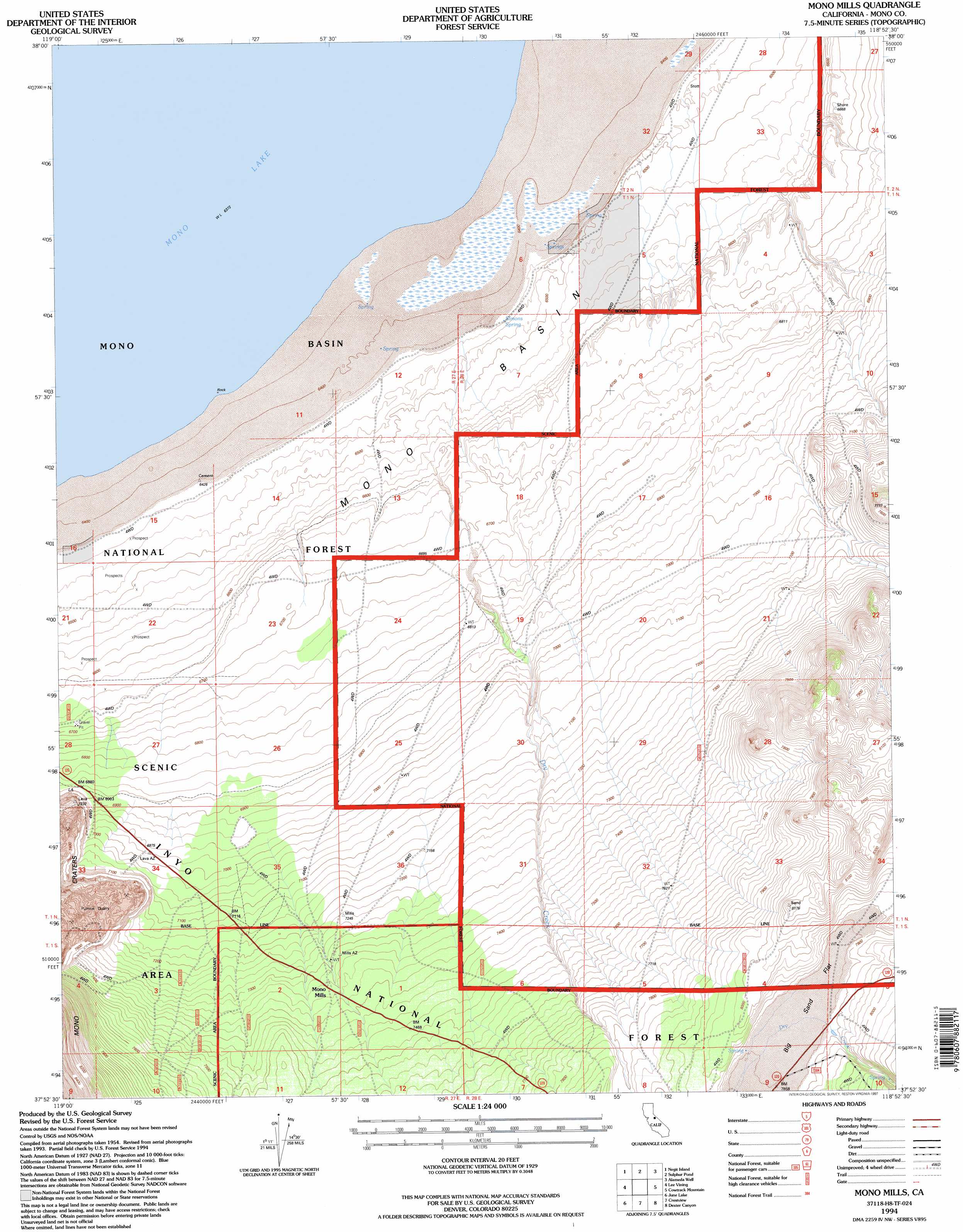
USGS Topo Quad 37118h8 - 1:24,000 scale
| Topo Map Name: | Mono Mills |
| USGS Topo Quad ID: | 37118h8 |
| Print Size: | ca. 21 1/4" wide x 27" high |
| Southeast Coordinates: | 37.875° N latitude / 118.875° W longitude |
| Map Center Coordinates: | 37.9375° N latitude / 118.9375° W longitude |
| U.S. State: | CA |
| Filename: | o37118h8.jpg |
| Download Map JPG Image: | Mono Mills topo map 1:24,000 scale |
| Map Type: | Topographic |
| Topo Series: | 7.5´ |
| Map Scale: | 1:24,000 |
| Source of Map Images: | United States Geological Survey (USGS) |
| Alternate Map Versions: |
Mono Mills CA 1986, updated 1986 Download PDF Buy paper map Mono Mills CA 1994, updated 1997 Download PDF Buy paper map Mono Mills CA 1994, updated 1997 Download PDF Buy paper map Mono Mills CA 2012 Download PDF Buy paper map Mono Mills CA 2015 Download PDF Buy paper map |
| FStopo: | US Forest Service topo Mono Mills is available: Download FStopo PDF Download FStopo TIF |
1:24,000 Topo Quads surrounding Mono Mills
Big Alkali |
Bodie |
Kirkwood Spring |
Cedar Hill |
Anchorite Hills |
Lundy |
Negit Island |
Sulphur Pond |
Alameda Well |
West Of Huntoon Spring |
Mount Dana |
Lee Vining |
Mono Mills |
Cowtrack Mountain |
Indian Meadows |
Koip Peak |
June Lake |
Crestview |
Dexter Canyon |
Glass Mountain |
Mount Ritter |
Mammoth Mountain |
Old Mammoth |
Whitmore Hot Springs |
Watterson Canyon |
> Back to 37118e1 at 1:100,000 scale
> Back to 37118a1 at 1:250,000 scale
> Back to U.S. Topo Maps home
Mono Mills topo map: Gazetteer
Mono Mills: Basins
Mono Basin elevation 1999m 6558′Mono Mills: Flats
Big Sand Flat elevation 2401m 7877′Mono Mills: Populated Places
Mono Mills elevation 2242m 7355′Mono Mills: Springs
Simons Spring elevation 1970m 6463′Mono Mills: Streams
Dry Creek elevation 2025m 6643′Mono Mills digital topo map on disk
Buy this Mono Mills topo map showing relief, roads, GPS coordinates and other geographical features, as a high-resolution digital map file on DVD: