Little Table Mountain Topo Map California
To zoom in, hover over the map of Little Table Mountain
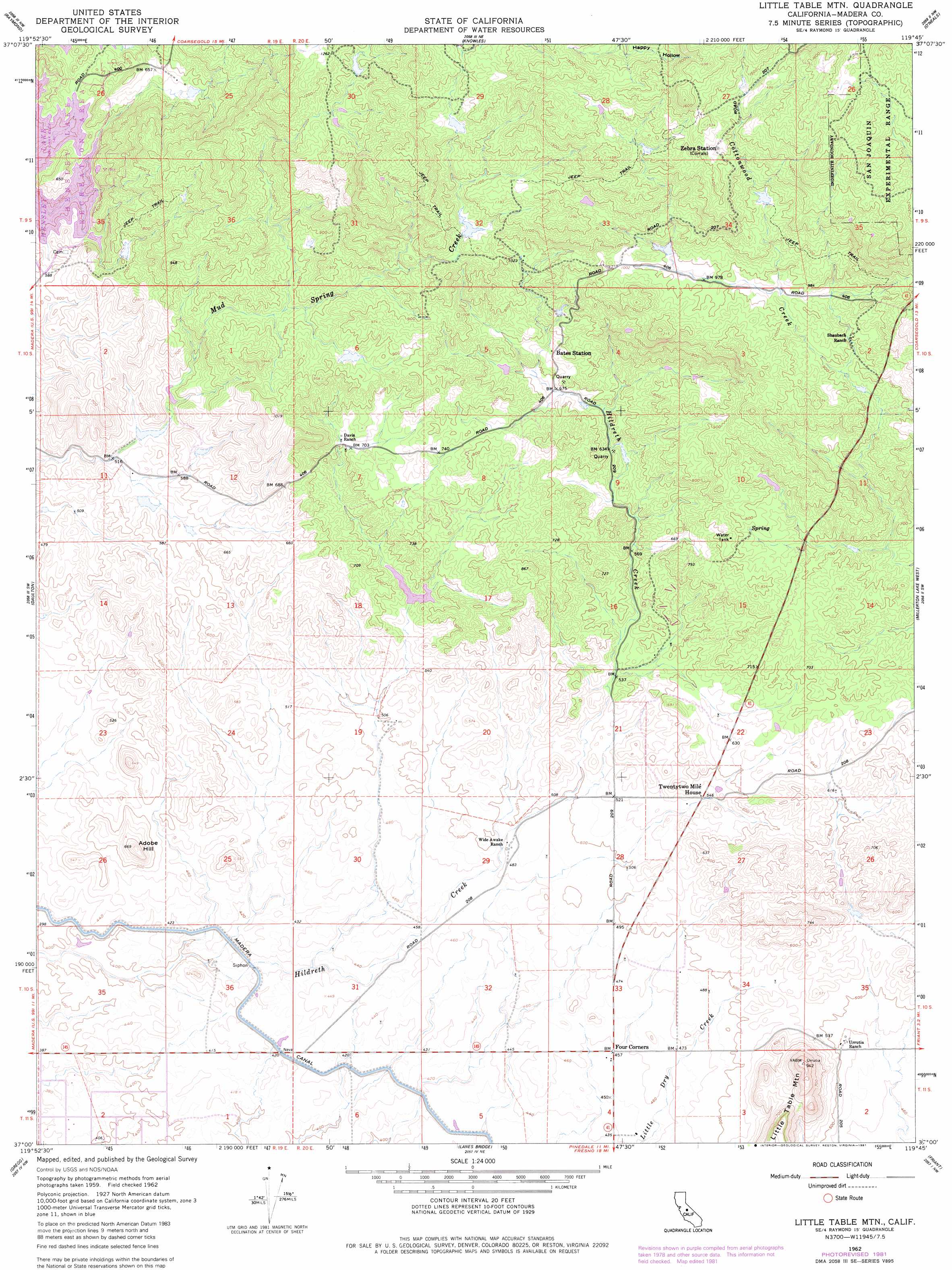
USGS Topo Quad 37119a7 - 1:24,000 scale
| Topo Map Name: | Little Table Mountain |
| USGS Topo Quad ID: | 37119a7 |
| Print Size: | ca. 21 1/4" wide x 27" high |
| Southeast Coordinates: | 37° N latitude / 119.75° W longitude |
| Map Center Coordinates: | 37.0625° N latitude / 119.8125° W longitude |
| U.S. State: | CA |
| Filename: | o37119a7.jpg |
| Download Map JPG Image: | Little Table Mountain topo map 1:24,000 scale |
| Map Type: | Topographic |
| Topo Series: | 7.5´ |
| Map Scale: | 1:24,000 |
| Source of Map Images: | United States Geological Survey (USGS) |
| Alternate Map Versions: |
Little Table Mountain CA 1942, updated 1954 Download PDF Buy paper map Little Table Mountain CA 1962, updated 1963 Download PDF Buy paper map Little Table Mountain CA 1962, updated 1981 Download PDF Buy paper map Little Table Mountain CA 1962, updated 1981 Download PDF Buy paper map Little Table Mtn CA 1962, updated 1981 Download PDF Buy paper map Little Table Mountain CA 2012 Download PDF Buy paper map Little Table Mountain CA 2015 Download PDF Buy paper map |
| FStopo: | US Forest Service topo Little Table Mountain is available: Download FStopo PDF Download FStopo TIF |
1:24,000 Topo Quads surrounding Little Table Mountain
Illinois Hill |
Ben Hur |
Horsecamp Mountain |
Ahwahnee |
Bass Lake |
Raynor Creek |
Raymond |
Knowles |
O'Neals |
North Fork |
Kismet |
Daulton |
Little Table Mountain |
Millerton Lake West |
Millerton Lake East |
Madera |
Gregg |
Lanes Bridge |
Friant |
Academy |
Biola |
Herndon |
Fresno North |
Clovis |
Round Mountain |
> Back to 37119a1 at 1:100,000 scale
> Back to 37118a1 at 1:250,000 scale
> Back to U.S. Topo Maps home
Little Table Mountain topo map: Gazetteer
Little Table Mountain: Dams
Lake Jane 686 Dam elevation 168m 551′Little Table Mountain: Summits
Adobe Hill elevation 201m 659′Little Table Mountain elevation 288m 944′
Little Table Mountain digital topo map on disk
Buy this Little Table Mountain topo map showing relief, roads, GPS coordinates and other geographical features, as a high-resolution digital map file on DVD: