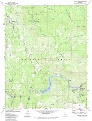
Cascadel Point Topo Map California
To zoom in, hover over the map of Cascadel Point
USGS Topo Quad 37119b4 - 1:24,000 scale
| Topo Map Name: | Cascadel Point |
| USGS Topo Quad ID: | 37119b4 |
| Print Size: | ca. 21 1/4" wide x 27" high |
| Southeast Coordinates: | 37.125° N latitude / 119.375° W longitude |
| Map Center Coordinates: | 37.1875° N latitude / 119.4375° W longitude |
| U.S. State: | CA |
| Filename: | o37119b4.jpg |
| Download Map JPG Image: | Cascadel Point topo map 1:24,000 scale |
| Map Type: | Topographic |
| Topo Series: | 7.5´ |
| Map Scale: | 1:24,000 |
| Source of Map Images: | United States Geological Survey (USGS) |
| Alternate Map Versions: |
Cascadel Point CA 1982, updated 1983 Download PDF Buy paper map Cascadel Point CA 1993, updated 2002 Download PDF Buy paper map Cascadel Point CA 2004, updated 2007 Download PDF Buy paper map Cascadel Point CA 2012 Download PDF Buy paper map Cascadel Point CA 2015 Download PDF Buy paper map |
| FStopo: | US Forest Service topo Cascadel Point is available: Download FStopo PDF Download FStopo TIF |
1:24,000 Topo Quads surrounding Cascadel Point
> Back to 37119a1 at 1:100,000 scale
> Back to 37118a1 at 1:250,000 scale
> Back to U.S. Topo Maps home
Cascadel Point topo map: Gazetteer
Cascadel Point: Bars
Itallan Bar elevation 488m 1601′Cascadel Point: Dams
Big Creek Number 7 104-022 Dam elevation 428m 1404′Number 1 Forebay 95-004 Dam elevation 707m 2319′
Cascadel Point: Flats
Benedict Meadow elevation 1714m 5623′Cascadel Point: Mines
Pine Grove Mine elevation 1423m 4668′Cascadel Point: Parks
North Fork Recreation Area Memorial Park elevation 787m 2582′Cascadel Point: Populated Places
Cascadel Woods elevation 1112m 3648′Lerona elevation 850m 2788′
South Fork elevation 808m 2650′
Cascadel Point: Reservoirs
Corrine Lake elevation 707m 2319′Corrine Lake elevation 727m 2385′
Redinger Lake elevation 374m 1227′
Cascadel Point: Ridges
Long Ridge elevation 738m 2421′Whisky Ridge elevation 1877m 6158′
Cascadel Point: Streams
Gertrude Creek elevation 1177m 3861′Indian Creek elevation 732m 2401′
Italian Creek elevation 437m 1433′
Jose Creek elevation 443m 1453′
Mill Creek elevation 643m 2109′
North Fork Willow Creek elevation 758m 2486′
Peckinpah Creek elevation 781m 2562′
Pitcher Creek elevation 785m 2575′
Saginaw Creek elevation 461m 1512′
South Fork Willow Creek elevation 758m 2486′
Whisky Creek elevation 496m 1627′
Willow Creek elevation 359m 1177′
Cascadel Point: Summits
Cascadel Point elevation 1316m 4317′Castle Peak elevation 1217m 3992′
Lion Point elevation 1490m 4888′
Mormon Hill elevation 1777m 5830′
Source Point elevation 1853m 6079′
Cascadel Point digital topo map on disk
Buy this Cascadel Point topo map showing relief, roads, GPS coordinates and other geographical features, as a high-resolution digital map file on DVD:


