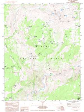
Cattle Mountain Topo Map California
To zoom in, hover over the map of Cattle Mountain
USGS Topo Quad 37119e2 - 1:24,000 scale
| Topo Map Name: | Cattle Mountain |
| USGS Topo Quad ID: | 37119e2 |
| Print Size: | ca. 21 1/4" wide x 27" high |
| Southeast Coordinates: | 37.5° N latitude / 119.125° W longitude |
| Map Center Coordinates: | 37.5625° N latitude / 119.1875° W longitude |
| U.S. State: | CA |
| Filename: | o37119e2.jpg |
| Download Map JPG Image: | Cattle Mountain topo map 1:24,000 scale |
| Map Type: | Topographic |
| Topo Series: | 7.5´ |
| Map Scale: | 1:24,000 |
| Source of Map Images: | United States Geological Survey (USGS) |
| Alternate Map Versions: |
Cattle Mtn CA 1983, updated 1984 Download PDF Buy paper map Cattle Mtn CA 1983, updated 1985 Download PDF Buy paper map Cattle Mtn CA 1992, updated 1995 Download PDF Buy paper map Cattle Mountain CA 2004, updated 2007 Download PDF Buy paper map Cattle Mountain CA 2012 Download PDF Buy paper map Cattle Mountain CA 2015 Download PDF Buy paper map |
| FStopo: | US Forest Service topo Cattle Mountain is available: Download FStopo PDF Download FStopo TIF |
1:24,000 Topo Quads surrounding Cattle Mountain
> Back to 37119e1 at 1:100,000 scale
> Back to 37118a1 at 1:250,000 scale
> Back to U.S. Topo Maps home
Cattle Mountain topo map: Gazetteer
Cattle Mountain: Crossings
Miller Crossing elevation 1399m 4589′Cattle Mountain: Flats
Buckhorn Meadow elevation 2358m 7736′Bugg Meadow elevation 2481m 8139′
Cargyle Meadow elevation 2419m 7936′
Corral Meadow elevation 2421m 7942′
Earthquake Meadow elevation 2521m 8270′
Headquarters Meadow elevation 2489m 8166′
Indian Meadow elevation 2223m 7293′
Naked Lady Meadow elevation 2505m 8218′
Pine Flat elevation 1422m 4665′
Snake Meadow elevation 2161m 7089′
Spano Meadow elevation 2699m 8854′
Stairway Meadow elevation 2734m 8969′
Cattle Mountain: Lakes
Alstot Lake elevation 2812m 9225′Anona Lake elevation 2775m 9104′
Ashley Lake elevation 2910m 9547′
Fern Lake elevation 2672m 8766′
Gertrude Lake elevation 2875m 9432′
Iron Lake elevation 3154m 10347′
Lily Lake elevation 2075m 6807′
Straube Lake elevation 2710m 8891′
Cattle Mountain: Streams
Cargyle Creek elevation 1503m 4931′Chetwood Creek elevation 2016m 6614′
Cora Creek elevation 1999m 6558′
East Fork Cargyle Creek elevation 2068m 6784′
Fish Creek elevation 1645m 5396′
Iron Creek elevation 2118m 6948′
Middle Fork San Joaquin River elevation 1479m 4852′
North Fork San Joaquin River elevation 1479m 4852′
Stairway Creek elevation 1620m 5314′
Cattle Mountain: Summits
Cattle Mountain elevation 2422m 7946′Granite Stairway elevation 2835m 9301′
Green Mountain elevation 2624m 8608′
Iron Mountain elevation 3350m 10990′
Junction Butte elevation 1951m 6400′
Cattle Mountain digital topo map on disk
Buy this Cattle Mountain topo map showing relief, roads, GPS coordinates and other geographical features, as a high-resolution digital map file on DVD:


