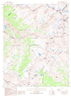
Mount Lyell Topo Map California
To zoom in, hover over the map of Mount Lyell
USGS Topo Quad 37119f3 - 1:24,000 scale
| Topo Map Name: | Mount Lyell |
| USGS Topo Quad ID: | 37119f3 |
| Print Size: | ca. 21 1/4" wide x 27" high |
| Southeast Coordinates: | 37.625° N latitude / 119.25° W longitude |
| Map Center Coordinates: | 37.6875° N latitude / 119.3125° W longitude |
| U.S. State: | CA |
| Filename: | o37119f3.jpg |
| Download Map JPG Image: | Mount Lyell topo map 1:24,000 scale |
| Map Type: | Topographic |
| Topo Series: | 7.5´ |
| Map Scale: | 1:24,000 |
| Source of Map Images: | United States Geological Survey (USGS) |
| Alternate Map Versions: |
Mount Lyell CA 1990, updated 1990 Download PDF Buy paper map Mount Lyell CA 1992, updated 1995 Download PDF Buy paper map Mount Lyell CA 2004, updated 2007 Download PDF Buy paper map Mount Lyell CA 2012 Download PDF Buy paper map Mount Lyell CA 2015 Download PDF Buy paper map |
| FStopo: | US Forest Service topo Mount Lyell is available: Download FStopo PDF Download FStopo TIF |
1:24,000 Topo Quads surrounding Mount Lyell
> Back to 37119e1 at 1:100,000 scale
> Back to 37118a1 at 1:250,000 scale
> Back to U.S. Topo Maps home
Mount Lyell topo map: Gazetteer
Mount Lyell: Dams
McClure Lake 1-037 Dam elevation 2926m 9599′Mount Lyell: Gaps
Isberg Pass elevation 3209m 10528′Post Peak Pass elevation 3274m 10741′
Mount Lyell: Glaciers
Lyell Glacier elevation 3787m 12424′Maclure Glacier elevation 3735m 12253′
Mount Lyell: Lakes
Blue Lake elevation 3209m 10528′Florence Lake elevation 3006m 9862′
Harriet Lake elevation 3133m 10278′
Isberg Lakes elevation 3010m 9875′
Joe Crane Lake elevation 2935m 9629′
McGee Lake elevation 3084m 10118′
Porphyry Lake elevation 3094m 10150′
Post Lakes elevation 3053m 10016′
Rockbound Lake elevation 3076m 10091′
Sadler Lake elevation 2855m 9366′
Turner Lake elevation 2907m 9537′
Ward Lakes elevation 3149m 10331′
Washburn Lake elevation 2320m 7611′
Mount Lyell: Ranges
Cathedral Range elevation 3984m 13070′Mount Lyell: Reservoirs
McClure Lake elevation 2926m 9599′Mount Lyell: Ridges
Cony Crags elevation 3146m 10321′Mount Lyell: Streams
Foerster Creek elevation 2738m 8982′Hutchings Creek elevation 2851m 9353′
Lyell Fork Merced River elevation 2413m 7916′
Merced Peak Fork elevation 2413m 7916′
Red Peak Fork elevation 2339m 7673′
Triple Peak Fork elevation 2448m 8031′
Mount Lyell: Summits
Electra Peak elevation 3779m 12398′Foerster Peak elevation 3670m 12040′
Isberg Peak elevation 3337m 10948′
Long Mountain elevation 3503m 11492′
Mount Ansel Adams elevation 3569m 11709′
Mount Florence elevation 3816m 12519′
Mount Lyell elevation 3993m 13100′
Mount Maclure elevation 3869m 12693′
Post Peak elevation 3354m 11003′
Rodgers Peak elevation 3921m 12864′
Sadler Peak elevation 3223m 10574′
Triple Divide Peak elevation 3533m 11591′
Mount Lyell digital topo map on disk
Buy this Mount Lyell topo map showing relief, roads, GPS coordinates and other geographical features, as a high-resolution digital map file on DVD:


