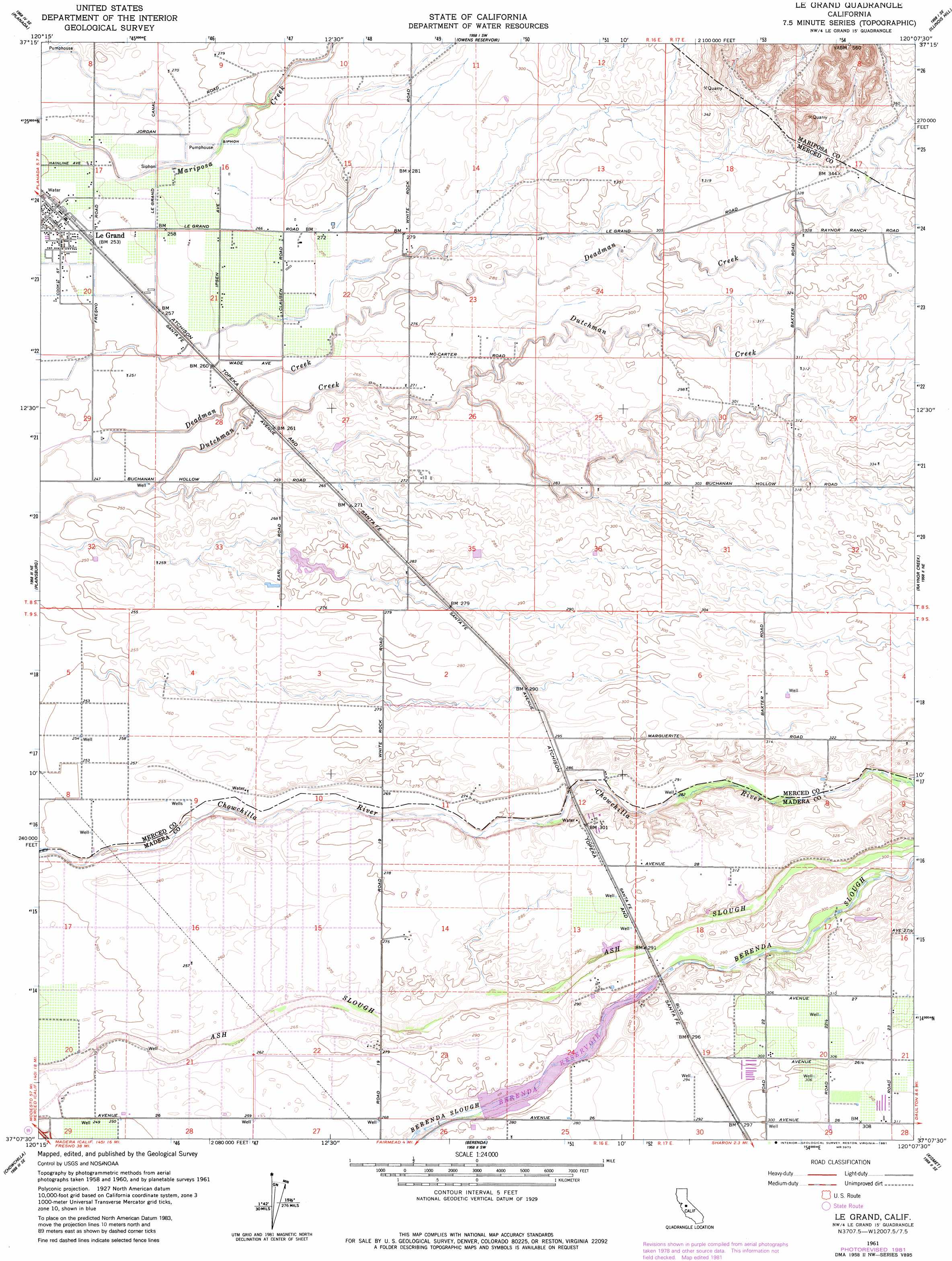
Le Grand Topo Map California
To zoom in, hover over the map of Le Grand
USGS Topo Quad 37120b2 - 1:24,000 scale
| Topo Map Name: | Le Grand |
| USGS Topo Quad ID: | 37120b2 |
| Print Size: | ca. 21 1/4" wide x 27" high |
| Southeast Coordinates: | 37.125° N latitude / 120.125° W longitude |
| Map Center Coordinates: | 37.1875° N latitude / 120.1875° W longitude |
| U.S. State: | CA |
| Filename: | o37120b2.jpg |
| Download Map JPG Image: | Le Grand topo map 1:24,000 scale |
| Map Type: | Topographic |
| Topo Series: | 7.5´ |
| Map Scale: | 1:24,000 |
| Source of Map Images: | United States Geological Survey (USGS) |
| Alternate Map Versions: |
Le Grand CA 1946, updated 1961 Download PDF Buy paper map Le Grand CA 1947 Download PDF Buy paper map Le Grand CA 1961, updated 1962 Download PDF Buy paper map Le Grand CA 1961, updated 1981 Download PDF Buy paper map Le Grand CA 2012 Download PDF Buy paper map Le Grand CA 2015 Download PDF Buy paper map |
1:24,000 Topo Quads surrounding Le Grand
Yosemite Lake |
Haystack Mountain |
Indian Gulch |
Catheys Valley |
Mariposa |
Merced |
Planada |
Owens Reservoir |
Illinois Hill |
Ben Hur |
El Nido |
Plainsburg |
Le Grand |
Raynor Creek |
Raymond |
Bliss Ranch |
Chowchilla |
Berenda |
Kismet |
Daulton |
Poso Farm |
Firebaugh Ne |
Bonita Ranch |
Madera |
Gregg |
> Back to 37120a1 at 1:100,000 scale
> Back to 37120a1 at 1:250,000 scale
> Back to U.S. Topo Maps home
Le Grand topo map: Gazetteer
Le Grand: Dams
Berenda Slough 1015 Dam elevation 81m 265′Le Grand: Populated Places
Dickenson (historical) elevation 83m 272′Le Grand elevation 77m 252′
Marguerite (historical) elevation 91m 298′
Medano (historical) elevation 91m 298′
Le Grand digital topo map on disk
Buy this Le Grand topo map showing relief, roads, GPS coordinates and other geographical features, as a high-resolution digital map file on DVD: