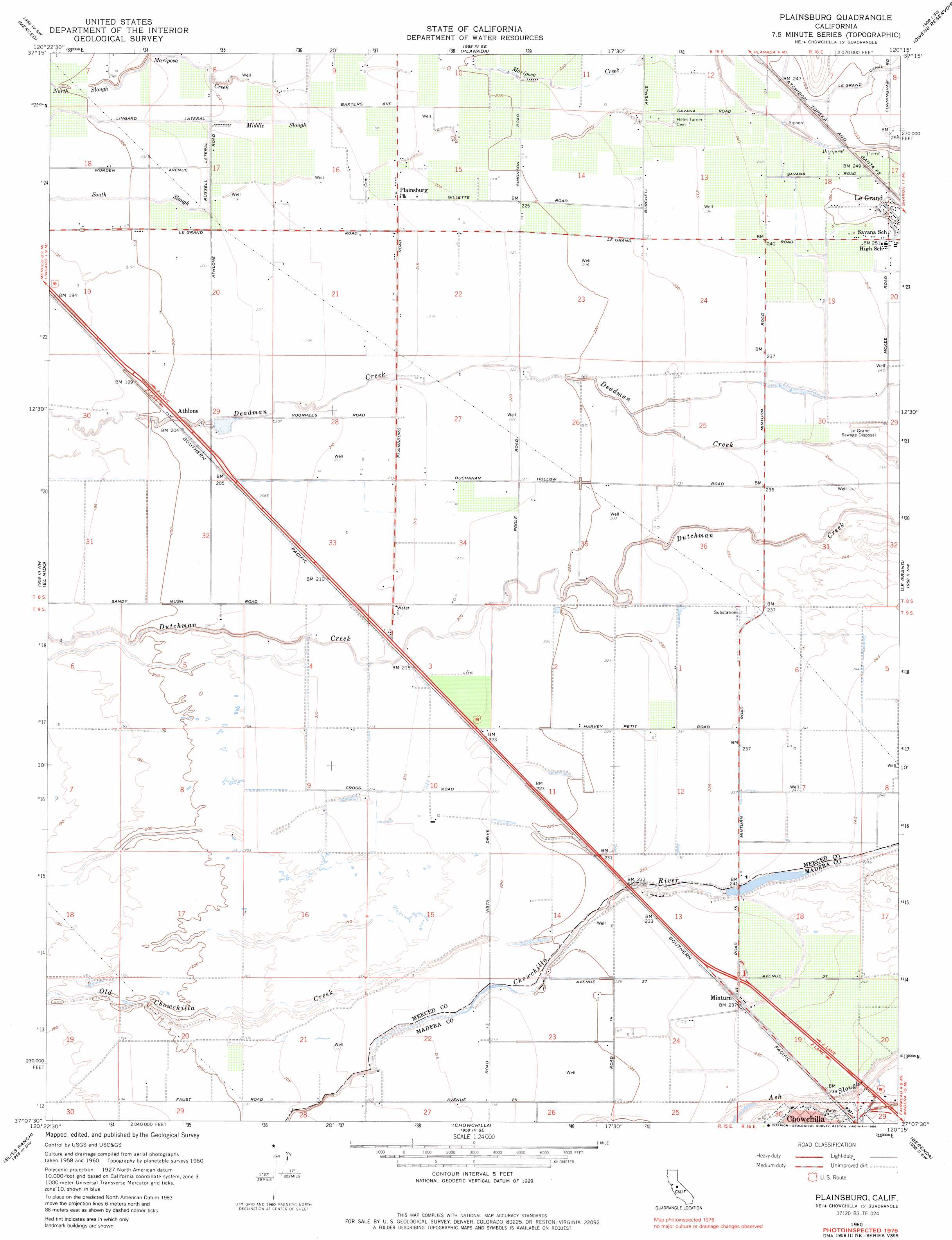
Plainsburg Topo Map California
To zoom in, hover over the map of Plainsburg
USGS Topo Quad 37120b3 - 1:24,000 scale
| Topo Map Name: | Plainsburg |
| USGS Topo Quad ID: | 37120b3 |
| Print Size: | ca. 21 1/4" wide x 27" high |
| Southeast Coordinates: | 37.125° N latitude / 120.25° W longitude |
| Map Center Coordinates: | 37.1875° N latitude / 120.3125° W longitude |
| U.S. State: | CA |
| Filename: | o37120b3.jpg |
| Download Map JPG Image: | Plainsburg topo map 1:24,000 scale |
| Map Type: | Topographic |
| Topo Series: | 7.5´ |
| Map Scale: | 1:24,000 |
| Source of Map Images: | United States Geological Survey (USGS) |
| Alternate Map Versions: |
Plainsburg CA 1947 Download PDF Buy paper map Plainsburg CA 1960, updated 1961 Download PDF Buy paper map Plainsburg CA 1960, updated 1973 Download PDF Buy paper map Plainsburg CA 1960, updated 1986 Download PDF Buy paper map Plainsburg CA 2012 Download PDF Buy paper map Plainsburg CA 2015 Download PDF Buy paper map |
1:24,000 Topo Quads surrounding Plainsburg
Winton |
Yosemite Lake |
Haystack Mountain |
Indian Gulch |
Catheys Valley |
Atwater |
Merced |
Planada |
Owens Reservoir |
Illinois Hill |
Sandy Mush |
El Nido |
Plainsburg |
Le Grand |
Raynor Creek |
Santa Rita Bridge |
Bliss Ranch |
Chowchilla |
Berenda |
Kismet |
Oxalis |
Poso Farm |
Firebaugh Ne |
Bonita Ranch |
Madera |
> Back to 37120a1 at 1:100,000 scale
> Back to 37120a1 at 1:250,000 scale
> Back to U.S. Topo Maps home
Plainsburg topo map: Gazetteer
Plainsburg: Airports
Johnson Ranch Airport elevation 72m 236′Plainsburg: Canals
Lingard Lateral elevation 61m 200′Russell Lateral elevation 64m 209′
Plainsburg: Dams
Sierra Vista 681 Dam elevation 72m 236′Plainsburg: Guts
Middle Slough elevation 66m 216′Plainsburg: Populated Places
Athlone elevation 63m 206′La Branza (historical) elevation 67m 219′
Minturn elevation 72m 236′
Plainsburg elevation 67m 219′
Sierra Vista elevation 72m 236′
Plainsburg: Streams
Mariposa Creek elevation 70m 229′Plainsburg digital topo map on disk
Buy this Plainsburg topo map showing relief, roads, GPS coordinates and other geographical features, as a high-resolution digital map file on DVD: