Gustine Topo Map California
To zoom in, hover over the map of Gustine
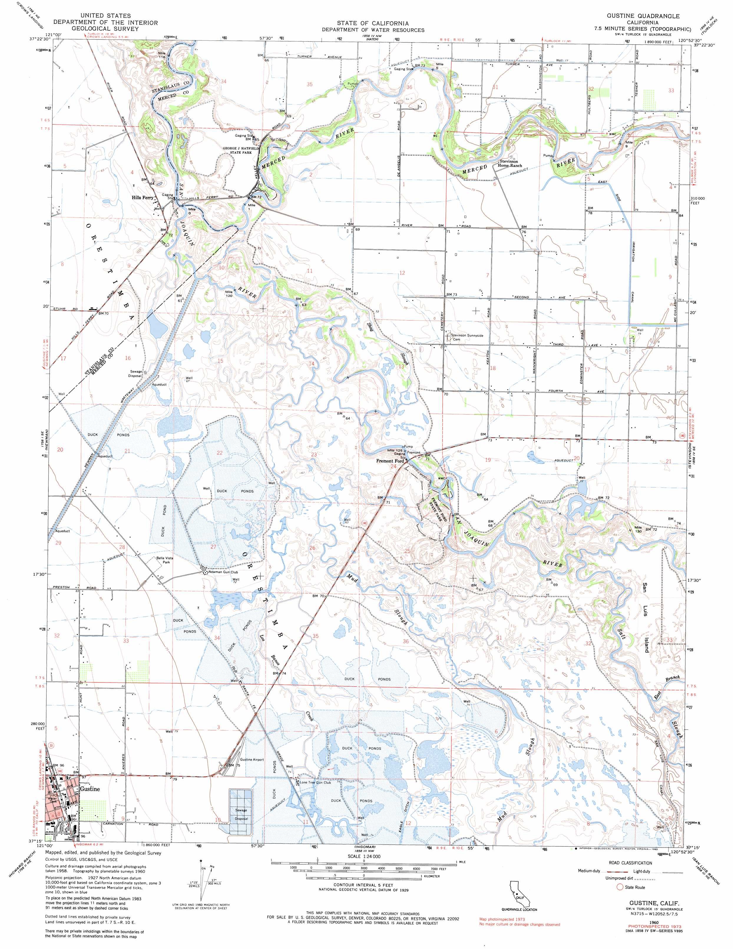
USGS Topo Quad 37120c8 - 1:24,000 scale
| Topo Map Name: | Gustine |
| USGS Topo Quad ID: | 37120c8 |
| Print Size: | ca. 21 1/4" wide x 27" high |
| Southeast Coordinates: | 37.25° N latitude / 120.875° W longitude |
| Map Center Coordinates: | 37.3125° N latitude / 120.9375° W longitude |
| U.S. State: | CA |
| Filename: | o37120c8.jpg |
| Download Map JPG Image: | Gustine topo map 1:24,000 scale |
| Map Type: | Topographic |
| Topo Series: | 7.5´ |
| Map Scale: | 1:24,000 |
| Source of Map Images: | United States Geological Survey (USGS) |
| Alternate Map Versions: |
Gustine CA 1947 Download PDF Buy paper map Gustine CA 1960, updated 1961 Download PDF Buy paper map Gustine CA 1960, updated 1973 Download PDF Buy paper map Gustine CA 1960, updated 1982 Download PDF Buy paper map Gustine CA 2012 Download PDF Buy paper map Gustine CA 2015 Download PDF Buy paper map |
1:24,000 Topo Quads surrounding Gustine
Westley |
Brush Lake |
Ceres |
Denair |
Montpelier |
Patterson |
Crows Landing |
Hatch |
Turlock |
Cressey |
Orestimba Peak |
Newman |
Gustine |
Stevinson |
Arena |
Crevison Peak |
Howard Ranch |
Ingomar |
San Luis Ranch |
Turner Ranch |
Pacheco Pass |
San Luis Dam |
Volta |
Los Banos |
Delta Ranch |
> Back to 37120a1 at 1:100,000 scale
> Back to 37120a1 at 1:250,000 scale
> Back to U.S. Topo Maps home
Gustine topo map: Gazetteer
Gustine: Airports
Gustine Airport elevation 24m 78′Gustine: Crossings
Fremont Ford elevation 18m 59′Gustine: Guts
Shag Slough elevation 19m 62′Gustine: Parks
Bella Vista Park elevation 23m 75′Fremont Ford State Park elevation 21m 68′
George J. Hatfield State Recreation Area elevation 21m 68′
Great Valley Grasslands State Park elevation 20m 65′
Kesterson National Wildlife Refuge elevation 22m 72′
Pioneer Park elevation 30m 98′
Gustine: Populated Places
Gustine elevation 30m 98′Hills Ferry elevation 21m 68′
Gustine: Post Offices
Gustine Post Office elevation 31m 101′Gustine: Streams
Los Banos Creek elevation 21m 68′Merced River elevation 17m 55′
Mud Slough elevation 18m 59′
Salt Slough elevation 19m 62′
Gustine digital topo map on disk
Buy this Gustine topo map showing relief, roads, GPS coordinates and other geographical features, as a high-resolution digital map file on DVD: