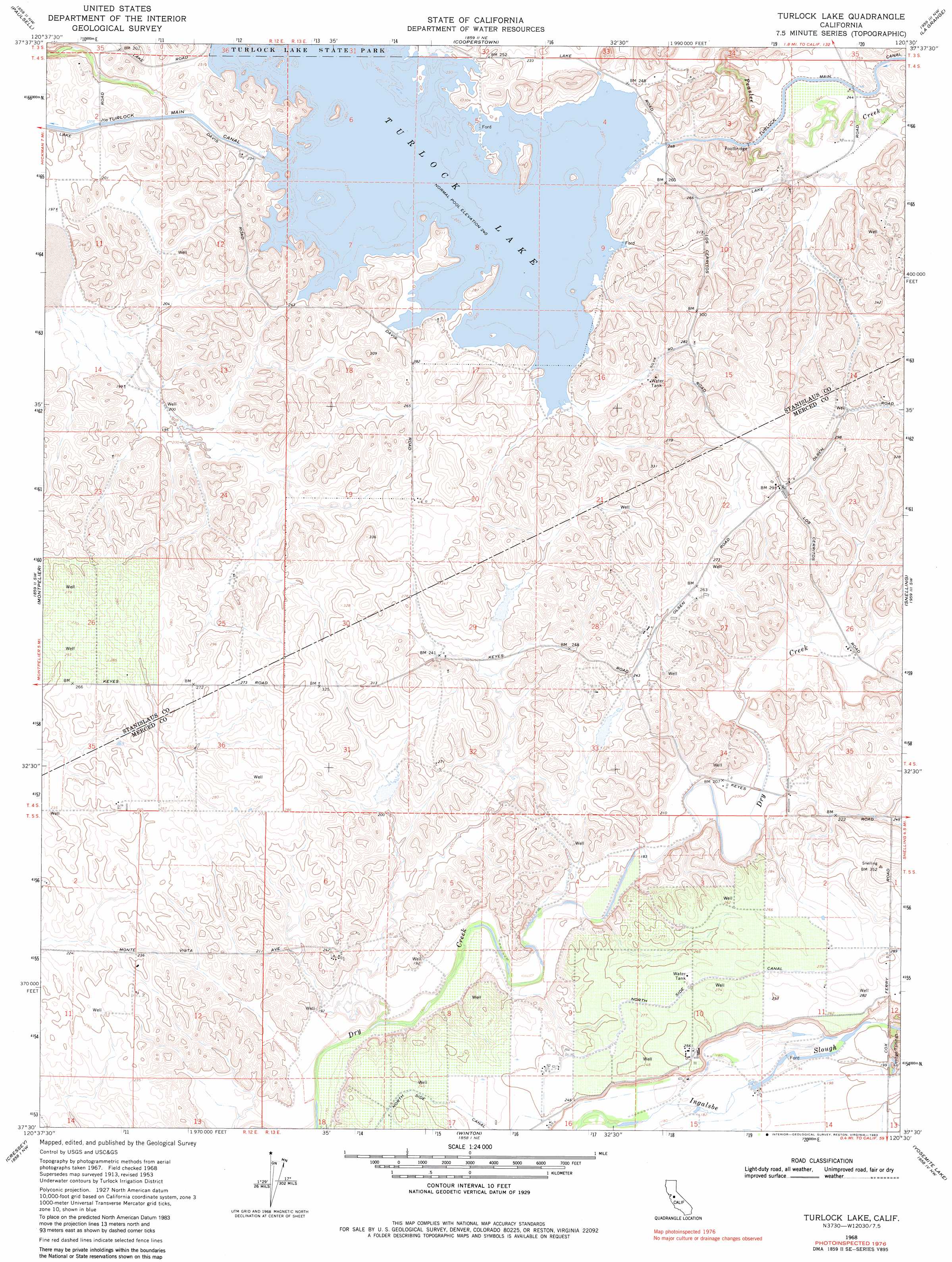
Turlock Lake Topo Map California
To zoom in, hover over the map of Turlock Lake
USGS Topo Quad 37120e5 - 1:24,000 scale
| Topo Map Name: | Turlock Lake |
| USGS Topo Quad ID: | 37120e5 |
| Print Size: | ca. 21 1/4" wide x 27" high |
| Southeast Coordinates: | 37.5° N latitude / 120.5° W longitude |
| Map Center Coordinates: | 37.5625° N latitude / 120.5625° W longitude |
| U.S. State: | CA |
| Filename: | o37120e5.jpg |
| Download Map JPG Image: | Turlock Lake topo map 1:24,000 scale |
| Map Type: | Topographic |
| Topo Series: | 7.5´ |
| Map Scale: | 1:24,000 |
| Source of Map Images: | United States Geological Survey (USGS) |
| Alternate Map Versions: |
Turlock Lake CA 1953, updated 1955 Download PDF Buy paper map Turlock Lake CA 1953, updated 1965 Download PDF Buy paper map Turlock Lake CA 1968, updated 1971 Download PDF Buy paper map Turlock Lake CA 1968, updated 1983 Download PDF Buy paper map Turlock Lake CA 2012 Download PDF Buy paper map Turlock Lake CA 2015 Download PDF Buy paper map |
1:24,000 Topo Quads surrounding Turlock Lake
Oakdale |
Knights Ferry |
Keystone |
Chinese Camp |
Moccasin |
Waterford |
Paulsell |
Cooperstown |
La Grange |
Penon Blanco Peak |
Denair |
Montpelier |
Turlock Lake |
Snelling |
Merced Falls |
Turlock |
Cressey |
Winton |
Yosemite Lake |
Haystack Mountain |
Stevinson |
Arena |
Atwater |
Merced |
Planada |
> Back to 37120e1 at 1:100,000 scale
> Back to 37120a1 at 1:250,000 scale
> Back to U.S. Topo Maps home
Turlock Lake topo map: Gazetteer
Turlock Lake: Dams
Turlock Lake 68-003 Dam elevation 74m 242′Turlock Lake: Flats
Three Tree Flat elevation 75m 246′Turlock Lake: Reservoirs
Turlock Lake elevation 74m 242′Turlock Lake digital topo map on disk
Buy this Turlock Lake topo map showing relief, roads, GPS coordinates and other geographical features, as a high-resolution digital map file on DVD: