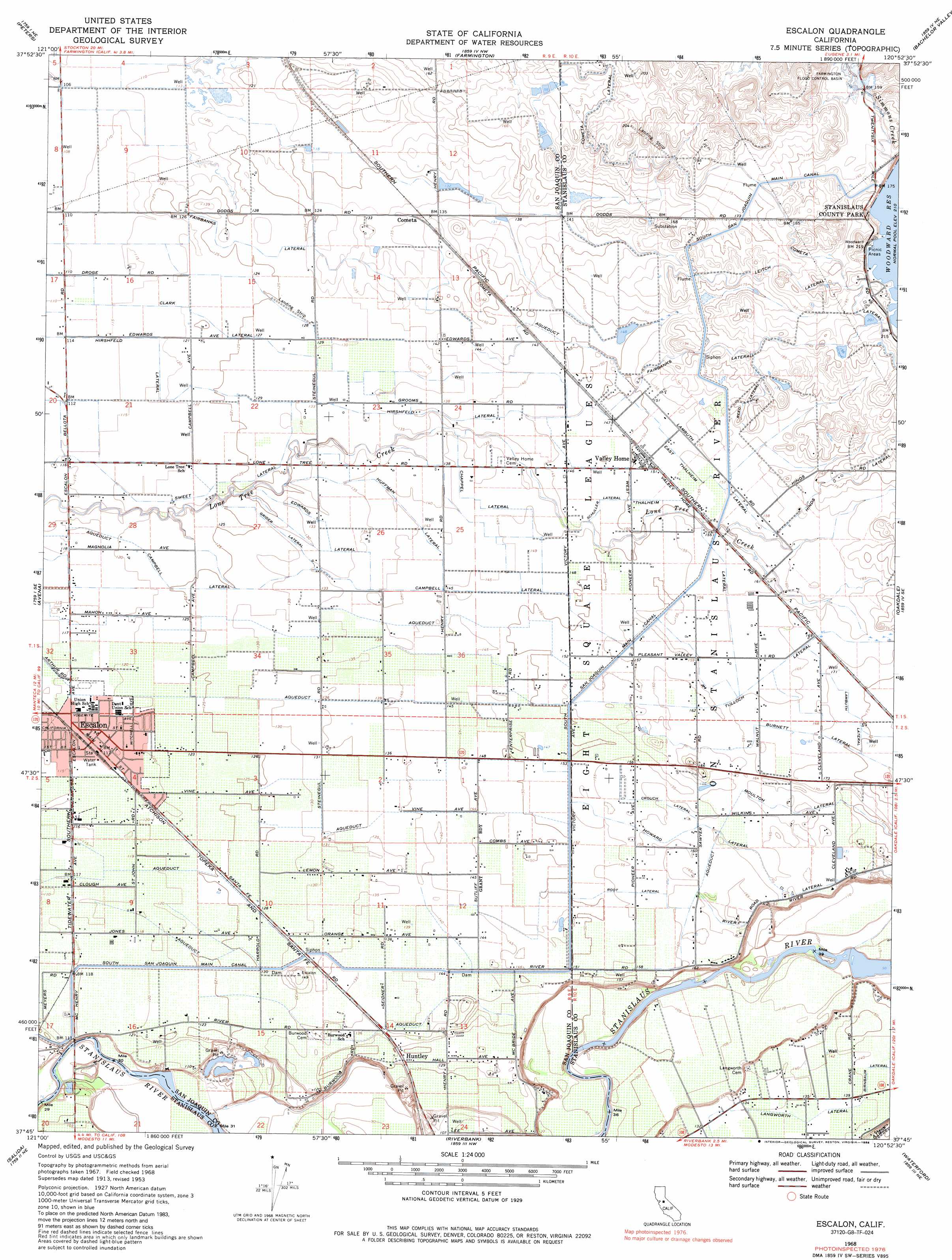
Escalon Topo Map California
To zoom in, hover over the map of Escalon
USGS Topo Quad 37120g8 - 1:24,000 scale
| Topo Map Name: | Escalon |
| USGS Topo Quad ID: | 37120g8 |
| Print Size: | ca. 21 1/4" wide x 27" high |
| Southeast Coordinates: | 37.75° N latitude / 120.875° W longitude |
| Map Center Coordinates: | 37.8125° N latitude / 120.9375° W longitude |
| U.S. State: | CA |
| Filename: | o37120g8.jpg |
| Download Map JPG Image: | Escalon topo map 1:24,000 scale |
| Map Type: | Topographic |
| Topo Series: | 7.5´ |
| Map Scale: | 1:24,000 |
| Source of Map Images: | United States Geological Survey (USGS) |
| Alternate Map Versions: |
Escalon CA 1953, updated 1954 Download PDF Buy paper map Escalon CA 1968, updated 1971 Download PDF Buy paper map Escalon CA 1968, updated 1971 Download PDF Buy paper map Escalon CA 1968, updated 1984 Download PDF Buy paper map Escalon CA 1968, updated 1988 Download PDF Buy paper map Escalon CA 2012 Download PDF Buy paper map Escalon CA 2015 Download PDF Buy paper map |
1:24,000 Topo Quads surrounding Escalon
Waterloo |
Linden |
Valley Springs Sw |
Jenny Lind |
Salt Spring Valley |
Stockton East |
Peters |
Farmington |
Bachelor Valley |
Copperopolis |
Manteca |
Avena |
Escalon |
Oakdale |
Knights Ferry |
Ripon |
Salida |
Riverbank |
Waterford |
Paulsell |
Westley |
Brush Lake |
Ceres |
Denair |
Montpelier |
> Back to 37120e1 at 1:100,000 scale
> Back to 37120a1 at 1:250,000 scale
> Back to U.S. Topo Maps home
Escalon topo map: Gazetteer
Escalon: Airports
Escalon Airport elevation 39m 127′Escalon: Canals
Campbell Lateral elevation 43m 141′Chappel Lateral elevation 44m 144′
Clark Lateral elevation 38m 124′
Cometa Lateral elevation 64m 209′
Crouch Lateral elevation 50m 164′
East Thalheim Lateral elevation 48m 157′
Edwards Lateral elevation 41m 134′
Fairbanks Lateral elevation 56m 183′
Fairbanks Lateral elevation 39m 127′
Grider Lateral elevation 41m 134′
Hinds Lateral elevation 56m 183′
Hirshfield Lateral elevation 42m 137′
Howard Lateral elevation 51m 167′
Huffman Lateral elevation 43m 141′
Lambuth Lateral elevation 54m 177′
Langworth Lateral elevation 43m 141′
Leitch Lateral elevation 60m 196′
Moulton Lateral elevation 53m 173′
Reed Lateral elevation 55m 180′
River Road Lateral elevation 52m 170′
Root Lateral elevation 48m 157′
Schuller Lateral elevation 46m 150′
South San Joaquin Main Canal elevation 48m 157′
Sweet Lateral elevation 39m 127′
Thalheim Lateral elevation 49m 160′
Escalon: Dams
Woodward 66 Dam elevation 62m 203′Escalon: Populated Places
Cometa elevation 42m 137′Escalon elevation 36m 118′
Huntley elevation 40m 131′
Valley Home elevation 47m 154′
Escalon: Post Offices
Valley Home Post Office elevation 47m 154′Escalon: Reservoirs
Woodward Reservoir elevation 61m 200′Escalon digital topo map on disk
Buy this Escalon topo map showing relief, roads, GPS coordinates and other geographical features, as a high-resolution digital map file on DVD: