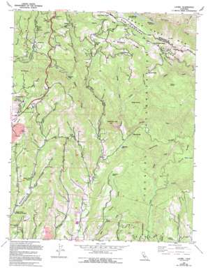
Laurel Topo Map California
To zoom in, hover over the map of Laurel
USGS Topo Quad 37121a8 - 1:24,000 scale
| Topo Map Name: | Laurel |
| USGS Topo Quad ID: | 37121a8 |
| Print Size: | ca. 21 1/4" wide x 27" high |
| Southeast Coordinates: | 37° N latitude / 121.875° W longitude |
| Map Center Coordinates: | 37.0625° N latitude / 121.9375° W longitude |
| U.S. State: | CA |
| Filename: | o37121a8.jpg |
| Download Map JPG Image: | Laurel topo map 1:24,000 scale |
| Map Type: | Topographic |
| Topo Series: | 7.5´ |
| Map Scale: | 1:24,000 |
| Source of Map Images: | United States Geological Survey (USGS) |
| Alternate Map Versions: |
Laurel CA 1955, updated 1956 Download PDF Buy paper map Laurel CA 1955, updated 1963 Download PDF Buy paper map Laurel CA 1955, updated 1969 Download PDF Buy paper map Laurel CA 1955, updated 1979 Download PDF Buy paper map Laurel CA 1955, updated 1986 Download PDF Buy paper map Laurel CA 1955, updated 1994 Download PDF Buy paper map Laurel CA 1955, updated 1994 Download PDF Buy paper map Laurel CA 1996, updated 2000 Download PDF Buy paper map Laurel CA 2012 Download PDF Buy paper map Laurel CA 2015 Download PDF Buy paper map |
1:24,000 Topo Quads surrounding Laurel
> Back to 37121a1 at 1:100,000 scale
> Back to 37120a1 at 1:250,000 scale
> Back to U.S. Topo Maps home
Laurel topo map: Gazetteer
Laurel: Areas
Lone Tree Prairie elevation 658m 2158′Laurel: Basins
Glenwood Basin elevation 131m 429′Laurel: Bridges
Halls Bridge elevation 473m 1551′Laurel: Dams
Williams 622-004 Dam elevation 366m 1200′Laurel: Falls
Maple Falls elevation 299m 980′Laurel: Lakes
Brush Lagoon (historical) elevation 314m 1030′Whites Lagoon elevation 437m 1433′
Laurel: Mines
Olives Spring Quarry elevation 164m 538′Laurel: Parks
Bethany Park elevation 255m 836′Bridge Creek Historic Site elevation 163m 534′
Hoffman Historic Site elevation 152m 498′
Laurel: Populated Places
Bethany Park elevation 253m 830′Clems (historical) elevation 242m 793′
Fontenay Villa elevation 322m 1056′
Glenwood elevation 277m 908′
Highland (historical) elevation 595m 1952′
Laurel elevation 273m 895′
Magnetic Spring (historical) elevation 283m 928′
Olive Springs (historical) elevation 120m 393′
Redwood Lodge elevation 433m 1420′
The Willows elevation 479m 1571′
Laurel: Reservoirs
Millpond Lake elevation 80m 262′Williams Reservoir elevation 366m 1200′
Laurel: Ridges
China Ridge elevation 458m 1502′Garrity Ridge elevation 662m 2171′
Hinckley Ridge elevation 436m 1430′
Inspiration Point elevation 433m 1420′
Skyland Ridge elevation 646m 2119′
Laurel: Springs
Badger Spring elevation 237m 777′Olive Spring elevation 159m 521′
Sulphur Springs elevation 438m 1437′
Laurel: Streams
Amaya Creek elevation 155m 508′Bridge Creek elevation 96m 314′
Burns Creek elevation 216m 708′
Crystal Creek elevation 53m 173′
Granite Creek elevation 40m 131′
Hester Creek elevation 75m 246′
Hinckley Creek elevation 87m 285′
Laurel Creek elevation 226m 741′
Laurel: Summits
La Corona elevation 137m 449′Mount Roberta elevation 453m 1486′
Sand Point elevation 541m 1774′
Sugarloaf Mountain elevation 366m 1200′
Laurel: Trails
Aptos Creek Trail elevation 85m 278′Big Slide Trail elevation 436m 1430′
Big Stump Trail elevation 378m 1240′
Mill Pond Trail elevation 88m 288′
Porter Trail elevation 105m 344′
Trout Gulch Trail elevation 216m 708′
West Ridge Trail elevation 308m 1010′
Laurel: Tunnels
Tunnel Number 2 elevation 440m 1443′Laurel: Valleys
Ashbury Gulch elevation 285m 935′Blackburn Gulch elevation 105m 344′
Caldwell Gulch elevation 201m 659′
Fern Gulch elevation 193m 633′
Grover Gulch elevation 59m 193′
Moores Gulch elevation 106m 347′
Tie Gulch elevation 98m 321′
Laurel digital topo map on disk
Buy this Laurel topo map showing relief, roads, GPS coordinates and other geographical features, as a high-resolution digital map file on DVD:


