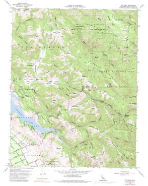
Mount Sizer Topo Map California
To zoom in, hover over the map of Mount Sizer
USGS Topo Quad 37121b5 - 1:24,000 scale
| Topo Map Name: | Mount Sizer |
| USGS Topo Quad ID: | 37121b5 |
| Print Size: | ca. 21 1/4" wide x 27" high |
| Southeast Coordinates: | 37.125° N latitude / 121.5° W longitude |
| Map Center Coordinates: | 37.1875° N latitude / 121.5625° W longitude |
| U.S. State: | CA |
| Filename: | o37121b5.jpg |
| Download Map JPG Image: | Mount Sizer topo map 1:24,000 scale |
| Map Type: | Topographic |
| Topo Series: | 7.5´ |
| Map Scale: | 1:24,000 |
| Source of Map Images: | United States Geological Survey (USGS) |
| Alternate Map Versions: |
Mt. Sizer CA 1955, updated 1963 Download PDF Buy paper map Mt. Sizer CA 1955, updated 1972 Download PDF Buy paper map Mt. Sizer CA 1955, updated 1983 Download PDF Buy paper map Mt. Sizer CA 1955, updated 1983 Download PDF Buy paper map Mount Sizer CA 2012 Download PDF Buy paper map Mount Sizer CA 2015 Download PDF Buy paper map |
1:24,000 Topo Quads surrounding Mount Sizer
> Back to 37121a1 at 1:100,000 scale
> Back to 37120a1 at 1:250,000 scale
> Back to U.S. Topo Maps home
Mount Sizer topo map: Gazetteer
Mount Sizer: Bridges
Cochrane Bridge elevation 190m 623′Mount Sizer: Capes
Manzanita Point elevation 554m 1817′Mount Sizer: Dams
Laurel Spring Club 1624 Dam elevation 775m 2542′Mount Sizer: Flats
Cold Flat elevation 784m 2572′Dairy Flat elevation 389m 1276′
Poverty Flat elevation 373m 1223′
Rodeo Flat elevation 868m 2847′
Sizer Flat elevation 800m 2624′
Mount Sizer: Lakes
Lone Lake elevation 373m 1223′Mud Lake elevation 275m 902′
Tule Lake elevation 244m 800′
Turnbull Learning Academy elevation 312m 1023′
Mount Sizer: Parks
Henry W. Coe State Park elevation 580m 1902′Jackson Oaks Park elevation 114m 374′
Mount Sizer: Populated Places
Madrone Soda Springs (historical) elevation 464m 1522′Mount Sizer: Ridges
Blue Ridge elevation 903m 2962′Cordoza Ridge elevation 698m 2290′
Divide Ridge elevation 808m 2650′
Finley Ridge elevation 649m 2129′
Fitzgerald Ridge elevation 665m 2181′
Hogsback elevation 731m 2398′
Mare Pasture Ridge elevation 713m 2339′
Middle Ridge elevation 811m 2660′
Nesbit Ridge elevation 755m 2477′
Pine Ridge elevation 904m 2965′
Samson Ridge elevation 671m 2201′
Schoolhouse Ridge elevation 725m 2378′
Mount Sizer: Springs
Blackberry Spring elevation 841m 2759′Deer Horn Spring elevation 697m 2286′
Madrone Soda Springs elevation 452m 1482′
Willow Spring elevation 758m 2486′
Mount Sizer: Streams
Hoover Creek elevation 384m 1259′Little Coyote Creek elevation 375m 1230′
Packwood Creek elevation 190m 623′
Sulphur Creek elevation 635m 2083′
Mount Sizer: Summits
Blue Rocks elevation 742m 2434′Mount Sizer elevation 970m 3182′
Mount Sizer: Valleys
Brushy Canyon elevation 289m 948′Clarks Canyon elevation 404m 1325′
Cordoza Canyon elevation 416m 1364′
Hoover Valley elevation 395m 1295′
North Fork Otis Canyon elevation 312m 1023′
Otis Canyon elevation 204m 669′
Packwood Valley elevation 391m 1282′
Samson Canyon elevation 430m 1410′
South Fork Otis Canyon elevation 350m 1148′
Star Canyon elevation 497m 1630′
Sycamore Canyon elevation 474m 1555′
Vance Canyon elevation 430m 1410′
Mount Sizer digital topo map on disk
Buy this Mount Sizer topo map showing relief, roads, GPS coordinates and other geographical features, as a high-resolution digital map file on DVD:


