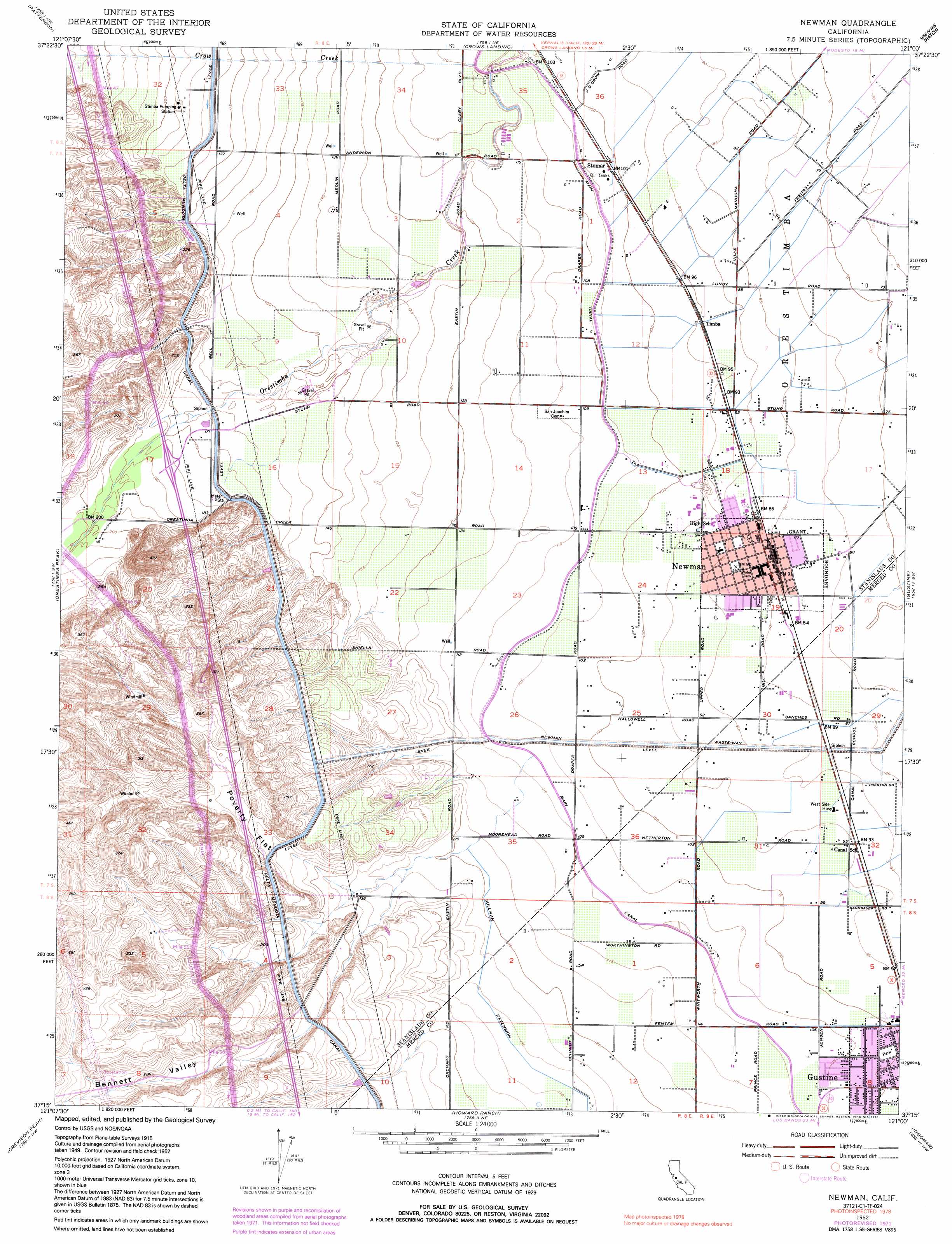
Newman Topo Map California
To zoom in, hover over the map of Newman
USGS Topo Quad 37121c1 - 1:24,000 scale
| Topo Map Name: | Newman |
| USGS Topo Quad ID: | 37121c1 |
| Print Size: | ca. 21 1/4" wide x 27" high |
| Southeast Coordinates: | 37.25° N latitude / 121° W longitude |
| Map Center Coordinates: | 37.3125° N latitude / 121.0625° W longitude |
| U.S. State: | CA |
| Filename: | o37121c1.jpg |
| Download Map JPG Image: | Newman topo map 1:24,000 scale |
| Map Type: | Topographic |
| Topo Series: | 7.5´ |
| Map Scale: | 1:24,000 |
| Source of Map Images: | United States Geological Survey (USGS) |
| Alternate Map Versions: |
Newman CA 1952, updated 1954 Download PDF Buy paper map Newman CA 1952, updated 1972 Download PDF Buy paper map Newman CA 1952, updated 1991 Download PDF Buy paper map Newman CA 2012 Download PDF Buy paper map Newman CA 2015 Download PDF Buy paper map |
1:24,000 Topo Quads surrounding Newman
Solyo |
Westley |
Brush Lake |
Ceres |
Denair |
Copper Mountain |
Patterson |
Crows Landing |
Hatch |
Turlock |
Wilcox Ridge |
Orestimba Peak |
Newman |
Gustine |
Stevinson |
Mustang Peak |
Crevison Peak |
Howard Ranch |
Ingomar |
San Luis Ranch |
Pacheco Peak |
Pacheco Pass |
San Luis Dam |
Volta |
Los Banos |
> Back to 37121a1 at 1:100,000 scale
> Back to 37120a1 at 1:250,000 scale
> Back to U.S. Topo Maps home
Newman topo map: Gazetteer
Newman: Canals
Newman Waste-Way elevation 26m 85′Sullivan Extension elevation 42m 137′
Newman: Flats
Poverty Flat elevation 54m 177′Newman: Parks
Harry P Schmidt Park elevation 33m 108′Henry Miller Park elevation 31m 101′
Lions Park elevation 30m 98′
Pioneer Park elevation 28m 91′
Sherwood Park elevation 33m 108′
Newman: Populated Places
Newman elevation 27m 88′Stomar elevation 32m 104′
Timba elevation 29m 95′
Newman: Post Offices
Newman Post Office elevation 27m 88′Newman: Streams
Crow Creek elevation 33m 108′Newman: Valleys
Bennett Valley elevation 42m 137′Newman digital topo map on disk
Buy this Newman topo map showing relief, roads, GPS coordinates and other geographical features, as a high-resolution digital map file on DVD: