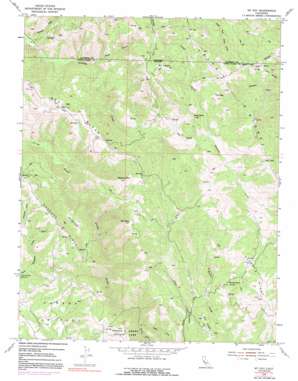
Mount Day Topo Map California
To zoom in, hover over the map of Mount Day
USGS Topo Quad 37121d6 - 1:24,000 scale
| Topo Map Name: | Mount Day |
| USGS Topo Quad ID: | 37121d6 |
| Print Size: | ca. 21 1/4" wide x 27" high |
| Southeast Coordinates: | 37.375° N latitude / 121.625° W longitude |
| Map Center Coordinates: | 37.4375° N latitude / 121.6875° W longitude |
| U.S. State: | CA |
| Filename: | o37121d6.jpg |
| Download Map JPG Image: | Mount Day topo map 1:24,000 scale |
| Map Type: | Topographic |
| Topo Series: | 7.5´ |
| Map Scale: | 1:24,000 |
| Source of Map Images: | United States Geological Survey (USGS) |
| Alternate Map Versions: |
Mt. Day CA 1955, updated 1957 Download PDF Buy paper map Mt. Day CA 1955, updated 1963 Download PDF Buy paper map Mt. Day CA 1955, updated 1972 Download PDF Buy paper map Mt. Day CA 1955, updated 1991 Download PDF Buy paper map Mount Day CA 1996, updated 1999 Download PDF Buy paper map Mount Day CA 2012 Download PDF Buy paper map Mount Day CA 2015 Download PDF Buy paper map |
1:24,000 Topo Quads surrounding Mount Day
> Back to 37121a1 at 1:100,000 scale
> Back to 37120a1 at 1:250,000 scale
> Back to U.S. Topo Maps home
Mount Day topo map: Gazetteer
Mount Day: Flats
Hamilton Flat elevation 1037m 3402′Van Horn Flats elevation 746m 2447′
Mount Day: Parks
Camp Ohlone Regional Park elevation 411m 1348′Mount Day: Ridges
Beartrap Ridge elevation 978m 3208′Oak Ridge elevation 857m 2811′
Packard Ridge elevation 1026m 3366′
Valpe Ridge elevation 1029m 3375′
Mount Day: Streams
Isabel Creek elevation 486m 1594′Smith Creek elevation 486m 1594′
Valpe Creek elevation 643m 2109′
Mount Day: Summits
Baby Peak elevation 828m 2716′Black Mountain elevation 1169m 3835′
Mount Day elevation 1163m 3815′
Mount Lewis elevation 1136m 3727′
Rattlesnake Butte elevation 960m 3149′
Mount Day: Valleys
Bear Gulch elevation 412m 1351′Mount Day digital topo map on disk
Buy this Mount Day topo map showing relief, roads, GPS coordinates and other geographical features, as a high-resolution digital map file on DVD:


