Solyo Topo Map California
To zoom in, hover over the map of Solyo
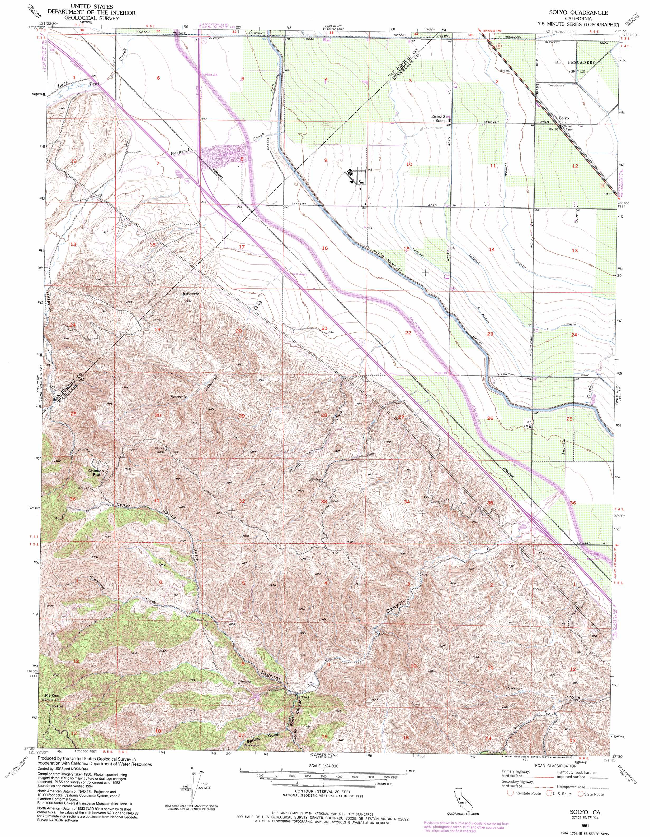
USGS Topo Quad 37121e3 - 1:24,000 scale
| Topo Map Name: | Solyo |
| USGS Topo Quad ID: | 37121e3 |
| Print Size: | ca. 21 1/4" wide x 27" high |
| Southeast Coordinates: | 37.5° N latitude / 121.25° W longitude |
| Map Center Coordinates: | 37.5625° N latitude / 121.3125° W longitude |
| U.S. State: | CA |
| Filename: | o37121e3.jpg |
| Download Map JPG Image: | Solyo topo map 1:24,000 scale |
| Map Type: | Topographic |
| Topo Series: | 7.5´ |
| Map Scale: | 1:24,000 |
| Source of Map Images: | United States Geological Survey (USGS) |
| Alternate Map Versions: |
Solyo CA 1953, updated 1955 Download PDF Buy paper map Solyo CA 1953, updated 1966 Download PDF Buy paper map Solyo CA 1953, updated 1973 Download PDF Buy paper map Solyo CA 1953, updated 1984 Download PDF Buy paper map Solyo CA 1991, updated 1995 Download PDF Buy paper map Solyo CA 1999, updated 2002 Download PDF Buy paper map Solyo CA 2012 Download PDF Buy paper map Solyo CA 2015 Download PDF Buy paper map |
1:24,000 Topo Quads surrounding Solyo
Clifton Court Forebay |
Union Island |
Lathrop |
Manteca |
Avena |
Midway |
Tracy |
Vernalis |
Ripon |
Salida |
Cedar Mountain |
Lone Tree Creek |
Solyo |
Westley |
Brush Lake |
Eylar Mountain |
Mount Boardman |
Copper Mountain |
Patterson |
Crows Landing |
Isabel Valley |
Mount Stakes |
Wilcox Ridge |
Orestimba Peak |
Newman |
> Back to 37121e1 at 1:100,000 scale
> Back to 37120a1 at 1:250,000 scale
> Back to U.S. Topo Maps home
Solyo topo map: Gazetteer
Solyo: Canals
Lateral Five North elevation 41m 134′Lateral Four North elevation 34m 111′
Lateral Six North elevation 48m 157′
Solyo: Flats
Chicken Flat elevation 369m 1210′Solyo: Populated Places
Solyo elevation 28m 91′Solyo: Streams
Arkansas Creek elevation 89m 291′Grummett Creek elevation 271m 889′
Martin Creek elevation 85m 278′
Solyo: Summits
Mount Oso elevation 1024m 3359′Solyo: Valleys
Cedar Spring Gulch elevation 271m 889′Ingram Canyon elevation 79m 259′
Rocky Ford Canyon elevation 202m 662′
Spring Gulch elevation 227m 744′
Solyo digital topo map on disk
Buy this Solyo topo map showing relief, roads, GPS coordinates and other geographical features, as a high-resolution digital map file on DVD: