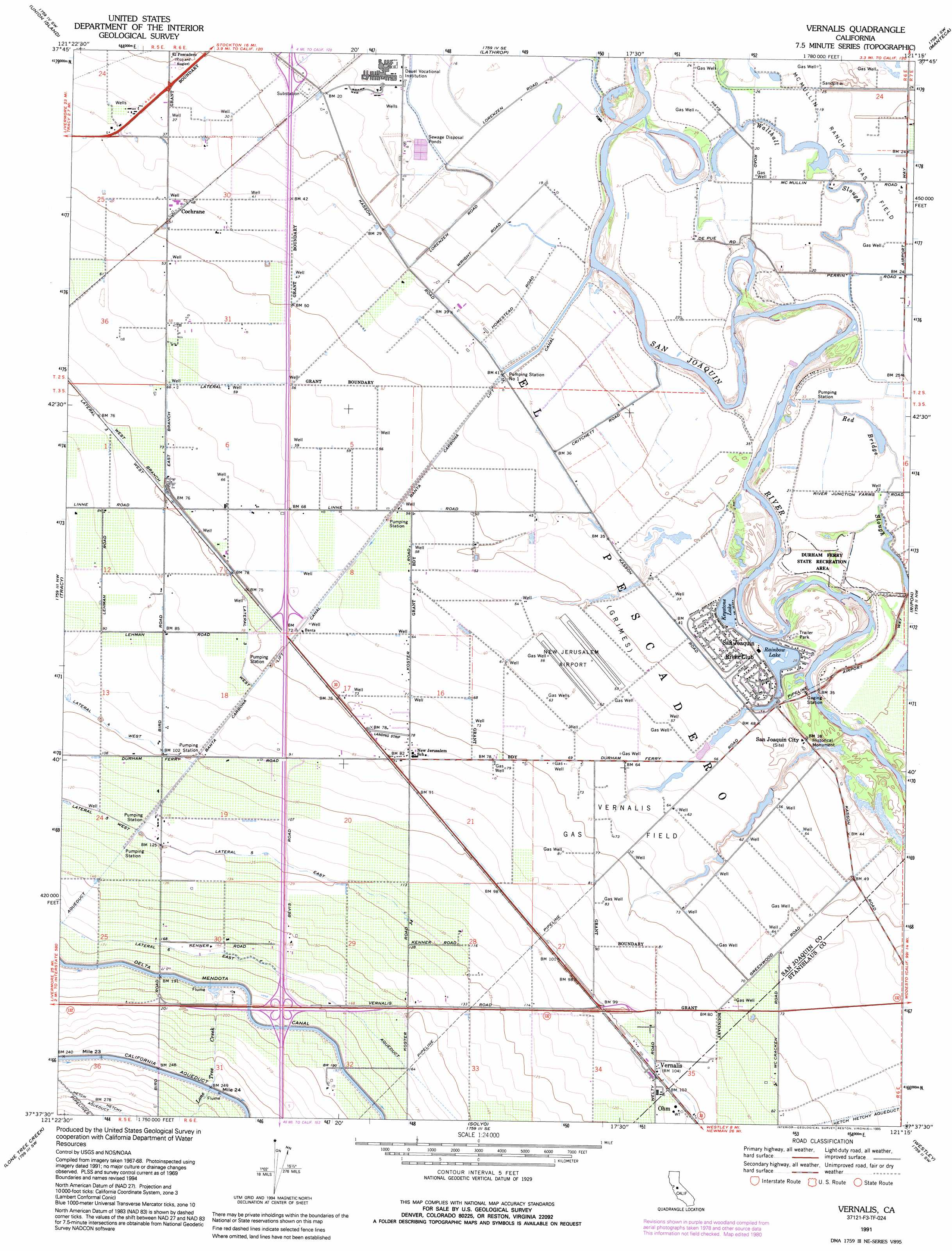
Vernalis Topo Map California
To zoom in, hover over the map of Vernalis
USGS Topo Quad 37121f3 - 1:24,000 scale
| Topo Map Name: | Vernalis |
| USGS Topo Quad ID: | 37121f3 |
| Print Size: | ca. 21 1/4" wide x 27" high |
| Southeast Coordinates: | 37.625° N latitude / 121.25° W longitude |
| Map Center Coordinates: | 37.6875° N latitude / 121.3125° W longitude |
| U.S. State: | CA |
| Filename: | o37121f3.jpg |
| Download Map JPG Image: | Vernalis topo map 1:24,000 scale |
| Map Type: | Topographic |
| Topo Series: | 7.5´ |
| Map Scale: | 1:24,000 |
| Source of Map Images: | United States Geological Survey (USGS) |
| Alternate Map Versions: |
Vernalis CA 1952, updated 1954 Download PDF Buy paper map Vernalis CA 1952, updated 1965 Download PDF Buy paper map Vernalis CA 1969, updated 1972 Download PDF Buy paper map Vernalis CA 1969, updated 1980 Download PDF Buy paper map Vernalis CA 1991, updated 1995 Download PDF Buy paper map Vernalis CA 2012 Download PDF Buy paper map Vernalis CA 2015 Download PDF Buy paper map |
1:24,000 Topo Quads surrounding Vernalis
Woodward Island |
Holt |
Stockton West |
Stockton East |
Peters |
Clifton Court Forebay |
Union Island |
Lathrop |
Manteca |
Avena |
Midway |
Tracy |
Vernalis |
Ripon |
Salida |
Cedar Mountain |
Lone Tree Creek |
Solyo |
Westley |
Brush Lake |
Eylar Mountain |
Mount Boardman |
Copper Mountain |
Patterson |
Crows Landing |
> Back to 37121e1 at 1:100,000 scale
> Back to 37120a1 at 1:250,000 scale
> Back to U.S. Topo Maps home
Vernalis topo map: Gazetteer
Vernalis: Airports
33 Strip elevation 25m 82′New Jerusalem Airport elevation 18m 59′
Vernalis: Canals
Banta Carbona Canal elevation 21m 68′East Branch Lateral elevation 22m 72′
Hetch Hetchy Aqueduct elevation 85m 278′
Lateral Five East elevation 38m 124′
Lateral Six East elevation 52m 170′
Lateral Three West elevation 24m 78′
West Branch Lateral elevation 24m 78′
Vernalis: Guts
Red Bridge Slough elevation 7m 22′Vernalis: Oilfields
McMullin Ranch Gas Field elevation 7m 22′Vernalis Gas Field elevation 22m 72′
Vernalis: Populated Places
Cochrane elevation 15m 49′Ohm elevation 33m 108′
San Joaquin River Club elevation 10m 32′
Vernalis elevation 32m 104′
Yarmouth (historical) elevation 24m 78′
Vernalis: Streams
Lone Tree Creek elevation 59m 193′Vernalis digital topo map on disk
Buy this Vernalis topo map showing relief, roads, GPS coordinates and other geographical features, as a high-resolution digital map file on DVD: