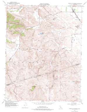
Byron Hot Springs Topo Map California
To zoom in, hover over the map of Byron Hot Springs
USGS Topo Quad 37121g6 - 1:24,000 scale
| Topo Map Name: | Byron Hot Springs |
| USGS Topo Quad ID: | 37121g6 |
| Print Size: | ca. 21 1/4" wide x 27" high |
| Southeast Coordinates: | 37.75° N latitude / 121.625° W longitude |
| Map Center Coordinates: | 37.8125° N latitude / 121.6875° W longitude |
| U.S. State: | CA |
| Filename: | o37121g6.jpg |
| Download Map JPG Image: | Byron Hot Springs topo map 1:24,000 scale |
| Map Type: | Topographic |
| Topo Series: | 7.5´ |
| Map Scale: | 1:24,000 |
| Source of Map Images: | United States Geological Survey (USGS) |
| Alternate Map Versions: |
Byron Hot Springs CA 1953, updated 1954 Download PDF Buy paper map Byron Hot Springs CA 1953, updated 1963 Download PDF Buy paper map Byron Hot Springs CA 1953, updated 1969 Download PDF Buy paper map Byron Hot Springs CA 1953, updated 1969 Download PDF Buy paper map Byron Hot Springs CA 1953, updated 1975 Download PDF Buy paper map Byron Hot Springs CA 2012 Download PDF Buy paper map Byron Hot Springs CA 2015 Download PDF Buy paper map |
1:24,000 Topo Quads surrounding Byron Hot Springs
> Back to 37121e1 at 1:100,000 scale
> Back to 37120a1 at 1:250,000 scale
> Back to U.S. Topo Maps home
Byron Hot Springs topo map: Gazetteer
Byron Hot Springs: Airports
Byron Airport elevation 19m 62′Byron Hot Springs: Canals
Byron-Bethany Irrigation Canal elevation 14m 45′Forty-Five Canal elevation 13m 42′
South Bay Aqueduct elevation 244m 800′
Byron Hot Springs: Populated Places
Byron elevation 10m 32′Byron Hot Springs: Post Offices
Byron Hot Springs Post Office (historical) elevation 14m 45′Byron Hot Springs: Springs
Byron Hot Springs elevation 15m 49′Byron Hot Springs: Summits
Brushy Peak elevation 514m 1686′Byron Hot Springs digital topo map on disk
Buy this Byron Hot Springs topo map showing relief, roads, GPS coordinates and other geographical features, as a high-resolution digital map file on DVD:


