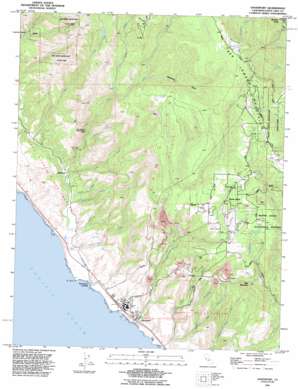
Davenport Topo Map California
To zoom in, hover over the map of Davenport
USGS Topo Quad 37122a2 - 1:24,000 scale
| Topo Map Name: | Davenport |
| USGS Topo Quad ID: | 37122a2 |
| Print Size: | ca. 21 1/4" wide x 27" high |
| Southeast Coordinates: | 37° N latitude / 122.125° W longitude |
| Map Center Coordinates: | 37.0625° N latitude / 122.1875° W longitude |
| U.S. State: | CA |
| Filename: | o37122a2.jpg |
| Download Map JPG Image: | Davenport topo map 1:24,000 scale |
| Map Type: | Topographic |
| Topo Series: | 7.5´ |
| Map Scale: | 1:24,000 |
| Source of Map Images: | United States Geological Survey (USGS) |
| Alternate Map Versions: |
Davenport CA 1955, updated 1957 Download PDF Buy paper map Davenport CA 1955, updated 1957 Download PDF Buy paper map Davenport CA 1955, updated 1964 Download PDF Buy paper map Davenport CA 1955, updated 1970 Download PDF Buy paper map Davenport CA 1955, updated 1970 Download PDF Buy paper map Davenport CA 1955, updated 1975 Download PDF Buy paper map Davenport CA 1991, updated 1995 Download PDF Buy paper map Davenport CA 1997, updated 1999 Download PDF Buy paper map Davenport CA 2012 Download PDF Buy paper map Davenport CA 2015 Download PDF Buy paper map |
1:24,000 Topo Quads surrounding Davenport
San Gregorio |
La Honda |
Mindego Hill |
Cupertino |
San Jose West |
Pigeon Point |
Franklin Point |
Big Basin |
Castle Rock Ridge |
Los Gatos |
Ano Nuevo * |
Davenport |
Felton |
Laurel |
|
Santa Cruz |
Soquel |
|||
> Back to 37122a1 at 1:100,000 scale
> Back to 37122a1 at 1:250,000 scale
> Back to U.S. Topo Maps home
Davenport topo map: Gazetteer
Davenport: Airports
Bonny Doon Village Airport elevation 611m 2004′Davenport: Beaches
Scott Creek Beach elevation 2m 6′Davenport: Capes
El Jarro Point elevation 16m 52′Davenport: Dams
Mill Creek 630 Dam elevation 460m 1509′Davenport: Populated Places
Bonny Doon elevation 382m 1253′Davenport elevation 12m 39′
Davenport Landing elevation 4m 13′
Swanton elevation 21m 68′
Davenport: Streams
Agua Puera Creek elevation 3m 9′Archibald Creek elevation 7m 22′
Berry Creek elevation 57m 187′
Big Creek elevation 12m 39′
Boyer Creek elevation 301m 987′
East Branch Liddell Creek elevation 46m 150′
Little Creek elevation 10m 32′
Mill Creek elevation 21m 68′
Mill Creek elevation 74m 242′
Molino Creek elevation 13m 42′
Reggiardo Creek elevation 182m 597′
San Vicente Creek elevation 4m 13′
Scott Creek elevation 3m 9′
West Liddell Creek elevation 13m 42′
Winter Creek elevation 9m 29′
Davenport: Summits
Bald Mountain elevation 399m 1309′Davenport: Swamps
Scott Creek Marsh elevation 7m 22′Davenport: Valleys
Deadman Gulch elevation 362m 1187′Davenport digital topo map on disk
Buy this Davenport topo map showing relief, roads, GPS coordinates and other geographical features, as a high-resolution digital map file on DVD:


