Hunters Point Topo Map California
To zoom in, hover over the map of Hunters Point
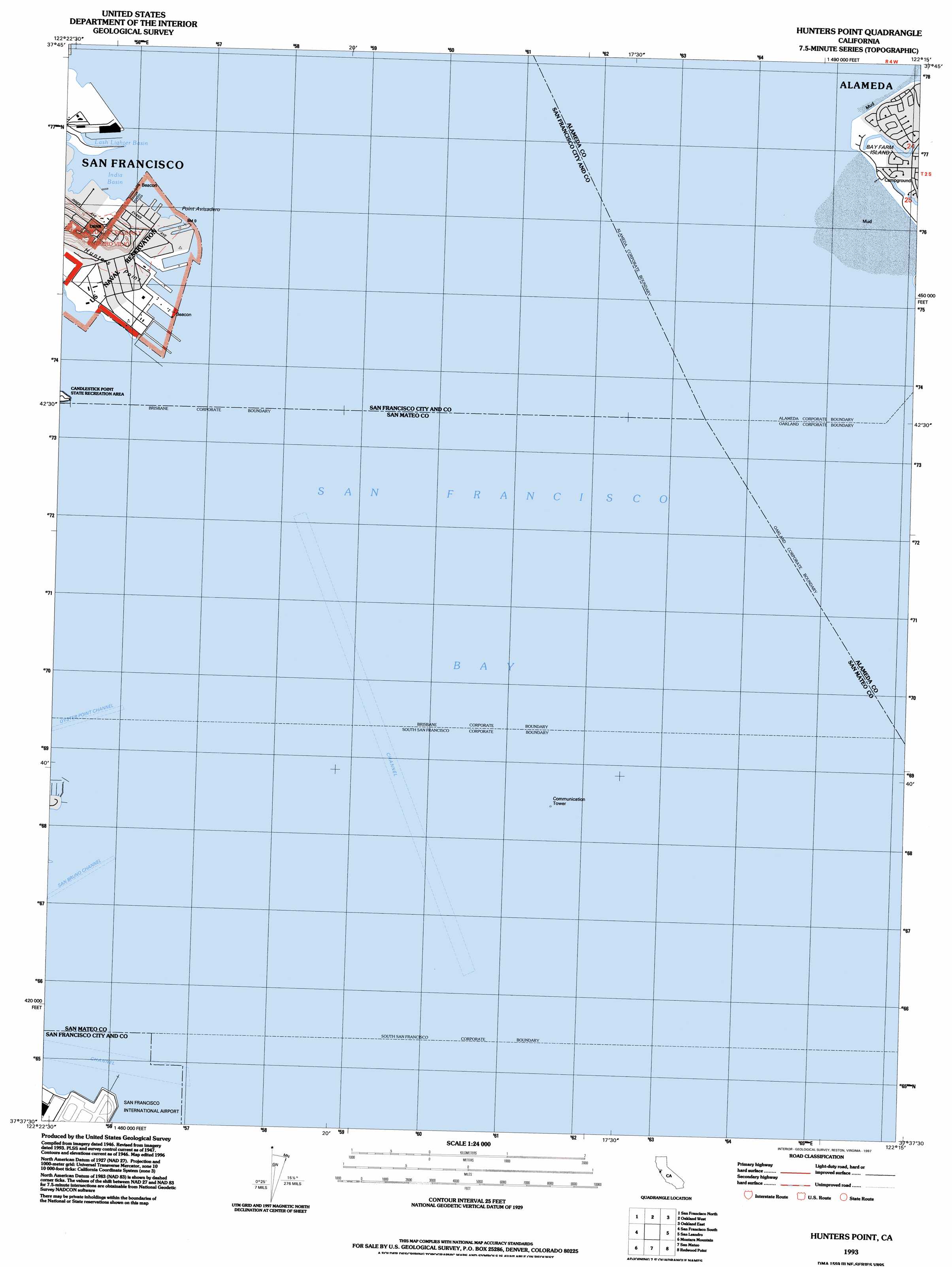
USGS Topo Quad 37122f3 - 1:24,000 scale
| Topo Map Name: | Hunters Point |
| USGS Topo Quad ID: | 37122f3 |
| Print Size: | ca. 21 1/4" wide x 27" high |
| Southeast Coordinates: | 37.625° N latitude / 122.25° W longitude |
| Map Center Coordinates: | 37.6875° N latitude / 122.3125° W longitude |
| U.S. State: | CA |
| Filename: | o37122f3.jpg |
| Download Map JPG Image: | Hunters Point topo map 1:24,000 scale |
| Map Type: | Topographic |
| Topo Series: | 7.5´ |
| Map Scale: | 1:24,000 |
| Source of Map Images: | United States Geological Survey (USGS) |
| Alternate Map Versions: |
Hunters Point CA 1956, updated 1967 Download PDF Buy paper map Hunters Point CA 1956, updated 1969 Download PDF Buy paper map Hunters Point CA 1956, updated 1974 Download PDF Buy paper map Hunters Point CA 1956, updated 1980 Download PDF Buy paper map Hunters Point CA 1956, updated 1985 Download PDF Buy paper map Hunters Point CA 1993, updated 1997 Download PDF Buy paper map Hunters Point CA 2012 Download PDF Buy paper map Hunters Point CA 2015 Download PDF Buy paper map |
1:24,000 Topo Quads surrounding Hunters Point
San Rafael |
San Quentin |
Richmond |
Briones Valley |
Walnut Creek |
Point Bonita |
San Francisco North |
Oakland West |
Oakland East |
Las Trampas Ridge |
San Francisco South |
Hunters Point |
San Leandro |
Hayward |
|
Montara Mountain |
San Mateo |
Redwood Point |
Newark |
|
Half Moon Bay |
Woodside |
Palo Alto |
Mountain View |
> Back to 37122e1 at 1:100,000 scale
> Back to 37122a1 at 1:250,000 scale
> Back to U.S. Topo Maps home
Hunters Point topo map: Gazetteer
Hunters Point: Bars
San Bruno Shoal elevation 0m 0′Hunters Point: Bays
India Basin elevation 0m 0′Lash Lighter Basin elevation 0m 0′
San Francisco Bay elevation -1m -4′
Hunters Point: Capes
Hunters Point elevation 6m 19′Point Avisadero elevation 0m 0′
Hunters Point: Channels
San Bruno Channel elevation 0m 0′Hunters Point digital topo map on disk
Buy this Hunters Point topo map showing relief, roads, GPS coordinates and other geographical features, as a high-resolution digital map file on DVD: