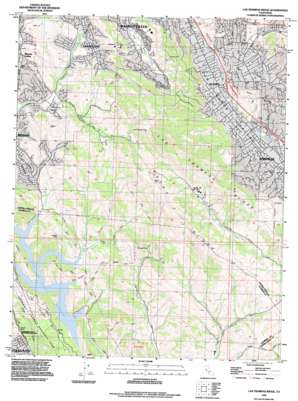
Las Trampas Ridge Topo Map California
To zoom in, hover over the map of Las Trampas Ridge
USGS Topo Quad 37122g1 - 1:24,000 scale
| Topo Map Name: | Las Trampas Ridge |
| USGS Topo Quad ID: | 37122g1 |
| Print Size: | ca. 21 1/4" wide x 27" high |
| Southeast Coordinates: | 37.75° N latitude / 122° W longitude |
| Map Center Coordinates: | 37.8125° N latitude / 122.0625° W longitude |
| U.S. State: | CA |
| Filename: | o37122g1.jpg |
| Download Map JPG Image: | Las Trampas Ridge topo map 1:24,000 scale |
| Map Type: | Topographic |
| Topo Series: | 7.5´ |
| Map Scale: | 1:24,000 |
| Source of Map Images: | United States Geological Survey (USGS) |
| Alternate Map Versions: |
Las Trampas Ridge CA 1947, updated 1956 Download PDF Buy paper map Las Trampas Ridge CA 1949 Download PDF Buy paper map Las Trampas Ridge CA 1959, updated 1960 Download PDF Buy paper map Las Trampas Ridge CA 1959, updated 1965 Download PDF Buy paper map Las Trampas Ridge CA 1959, updated 1969 Download PDF Buy paper map Las Trampas Ridge CA 1959, updated 1975 Download PDF Buy paper map Las Trampas Ridge CA 1959, updated 1980 Download PDF Buy paper map Las Trampas Ridge CA 1993, updated 1997 Download PDF Buy paper map Las Trampas Ridge CA 1995, updated 1999 Download PDF Buy paper map Las Trampas Ridge CA 2012 Download PDF Buy paper map Las Trampas Ridge CA 2015 Download PDF Buy paper map |
1:24,000 Topo Quads surrounding Las Trampas Ridge
> Back to 37122e1 at 1:100,000 scale
> Back to 37122a1 at 1:250,000 scale
> Back to U.S. Topo Maps home
Las Trampas Ridge topo map: Gazetteer
Las Trampas Ridge: Airports
Little Hands Stolport elevation 312m 1023′Las Trampas Ridge: Crossings
Exit 40 elevation 111m 364′Exit 41 elevation 110m 360′
Exit 42 elevation 80m 262′
Exit 43 elevation 77m 252′
Las Trampas Ridge: Dams
Danville 31-028 Dam elevation 166m 544′Moraga 31-022 Dam elevation 236m 774′
New Upper San Leandro 31-031 Dam elevation 141m 462′
Las Trampas Ridge: Parks
Chabot Regional Park elevation 213m 698′Chapel Green elevation 188m 616′
Eugene O'Neil National Historic Site elevation 205m 672′
La Vista Park elevation 98m 321′
Louis Guisto Baseball Field elevation 184m 603′
Pat Vincent Memorial Field elevation 183m 600′
Rancho Laguna Park elevation 163m 534′
Sugarloaf Open Space elevation 125m 410′
Las Trampas Ridge: Populated Places
Alamo elevation 79m 259′Brookshire elevation 177m 580′
Las Trampas Ridge: Reservoirs
Fay Hill Reservoir elevation 291m 954′Moraga Reservoir elevation 237m 777′
Upper San Leandro Reservoir elevation 141m 462′
Las Trampas Ridge: Ridges
Alamo Ridge elevation 212m 695′Las Trampas Ridge elevation 519m 1702′
Riley Ridge elevation 368m 1207′
Rocky Ridge elevation 617m 2024′
Las Trampas Ridge: Streams
Bolinas Creek elevation 157m 515′Buckhorn Creek elevation 144m 472′
Grizzly Creek elevation 113m 370′
Kaiser Creek elevation 143m 469′
Miller Creek elevation 97m 318′
Las Trampas Ridge: Summits
Castle Hill elevation 210m 688′Las Trampas Peak elevation 551m 1807′
Ramage Peak elevation 411m 1348′
Las Trampas Ridge: Valleys
Burton Valley elevation 111m 364′King Canyon elevation 141m 462′
Miller Canyon elevation 98m 321′
Riley Canyon elevation 141m 462′
Stone Valley elevation 93m 305′
Tice Valley elevation 75m 246′
Las Trampas Ridge digital topo map on disk
Buy this Las Trampas Ridge topo map showing relief, roads, GPS coordinates and other geographical features, as a high-resolution digital map file on DVD:


