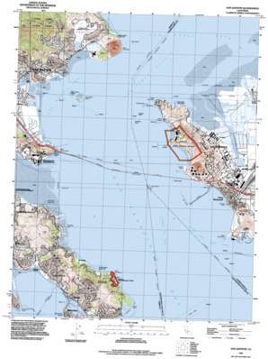
San Quentin Topo Map California
To zoom in, hover over the map of San Quentin
USGS Topo Quad 37122h4 - 1:24,000 scale
| Topo Map Name: | San Quentin |
| USGS Topo Quad ID: | 37122h4 |
| Print Size: | ca. 21 1/4" wide x 27" high |
| Southeast Coordinates: | 37.875° N latitude / 122.375° W longitude |
| Map Center Coordinates: | 37.9375° N latitude / 122.4375° W longitude |
| U.S. State: | CA |
| Filename: | o37122h4.jpg |
| Download Map JPG Image: | San Quentin topo map 1:24,000 scale |
| Map Type: | Topographic |
| Topo Series: | 7.5´ |
| Map Scale: | 1:24,000 |
| Source of Map Images: | United States Geological Survey (USGS) |
| Alternate Map Versions: |
San Quentin CA 1947, updated 1956 Download PDF Buy paper map San Quentin CA 1948 Download PDF Buy paper map San Quentin CA 1959, updated 1960 Download PDF Buy paper map San Quentin CA 1959, updated 1965 Download PDF Buy paper map San Quentin CA 1959, updated 1969 Download PDF Buy paper map San Quentin CA 1959, updated 1976 Download PDF Buy paper map San Quentin CA 1959, updated 1980 Download PDF Buy paper map San Quentin CA 1993, updated 1997 Download PDF Buy paper map San Quentin CA 1995, updated 1999 Download PDF Buy paper map San Quentin CA 2012 Download PDF Buy paper map San Quentin CA 2015 Download PDF Buy paper map |
1:24,000 Topo Quads surrounding San Quentin
> Back to 37122e1 at 1:100,000 scale
> Back to 37122a1 at 1:250,000 scale
> Back to U.S. Topo Maps home
San Quentin topo map: Gazetteer
San Quentin: Airports
San Rafel Heliport elevation 2m 6′San Quentin: Bars
Castro Rocks elevation 0m 0′Invincible Rock elevation 0m 0′
Sandpiper Spit elevation 3m 9′
Southampton Shoal elevation 0m 0′
Whiting Rock elevation 0m 0′
San Quentin: Bays
Brickyard Cove elevation 8m 26′Keil Cove elevation 0m 0′
Paradise Cove elevation 0m 0′
Point San Pablo Yacht Harbor elevation 0m 0′
San Rafael Bay elevation 0m 0′
San Quentin: Beaches
Kellers Beach elevation 4m 13′Point Molate Beach elevation 4m 13′
San Quentin: Bridges
Richmond -San Rafael Bridge elevation 0m 0′San Quentin: Capes
Bluff Point elevation 1m 3′California Point elevation 23m 75′
Castro Point elevation 7m 22′
Cypress Point elevation 7m 22′
Paradise Cay elevation 7m 22′
Point Chauncey elevation 0m 0′
Point Molate elevation 6m 19′
Point Orient elevation 18m 59′
Point Richmond elevation 6m 19′
Point San Pablo elevation 6m 19′
Point San Pedro elevation 0m 0′
Point San Quentin elevation 0m 0′
Tiburon Peninsula elevation 39m 127′
San Quentin: Channels
Point Potrero Reach elevation 0m 0′Richmond Harbor Entrance Channel elevation 0m 0′
San Pablo Strait elevation 0m 0′
Southampton Shoal Channel elevation 0m 0′
San Quentin: Crossings
Exit 2A elevation 4m 13′Exit 2B elevation 7m 22′
Exit 7A elevation 11m 36′
Exit 7B elevation 4m 13′
Exit 8 elevation 4m 13′
San Quentin: Flats
Blackies Pasture elevation 6m 19′San Quentin: Harbors
Loch Lomond Yacht Harbor elevation 6m 19′Turning Basin elevation 0m 0′
San Quentin: Islands
East Marin Island elevation 21m 68′Red Rock elevation 41m 134′
The Brothers elevation 7m 22′
The Sisters elevation 0m 0′
West Marin Island elevation 17m 55′
San Quentin: Lakes
Belvedere Lagoon elevation 0m 0′San Quentin: Parks
Belvedere Park elevation 6m 19′George Miller Junior Memorial Regional Shoreline elevation 3m 9′
Henry A Barbier Memorial Park elevation 115m 377′
John T Knox Shoreline elevation 0m 0′
Kellers Beach Park elevation 4m 13′
McKegney Field elevation 5m 16′
McNears Beach County Park elevation 3m 9′
Old Saint Hilarys Historic Preserve elevation 45m 147′
Paradise Beach County Park elevation 6m 19′
Peacock Gap Neighborhood Park elevation 5m 16′
Pickleweed Park elevation 0m 0′
Richardson Bay Audubon Center and Wildlife Sanctuary elevation 8m 26′
Richardson Bay Park elevation 5m 16′
San Clemente Park elevation 5m 16′
Schoen Park elevation 3m 9′
Shoreline Band Park elevation 7m 22′
Tiburon Uplands Nature Preserve elevation 81m 265′
Victor Jones Park elevation 26m 85′
Washington Park elevation 6m 19′
San Quentin: Populated Places
Bel Aire elevation 6m 19′Belvedere Island elevation 21m 68′
El Campo elevation 17m 55′
Hilarita elevation 4m 13′
Little Reed Heights elevation 23m 75′
McNears Beach elevation 3m 9′
Paradise Cay elevation 7m 22′
Point Richmond elevation 35m 114′
San Quentin elevation 9m 29′
San Quentin: Post Offices
Point Richmond Station Richmond Post Office elevation 6m 19′San Quentin Post Office elevation 12m 39′
San Quentin: Streams
Castro Creek elevation 0m 0′San Clemente Creek elevation 0m 0′
San Pablo Creek elevation 0m 0′
San Rafael Creek elevation 0m 0′
Wildcat Creek elevation 0m 0′
San Quentin: Summits
Nickols Knob elevation 113m 370′Ring Mountain elevation 185m 606′
San Pedro Hill elevation 91m 298′
San Quentin: Trails
Peacock Gap Trail elevation 20m 65′San Quentin digital topo map on disk
Buy this San Quentin topo map showing relief, roads, GPS coordinates and other geographical features, as a high-resolution digital map file on DVD:


