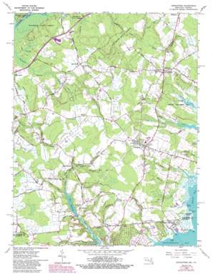
Girdletree Topo Map Maryland
To zoom in, hover over the map of Girdletree
USGS Topo Quad 38075a4 - 1:24,000 scale
| Topo Map Name: | Girdletree |
| USGS Topo Quad ID: | 38075a4 |
| Print Size: | ca. 21 1/4" wide x 27" high |
| Southeast Coordinates: | 38° N latitude / 75.375° W longitude |
| Map Center Coordinates: | 38.0625° N latitude / 75.4375° W longitude |
| U.S. States: | MD, VA |
| Filename: | o38075a4.jpg |
| Download Map JPG Image: | Girdletree topo map 1:24,000 scale |
| Map Type: | Topographic |
| Topo Series: | 7.5´ |
| Map Scale: | 1:24,000 |
| Source of Map Images: | United States Geological Survey (USGS) |
| Alternate Map Versions: |
Girdletree MD 1953 Download PDF Buy paper map Girdletree MD 1953, updated 1953 Download PDF Buy paper map Girdletree MD 1966, updated 1968 Download PDF Buy paper map Girdletree MD 1966, updated 1974 Download PDF Buy paper map Girdletree MD 1966, updated 1980 Download PDF Buy paper map Girdletree MD 1966, updated 1988 Download PDF Buy paper map Girdletree MD 2011 Download PDF Buy paper map Girdletree MD 2014 Download PDF Buy paper map Girdletree MD 2016 Download PDF Buy paper map |
1:24,000 Topo Quads surrounding Girdletree
> Back to 38075a1 at 1:100,000 scale
> Back to 38074a1 at 1:250,000 scale
> Back to U.S. Topo Maps home
Girdletree topo map: Gazetteer
Girdletree: Canals
Bunn Ditch elevation 2m 6′Goodwill Ditch elevation 8m 26′
Jones Ditch elevation 5m 16′
Marshall Ditch elevation 2m 6′
Payne Ditch elevation 7m 22′
Rayfield Ditch elevation 5m 16′
Ward Ditch elevation 9m 29′
Girdletree: Capes
Goose Point elevation 0m 0′Guys Point elevation 0m 0′
Long Point elevation 0m 0′
Girdletree: Dams
Big Millpond Dam elevation 1m 3′Snider Dam elevation 1m 3′
Girdletree: Lakes
Big Millpond elevation 1m 3′Girdletree: Parks
Vaughn State Wildlife Management Area elevation 2m 6′Girdletree: Populated Places
Bessen Landing elevation 1m 3′Franklin City elevation 0m 0′
Girdletree elevation 10m 32′
Goodwill elevation 9m 29′
Greenbackville elevation 1m 3′
Milburn Landing elevation 4m 13′
Owl Hollow Acres elevation 11m 36′
Stockton elevation 9m 29′
Welbourne elevation 5m 16′
Girdletree: Post Offices
Girdletree Post Office elevation 10m 32′Greenbackville Post Office elevation 2m 6′
Stockton Post Office elevation 9m 29′
Girdletree: Reservoirs
Little Millpond elevation 4m 13′Little Millpond (historical) elevation 3m 9′
Girdletree: Streams
Bessen Creek elevation 0m 0′Cottingham Mill Run elevation 1m 3′
Guys Point Gut elevation 0m 0′
Hancock Creek elevation 0m 0′
Kelly Mill Branch elevation 4m 13′
Little Mill Creek elevation 3m 9′
Little Mill Run elevation 1m 3′
Marshall Mill Run elevation 4m 13′
Paradie Branch elevation 3m 9′
Powell Creek elevation 0m 0′
Redden Creek elevation 4m 13′
Sand Branch elevation 0m 0′
Sand Branch elevation 0m 0′
Selby Mill Branch elevation 1m 3′
Spring Hill Branch elevation 3m 9′
Tarr Branch elevation 3m 9′
Girdletree: Swamps
Goose Point Marsh elevation 1m 3′Holly Swamp (historical) elevation 10m 32′
Girdletree digital topo map on disk
Buy this Girdletree topo map showing relief, roads, GPS coordinates and other geographical features, as a high-resolution digital map file on DVD:
Atlantic Coast (NY, NJ, PA, DE, MD, VA, NC)
Buy digital topo maps: Atlantic Coast (NY, NJ, PA, DE, MD, VA, NC)


