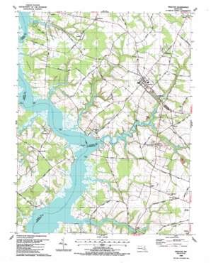
Preston Topo Map Maryland
To zoom in, hover over the map of Preston
USGS Topo Quad 38075f8 - 1:24,000 scale
| Topo Map Name: | Preston |
| USGS Topo Quad ID: | 38075f8 |
| Print Size: | ca. 21 1/4" wide x 27" high |
| Southeast Coordinates: | 38.625° N latitude / 75.875° W longitude |
| Map Center Coordinates: | 38.6875° N latitude / 75.9375° W longitude |
| U.S. State: | MD |
| Filename: | o38075f8.jpg |
| Download Map JPG Image: | Preston topo map 1:24,000 scale |
| Map Type: | Topographic |
| Topo Series: | 7.5´ |
| Map Scale: | 1:24,000 |
| Source of Map Images: | United States Geological Survey (USGS) |
| Alternate Map Versions: |
Preston MD 1944, updated 1962 Download PDF Buy paper map Preston MD 1944, updated 1976 Download PDF Buy paper map Preston MD 1988, updated 1988 Download PDF Buy paper map Preston MD 2011 Download PDF Buy paper map Preston MD 2014 Download PDF Buy paper map Preston MD 2016 Download PDF Buy paper map |
1:24,000 Topo Quads surrounding Preston
> Back to 38075e1 at 1:100,000 scale
> Back to 38074a1 at 1:250,000 scale
> Back to U.S. Topo Maps home
Preston topo map: Gazetteer
Preston: Bays
Ewens Bay elevation 0m 0′Preston: Bridges
Suicide Bridge elevation 0m 0′Preston: Capes
Andertons Point elevation 0m 0′Bamberry Neck elevation 12m 39′
Bow Knee Point elevation 0m 0′
Cabin Creek Neck elevation 9m 29′
Frazier Neck elevation 5m 16′
Frazier Point elevation 0m 0′
Hunting Creek Neck elevation 10m 32′
Poplar Neck elevation 8m 26′
Poplar Point elevation 0m 0′
Studd Point elevation 1m 3′
Preston: Crossings
Barkers Ferry (historical) elevation 0m 0′Preston: Dams
Maryland Noname 3 Dam elevation 4m 13′Preston: Parks
Jonestown Community Park elevation 14m 45′Preston Lions Club Park elevation 12m 39′
Preston: Populated Places
Belmont Acres elevation 7m 22′Bethlehem elevation 14m 45′
Beulah elevation 9m 29′
Bruceville elevation 10m 32′
Choptank elevation 2m 6′
Ellwood elevation 10m 32′
Everlea elevation 14m 45′
Grove elevation 16m 52′
Jonestown elevation 14m 45′
Linchester elevation 3m 9′
Lloyd Landing elevation 2m 6′
Nelpine Mobile Home Park elevation 15m 49′
Preston elevation 14m 45′
Prettyman Manor elevation 8m 26′
Tanyard Estates elevation 8m 26′
Waddells Corner elevation 13m 42′
West Haven elevation 6m 19′
West View elevation 13m 42′
Windyhill elevation 5m 16′
Wrights Wharf elevation 14m 45′
Preston: Post Offices
Bethlehem Post Office elevation 15m 49′Preston Post Office elevation 11m 36′
Preston: Reservoirs
Linchester Mill Pond elevation 3m 9′Maryland Noname 3 Reservoir elevation 4m 13′
Preston: Streams
Blinkhorn Creek elevation 0m 0′Cabin Creek elevation 0m 0′
Fox Creek elevation 1m 3′
Gravel Run elevation -1m -4′
Hunting Creek elevation 0m 0′
Little Creek elevation 1m 3′
Little Marsh Creek elevation -1m -4′
Little Marsh Creek elevation 0m 0′
Marsh Creek elevation 0m 0′
Miles Creek elevation 0m 0′
Muskeeta Creek elevation 1m 3′
Raccoon Creek elevation 0m 0′
Skeleton Creek elevation 4m 13′
Preston digital topo map on disk
Buy this Preston topo map showing relief, roads, GPS coordinates and other geographical features, as a high-resolution digital map file on DVD:
Atlantic Coast (NY, NJ, PA, DE, MD, VA, NC)
Buy digital topo maps: Atlantic Coast (NY, NJ, PA, DE, MD, VA, NC)


