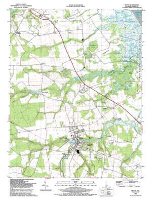
Milton Topo Map Delaware
To zoom in, hover over the map of Milton
USGS Topo Quad 38075g3 - 1:24,000 scale
| Topo Map Name: | Milton |
| USGS Topo Quad ID: | 38075g3 |
| Print Size: | ca. 21 1/4" wide x 27" high |
| Southeast Coordinates: | 38.75° N latitude / 75.25° W longitude |
| Map Center Coordinates: | 38.8125° N latitude / 75.3125° W longitude |
| U.S. State: | DE |
| Filename: | o38075g3.jpg |
| Download Map JPG Image: | Milton topo map 1:24,000 scale |
| Map Type: | Topographic |
| Topo Series: | 7.5´ |
| Map Scale: | 1:24,000 |
| Source of Map Images: | United States Geological Survey (USGS) |
| Alternate Map Versions: |
Milton DE 1944 Download PDF Buy paper map Milton DE 1955, updated 1957 Download PDF Buy paper map Milton DE 1955, updated 1982 Download PDF Buy paper map Milton DE 1992, updated 1992 Download PDF Buy paper map Milton DE 2011 Download PDF Buy paper map Milton DE 2014 Download PDF Buy paper map Milton DE 2016 Download PDF Buy paper map |
1:24,000 Topo Quads surrounding Milton
> Back to 38075e1 at 1:100,000 scale
> Back to 38074a1 at 1:250,000 scale
> Back to U.S. Topo Maps home
Milton topo map: Gazetteer
Milton: Bridges
Lavinia Causeway elevation 2m 6′Milton: Capes
Broadkill Neck elevation 3m 9′Cave Neck elevation 6m 19′
Little Neck elevation 1m 3′
Pikes Neck elevation 3m 9′
Primehook Neck elevation 2m 6′
Milton: Dams
Diamond Pond Dam (historical) elevation 6m 19′Reynolds Pond Dam (historical) elevation 6m 19′
Wagamons Pond Dam elevation 2m 6′
Waples Pond Dam (historical) elevation 1m 3′
Milton: Islands
Cods Hammocks (historical) elevation 1m 3′First Hill elevation 1m 3′
Hay Hummock elevation 1m 3′
Horse Island elevation 1m 3′
Negro Island elevation 1m 3′
Oak Hill elevation 1m 3′
Second Hill elevation 1m 3′
Milton: Lakes
Bennett Pond elevation 0m 0′Big Round Pond elevation 1m 3′
Blind Pond elevation 3m 9′
Caleb Pond elevation 1m 3′
Conwell Pond elevation 1m 3′
Flaxhole Pond elevation 0m 0′
Fleetwood Pond elevation 0m 0′
Goose Pond elevation 1m 3′
Goose Pond elevation 0m 0′
Horseshoe Pond elevation 0m 0′
Ingram Pond elevation 1m 3′
Jack Roach Pond elevation 1m 3′
Jones Pond elevation 1m 3′
Little Round Pond elevation 1m 3′
Miry Pond elevation 1m 3′
Noah Pond elevation 1m 3′
Oak Pond elevation 1m 3′
Peach Pond elevation 1m 3′
Poplar Woods Pond elevation 1m 3′
Southwest Pond elevation 1m 3′
Spatterdock Pond elevation 0m 0′
Stickweed Pond elevation 1m 3′
Streak Ponds elevation 1m 3′
Teal Pond elevation 1m 3′
Turkle Pond elevation 0m 0′
Twin Ponds elevation 1m 3′
Waples Pond elevation 1m 3′
Wilson Pond elevation 1m 3′
Milton: Parks
Prime Hook State Wildlife Management Area elevation 1m 3′Milton: Populated Places
Anderson Crossroads elevation 7m 22′Argo Corners elevation 9m 29′
Cave Colony elevation 10m 32′
Collins and Russell Development elevation 11m 36′
Drawbridge elevation 2m 6′
East Side Village elevation 8m 26′
Foord Landing elevation 1m 3′
Holly Lake Mobile Home Park elevation 4m 13′
Jefferson Crossroads elevation 10m 32′
Milton elevation 4m 13′
Reynolds Mill elevation 7m 22′
Smith Landing elevation 3m 9′
Vaughn Landing elevation 6m 19′
Waples elevation 4m 13′
Waples Pond Acres elevation 4m 13′
Milton: Post Offices
Milton Post Office elevation 3m 9′Milton: Reservoirs
Diamond Pond elevation 6m 19′Reynolds Pond elevation 6m 19′
Wagamons Pond elevation 2m 6′
Waples Pond elevation 1m 3′
Milton: Streams
Beaverdam Creek elevation 1m 3′Brittingham Branch elevation 5m 16′
Deep Branch elevation 2m 6′
Ingram Branch elevation 2m 6′
Ingram Branch elevation 1m 3′
North Prong elevation 1m 3′
Old Slaughter Creek elevation 1m 3′
Pemberton Branch elevation 2m 6′
Piney Branch elevation 5m 16′
Round Pole Branch elevation 1m 3′
Sowbridge Branch elevation 1m 3′
Milton: Summits
Rattlesnake Hill elevation 6m 19′Sugar Hill elevation 4m 13′
Milton: Swamps
Broken Marshes elevation 1m 3′Buzzard Swamp elevation 4m 13′
Huckleberry Swamp elevation 2m 6′
Little Rabbit Swamp elevation 4m 13′
Milton digital topo map on disk
Buy this Milton topo map showing relief, roads, GPS coordinates and other geographical features, as a high-resolution digital map file on DVD:
Atlantic Coast (NY, NJ, PA, DE, MD, VA, NC)
Buy digital topo maps: Atlantic Coast (NY, NJ, PA, DE, MD, VA, NC)


