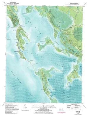
Honga Topo Map Maryland
To zoom in, hover over the map of Honga
USGS Topo Quad 38076c2 - 1:24,000 scale
| Topo Map Name: | Honga |
| USGS Topo Quad ID: | 38076c2 |
| Print Size: | ca. 21 1/4" wide x 27" high |
| Southeast Coordinates: | 38.25° N latitude / 76.125° W longitude |
| Map Center Coordinates: | 38.3125° N latitude / 76.1875° W longitude |
| U.S. State: | MD |
| Filename: | p38076c2.jpg |
| Download Map JPG Image: | Honga topo map 1:24,000 scale |
| Map Type: | Orthophoto |
| Topo Series: | 7.5´ |
| Map Scale: | 1:24,000 |
| Source of Map Images: | United States Geological Survey (USGS) |
| Alternate Map Versions: |
Honga MD 1942, updated 1958 Download PDF Buy paper map Honga MD 1942, updated 1969 Download PDF Buy paper map Honga MD 1942, updated 1976 Download PDF Buy paper map Honga MD 1984, updated 1984 Download PDF Buy paper map Honga MD 2011 Download PDF Buy paper map Honga MD 2014 Download PDF Buy paper map Honga MD 2016 Download PDF Buy paper map |
1:24,000 Topo Quads surrounding Honga
> Back to 38076a1 at 1:100,000 scale
> Back to 38076a1 at 1:250,000 scale
> Back to U.S. Topo Maps home
Honga topo map: Gazetteer
Honga: Airports
Wroten Island Airport elevation 1m 3′Honga: Bays
Back Creek elevation 0m 0′Bentley Cove elevation 0m 0′
Cat Cove elevation 0m 0′
Fishing Creek elevation 2m 6′
Flag Cove elevation 0m 0′
Flowers Cove elevation 4m 13′
Gunners Cove elevation 0m 0′
Hickory Cove elevation 0m 0′
Joes Cove elevation 0m 0′
Lakes Cove elevation 0m 0′
Long Cove elevation 0m 0′
Muddy Hook Cove elevation 0m 0′
Paul Cove elevation 0m 0′
Tom Cove elevation 0m 0′
Tyler Cove elevation 0m 0′
Wheatley Point Cove elevation 0m 0′
Windmill Cove elevation 0m 0′
Honga: Canals
The Canal elevation 0m 0′Honga: Capes
Ben Point elevation 0m 0′Bentley Point elevation 0m 0′
Bluff Point elevation 1m 3′
Cedar Point elevation 1m 3′
Cedar Point elevation 0m 0′
Charity Point elevation 0m 0′
Clay Point elevation 1m 3′
Dicks Point elevation 0m 0′
Docs Point elevation 1m 3′
Ferry Point elevation 0m 0′
Fishing Point elevation 1m 3′
Hickory Point elevation 0m 0′
Horse Point elevation 1m 3′
Keenes Point elevation 1m 3′
Kirwan Neck elevation 1m 3′
Long Point elevation 1m 3′
Lower Wroten Point elevation 1m 3′
Nans Point elevation 0m 0′
Old House Point elevation 1m 3′
Parks Neck elevation 1m 3′
Pons Point elevation 1m 3′
Sand Point elevation 0m 0′
Seven Oaks Point elevation 1m 3′
Smoke Point elevation 0m 0′
Sols Point elevation 1m 3′
Taylor Point elevation 1m 3′
Tom Point elevation 0m 0′
Tom Point elevation 1m 3′
Upper Wroten Point elevation 0m 0′
Wheatley Point elevation 1m 3′
Windmill Point elevation 0m 0′
Honga: Guts
Sols Point Gut elevation 0m 0′Honga: Islands
Asquith Island elevation 1m 3′Gunners Island elevation 1m 3′
Hooper Islands elevation 1m 3′
Middle Hooper Island elevation 1m 3′
Opossum Island elevation 0m 0′
Pot Island elevation 0m 0′
Swan Island elevation 0m 0′
Upper Hooper Island elevation 1m 3′
Wroten Island elevation 1m 3′
Honga: Populated Places
Crapo elevation 1m 3′Fishing Creek elevation 1m 3′
Honga elevation 1m 3′
Hooper Islands elevation 0m 0′
Hoopersville elevation 1m 3′
Lakesville elevation 1m 3′
Honga: Post Offices
Crapo Post Office elevation 0m 0′Lakesville Post Office (historical) elevation 1m 3′
Honga: Streams
Charles Creek elevation 0m 0′Lowes Creek elevation 0m 0′
Pot Island Creek elevation 4m 13′
Tyler Creek elevation 0m 0′
Wallace Creek elevation 0m 0′
Worlds End Creek elevation 0m 0′
Honga: Swamps
Hell Hook Marsh elevation 1m 3′Honga digital topo map on disk
Buy this Honga topo map showing relief, roads, GPS coordinates and other geographical features, as a high-resolution digital map file on DVD:
Atlantic Coast (NY, NJ, PA, DE, MD, VA, NC)
Buy digital topo maps: Atlantic Coast (NY, NJ, PA, DE, MD, VA, NC)


