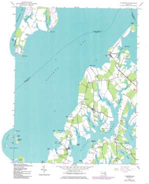
Claiborne Topo Map Maryland
To zoom in, hover over the map of Claiborne
USGS Topo Quad 38076g3 - 1:24,000 scale
| Topo Map Name: | Claiborne |
| USGS Topo Quad ID: | 38076g3 |
| Print Size: | ca. 21 1/4" wide x 27" high |
| Southeast Coordinates: | 38.75° N latitude / 76.25° W longitude |
| Map Center Coordinates: | 38.8125° N latitude / 76.3125° W longitude |
| U.S. State: | MD |
| Filename: | o38076g3.jpg |
| Download Map JPG Image: | Claiborne topo map 1:24,000 scale |
| Map Type: | Topographic |
| Topo Series: | 7.5´ |
| Map Scale: | 1:24,000 |
| Source of Map Images: | United States Geological Survey (USGS) |
| Alternate Map Versions: |
Claiborne MD 1942, updated 1961 Download PDF Buy paper map Claiborne MD 1942, updated 1973 Download PDF Buy paper map Claiborne MD 1942, updated 1976 Download PDF Buy paper map Claiborne MD 1942, updated 1986 Download PDF Buy paper map Claiborne MD 2011 Download PDF Buy paper map Claiborne MD 2014 Download PDF Buy paper map Claiborne MD 2016 Download PDF Buy paper map |
1:24,000 Topo Quads surrounding Claiborne
> Back to 38076e1 at 1:100,000 scale
> Back to 38076a1 at 1:250,000 scale
> Back to U.S. Topo Maps home
Claiborne topo map: Gazetteer
Claiborne: Airports
Martin Airport elevation 2m 6′Stewart Airport elevation 3m 9′
Claiborne: Bays
Briary Cove elevation 0m 0′Cabin Cove elevation 0m 0′
Caulk Cove elevation 1m 3′
Chews Creek elevation 1m 3′
Cummings Creek elevation 0m 0′
Eastern Bay elevation 0m 0′
Edgar Cove elevation 0m 0′
Ferry Cove elevation 0m 0′
Grace Creek elevation 0m 0′
Harbor Cove elevation 0m 0′
Hidden Creek elevation 0m 0′
Holligans Snooze Inlet elevation 0m 0′
Tilghman Creek elevation 2m 6′
Waterhole Cove elevation 0m 0′
Claiborne: Capes
Bloody Point elevation 3m 9′Great Marsh Point elevation 0m 0′
Indian Point elevation 1m 3′
Kent Point elevation 2m 6′
Little Neck Point elevation 1m 3′
Long Point elevation 1m 3′
Long Point elevation 3m 9′
Lowes Point elevation 0m 0′
North Point elevation 0m 0′
Punch Point elevation 0m 0′
Rabbit Point elevation 1m 3′
Rich Neck elevation 4m 13′
Seth Point elevation 1m 3′
Smith Point elevation 2m 6′
Tanners Point elevation 0m 0′
Tilghman Point elevation 0m 0′
Valliant Point elevation 0m 0′
Wades Point elevation 2m 6′
Claiborne: Channels
Poplar Island Narrows elevation 0m 0′Claiborne: Crossings
Claiborne-Romancoke Ferry (historical) elevation 0m 0′Claiborne: Guts
Scaffold Creek elevation 1m 3′Claiborne: Harbors
North Pond elevation 0m 0′Poplar Harbor elevation 0m 0′
Claiborne: Islands
Coaches Island elevation 0m 0′Goat Island elevation 0m 0′
Jefferson Island elevation 1m 3′
Claiborne: Parks
Wittman Park elevation 3m 9′Claiborne: Populated Places
Baie Holm elevation 4m 13′Bozman elevation 2m 6′
Brightwood elevation 2m 6′
Broad Creek Farms elevation 3m 9′
Chews Manor elevation 3m 9′
Claiborne elevation 1m 3′
Crescendo elevation 2m 6′
Crosswinds elevation 2m 6′
Grace Creek elevation 2m 6′
Indian Harbor elevation 3m 9′
Kent Fort Manor elevation 3m 9′
Kent Point Farm elevation 3m 9′
Kent Point Manor elevation 3m 9′
Mallard Point elevation 3m 9′
McDaniel elevation 5m 16′
Mount Pleasant elevation 2m 6′
Nutcracker Point elevation 4m 13′
Rolles Beach elevation 1m 3′
Sherwood elevation 2m 6′
Tower Gardens of the Bay elevation 3m 9′
Tunis elevation 4m 13′
Wittman elevation 2m 6′
Claiborne: Post Offices
Bozman Post Office elevation 1m 3′Claiborne Post Office elevation 4m 13′
McDaniel Post Office elevation 5m 16′
Sherwood Post Office elevation 2m 6′
Wittman Post Office elevation 2m 6′
Claiborne: Streams
Cove Creek elevation 0m 0′Northeast Branch Harris Creek elevation 0m 0′
Northwest Branch Harris Creek elevation 0m 0′
Tanners Creek elevation 0m 0′
Claiborne digital topo map on disk
Buy this Claiborne topo map showing relief, roads, GPS coordinates and other geographical features, as a high-resolution digital map file on DVD:
Atlantic Coast (NY, NJ, PA, DE, MD, VA, NC)
Buy digital topo maps: Atlantic Coast (NY, NJ, PA, DE, MD, VA, NC)


