Grottoes Topo Map Virginia
To zoom in, hover over the map of Grottoes
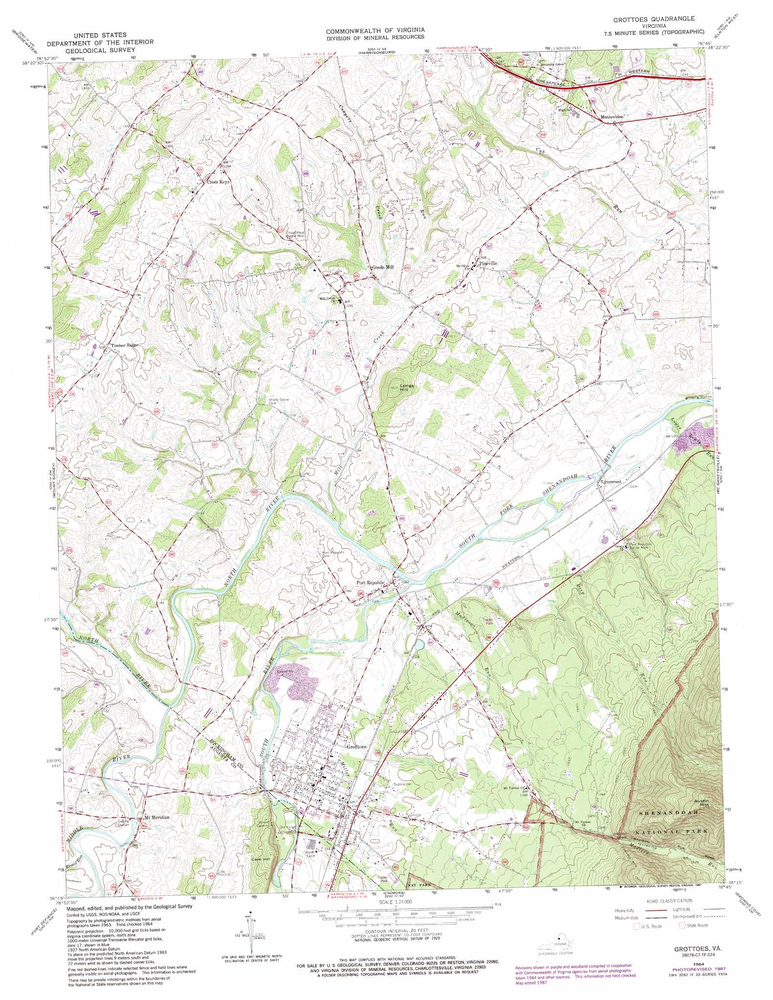
USGS Topo Quad 38078c7 - 1:24,000 scale
| Topo Map Name: | Grottoes |
| USGS Topo Quad ID: | 38078c7 |
| Print Size: | ca. 21 1/4" wide x 27" high |
| Southeast Coordinates: | 38.25° N latitude / 78.75° W longitude |
| Map Center Coordinates: | 38.3125° N latitude / 78.8125° W longitude |
| U.S. State: | VA |
| Filename: | o38078c7.jpg |
| Download Map JPG Image: | Grottoes topo map 1:24,000 scale |
| Map Type: | Topographic |
| Topo Series: | 7.5´ |
| Map Scale: | 1:24,000 |
| Source of Map Images: | United States Geological Survey (USGS) |
| Alternate Map Versions: |
Grottoes VA 1964, updated 1966 Download PDF Buy paper map Grottoes VA 1964, updated 1978 Download PDF Buy paper map Grottoes VA 1964, updated 1987 Download PDF Buy paper map Grottoes VA 1964, updated 1987 Download PDF Buy paper map Grottoes VA 2010 Download PDF Buy paper map Grottoes VA 2013 Download PDF Buy paper map Grottoes VA 2016 Download PDF Buy paper map |
1:24,000 Topo Quads surrounding Grottoes
Rawley Springs |
Singers Glen |
Broadway |
Tenth Legion |
Stanley |
Briery Branch |
Bridgewater |
Harrisonburg |
Elkton West |
Elkton East |
Parnassus |
Mount Sidney |
Grottoes |
Mcgaheysville |
Swift Run Gap |
Staunton |
Fort Defiance |
Crimora |
Browns Cove |
Free Union |
Stuarts Draft |
Waynesboro West |
Waynesboro East |
Crozet |
Charlottesville West |
> Back to 38078a1 at 1:100,000 scale
> Back to 38078a1 at 1:250,000 scale
> Back to U.S. Topo Maps home
Grottoes topo map: Gazetteer
Grottoes: Parks
Cross Keys Battle Monument elevation 360m 1181′Grand Caverns Regional Park elevation 358m 1174′
Port Republic Battle Monument elevation 329m 1079′
Port Republic Historic District elevation 323m 1059′
Grottoes: Populated Places
Cross Keys elevation 386m 1266′Goods Mill elevation 340m 1115′
Grottoes elevation 339m 1112′
Lynnwood elevation 317m 1040′
Montevideo elevation 354m 1161′
Pineville elevation 368m 1207′
Port Republic elevation 322m 1056′
Timber Ridge elevation 367m 1204′
Grottoes: Post Offices
Grottoes Post Office elevation 369m 1210′Port Republic Post Office elevation 323m 1059′
Grottoes: Streams
Broad Run elevation 325m 1066′Congers Creek elevation 345m 1131′
Deep Run elevation 317m 1040′
Duck Run elevation 340m 1115′
Lower Lewis Run elevation 312m 1023′
Madison Run elevation 317m 1040′
Middle River elevation 322m 1056′
Mill Creek elevation 324m 1062′
Miller Run elevation 320m 1049′
North River elevation 316m 1036′
South River elevation 316m 1036′
Grottoes: Summits
Austin Mountain elevation 802m 2631′Cave Hill elevation 424m 1391′
Longs Hill elevation 408m 1338′
Grottoes digital topo map on disk
Buy this Grottoes topo map showing relief, roads, GPS coordinates and other geographical features, as a high-resolution digital map file on DVD:
Western Virginia & Southern West Virginia
Buy digital topo maps: Western Virginia & Southern West Virginia