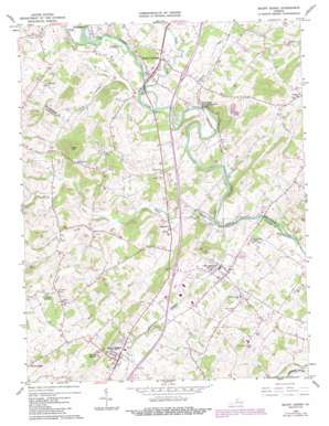
Mount Sidney Topo Map Virginia
To zoom in, hover over the map of Mount Sidney
USGS Topo Quad 38078c8 - 1:24,000 scale
| Topo Map Name: | Mount Sidney |
| USGS Topo Quad ID: | 38078c8 |
| Print Size: | ca. 21 1/4" wide x 27" high |
| Southeast Coordinates: | 38.25° N latitude / 78.875° W longitude |
| Map Center Coordinates: | 38.3125° N latitude / 78.9375° W longitude |
| U.S. State: | VA |
| Filename: | o38078c8.jpg |
| Download Map JPG Image: | Mount Sidney topo map 1:24,000 scale |
| Map Type: | Topographic |
| Topo Series: | 7.5´ |
| Map Scale: | 1:24,000 |
| Source of Map Images: | United States Geological Survey (USGS) |
| Alternate Map Versions: |
Mount Sidney VA 1964, updated 1966 Download PDF Buy paper map Mount Sidney VA 1964, updated 1973 Download PDF Buy paper map Mount Sidney VA 1964, updated 1983 Download PDF Buy paper map Mount Sidney VA 1964, updated 1987 Download PDF Buy paper map Mount Sidney VA 2002, updated 2004 Download PDF Buy paper map Mount Sidney VA 2010 Download PDF Buy paper map Mount Sidney VA 2013 Download PDF Buy paper map Mount Sidney VA 2016 Download PDF Buy paper map |
1:24,000 Topo Quads surrounding Mount Sidney
> Back to 38078a1 at 1:100,000 scale
> Back to 38078a1 at 1:250,000 scale
> Back to U.S. Topo Maps home
Mount Sidney topo map: Gazetteer
Mount Sidney: Airports
Bridgewater Air Park elevation 356m 1167′Shenandoah Valley Regional Airport elevation 360m 1181′
Mount Sidney: Crossings
Interchange 235 elevation 378m 1240′Interchange 240 elevation 366m 1200′
Mount Sidney: Populated Places
Burketown elevation 349m 1145′Friedens elevation 389m 1276′
Mount Crawford elevation 367m 1204′
Mount Sidney elevation 399m 1309′
Stonewall elevation 366m 1200′
Weyers Cave elevation 354m 1161′
Mount Sidney: Post Offices
Mount Crawford Post Office elevation 368m 1207′Mount Sidney Post Office elevation 398m 1305′
Mount Sidney: Springs
Seawright Springs elevation 390m 1279′Mount Sidney: Streams
Blacks Run elevation 357m 1171′Byers Branch elevation 340m 1115′
Cooks Creek elevation 347m 1138′
Goose Creek elevation 356m 1167′
Long Glade Creek elevation 355m 1164′
Naked Creek elevation 330m 1082′
North Fork Naked Creek elevation 349m 1145′
Pleasant Run elevation 340m 1115′
Mount Sidney: Summits
Mount Sidney elevation 482m 1581′Wise Hill elevation 515m 1689′
Mount Sidney: Valleys
Wise Hollow elevation 354m 1161′Mount Sidney digital topo map on disk
Buy this Mount Sidney topo map showing relief, roads, GPS coordinates and other geographical features, as a high-resolution digital map file on DVD:
Western Virginia & Southern West Virginia
Buy digital topo maps: Western Virginia & Southern West Virginia


