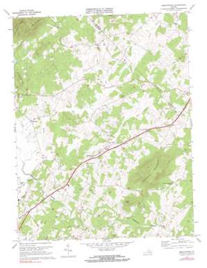
Brightwood Topo Map Virginia
To zoom in, hover over the map of Brightwood
USGS Topo Quad 38078d2 - 1:24,000 scale
| Topo Map Name: | Brightwood |
| USGS Topo Quad ID: | 38078d2 |
| Print Size: | ca. 21 1/4" wide x 27" high |
| Southeast Coordinates: | 38.375° N latitude / 78.125° W longitude |
| Map Center Coordinates: | 38.4375° N latitude / 78.1875° W longitude |
| U.S. State: | VA |
| Filename: | o38078d2.jpg |
| Download Map JPG Image: | Brightwood topo map 1:24,000 scale |
| Map Type: | Topographic |
| Topo Series: | 7.5´ |
| Map Scale: | 1:24,000 |
| Source of Map Images: | United States Geological Survey (USGS) |
| Alternate Map Versions: |
Brightwood VA 1971, updated 1972 Download PDF Buy paper map Brightwood VA 1971, updated 1983 Download PDF Buy paper map Brightwood VA 2010 Download PDF Buy paper map Brightwood VA 2013 Download PDF Buy paper map Brightwood VA 2016 Download PDF Buy paper map |
1:24,000 Topo Quads surrounding Brightwood
> Back to 38078a1 at 1:100,000 scale
> Back to 38078a1 at 1:250,000 scale
> Back to U.S. Topo Maps home
Brightwood topo map: Gazetteer
Brightwood: Airports
Grand Pre Farm Airport elevation 150m 492′Brightwood: Crossings
Russells Ferry (historical) elevation 115m 377′Brightwood: Dams
Hablutzel Lake Dam elevation 196m 643′Swain Dam elevation 158m 518′
Brightwood: Parks
Madison Wayside elevation 170m 557′Brightwood: Populated Places
Brightwood elevation 179m 587′Decapolis elevation 159m 521′
Leon elevation 168m 551′
Novum elevation 172m 564′
Reva elevation 183m 600′
Tryme elevation 183m 600′
Zeus elevation 147m 482′
Brightwood: Reservoirs
Hablutzel Lake elevation 196m 643′Swain Lake elevation 158m 518′
Brightwood: Streams
Dark Run elevation 113m 370′Deep Run elevation 118m 387′
Glebe Run elevation 123m 403′
Little Dark Run elevation 112m 367′
Muddy Run elevation 126m 413′
Whiteoak Run elevation 118m 387′
Brightwood: Summits
Arrington Mountain elevation 272m 892′Aylor Mountain elevation 403m 1322′
Hume Mountain elevation 248m 813′
Mitchells Mountain elevation 454m 1489′
Thorofare Mountain elevation 370m 1213′
Brightwood digital topo map on disk
Buy this Brightwood topo map showing relief, roads, GPS coordinates and other geographical features, as a high-resolution digital map file on DVD:
Western Virginia & Southern West Virginia
Buy digital topo maps: Western Virginia & Southern West Virginia


