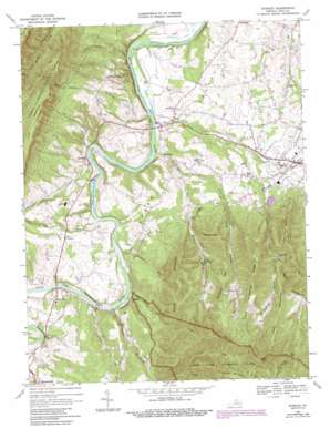
Stanley Topo Map Virginia
To zoom in, hover over the map of Stanley
USGS Topo Quad 38078e5 - 1:24,000 scale
| Topo Map Name: | Stanley |
| USGS Topo Quad ID: | 38078e5 |
| Print Size: | ca. 21 1/4" wide x 27" high |
| Southeast Coordinates: | 38.5° N latitude / 78.5° W longitude |
| Map Center Coordinates: | 38.5625° N latitude / 78.5625° W longitude |
| U.S. State: | VA |
| Filename: | o38078e5.jpg |
| Download Map JPG Image: | Stanley topo map 1:24,000 scale |
| Map Type: | Topographic |
| Topo Series: | 7.5´ |
| Map Scale: | 1:24,000 |
| Source of Map Images: | United States Geological Survey (USGS) |
| Alternate Map Versions: |
Stanley VA 1967, updated 1969 Download PDF Buy paper map Stanley VA 1967, updated 1987 Download PDF Buy paper map Stanley VA 1997, updated 2000 Download PDF Buy paper map Stanley VA 2011 Download PDF Buy paper map Stanley VA 2013 Download PDF Buy paper map Stanley VA 2016 Download PDF Buy paper map |
| FStopo: | US Forest Service topo Stanley is available: Download FStopo PDF Download FStopo TIF |
1:24,000 Topo Quads surrounding Stanley
> Back to 38078e1 at 1:100,000 scale
> Back to 38078a1 at 1:250,000 scale
> Back to U.S. Topo Maps home
Stanley topo map: Gazetteer
Stanley: Dams
Newport Dam elevation 278m 912′Stanley: Gaps
Utz Gap elevation 727m 2385′Stanley: Populated Places
Alma elevation 244m 800′Battle Creek elevation 305m 1000′
Grove Hill elevation 302m 990′
Honeyville elevation 251m 823′
Ingham elevation 267m 875′
Newport elevation 248m 813′
Stanley elevation 333m 1092′
Stanley: Post Offices
Stanley Post Office elevation 336m 1102′Stanley: Reservoirs
Newport Reservoir elevation 278m 912′Stanley: Ridges
Dog Slaughter Ridge elevation 622m 2040′Stanley: Streams
Crooked Run elevation 253m 830′Cub Run elevation 249m 816′
Foltz Creek elevation 243m 797′
Fultz Run elevation 253m 830′
Hawksclaw Creek elevation 233m 764′
Hickory Run elevation 250m 820′
Honey Run elevation 235m 770′
Line Run elevation 261m 856′
Stony Run elevation 236m 774′
Stanley: Summits
Cubbage Mountain elevation 577m 1893′Devils Tanyard elevation 864m 2834′
Dovel Mountain elevation 746m 2447′
Piney Mountain elevation 656m 2152′
Roundhead Mountain elevation 657m 2155′
Smith Mountain elevation 812m 2664′
The Pinnacle elevation 579m 1899′
Stanley: Trails
Chapman Dovel Trail elevation 792m 2598′Stanley: Valleys
Basin Hollow elevation 386m 1266′Cubbage Hollow elevation 388m 1272′
Dovel Hollow elevation 260m 853′
Fox Hollow elevation 244m 800′
Kettle Hollow elevation 335m 1099′
Lucas Hollow elevation 380m 1246′
Stark Hollow elevation 227m 744′
Steam Hollow elevation 263m 862′
Stanley digital topo map on disk
Buy this Stanley topo map showing relief, roads, GPS coordinates and other geographical features, as a high-resolution digital map file on DVD:
Western Virginia & Southern West Virginia
Buy digital topo maps: Western Virginia & Southern West Virginia


